Category:Talisker
Zur Navigation springen
Zur Suche springen
Siedlung im schottischen Verwaltungsdistrikt Highland  | |||||
| Medium hochladen | |||||
| Ist ein(e) | |||||
|---|---|---|---|---|---|
| Ort |
| ||||
| Verschieden von | |||||
 | |||||
Unterkategorien
Es werden 2 von insgesamt 2 Unterkategorien in dieser Kategorie angezeigt:
In Klammern die Anzahl der enthaltenen Kategorien (K), Seiten (S), Dateien (D)
P
- Preshal Beg (5 D)
T
- Talisker Bay (30 D)
Medien in der Kategorie „Talisker“
Folgende 48 Dateien sind in dieser Kategorie, von 48 insgesamt.
-
 Amygdales in Lava - geograph.org.uk - 5409566.jpg 640 × 427; 442 KB
-
 An Stac rock off Talisker Point - geograph.org.uk - 6137510.jpg 480 × 640; 55 KB
-
 Back of the beach - Talisker Bay - geograph.org.uk - 2313616.jpg 1.024 × 768; 775 KB
-

-
 Cliffs South of Talisker Point - geograph.org.uk - 5409592.jpg 640 × 427; 281 KB
-
 Gully near Talisker House - geograph.org.uk - 875186.jpg 640 × 430; 131 KB
-
 Lower Sleadale - geograph.org.uk - 798551.jpg 640 × 480; 181 KB
-
 Near Talisker House - geograph.org.uk - 858441.jpg 640 × 430; 109 KB
-
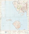 Ordnance Survey One-Inch Sheet 33 Rhum and part of Skye, Published 1957.jpg 8.263 × 9.746; 6,63 MB
-
 Ordnance Survey One-Inch Sheet 34 The Cuillins, Rhum & Canna, Published 1947.jpg 8.724 × 12.904; 8,71 MB
-
 Power station construction at Talisker (geograph 4199708).jpg 640 × 424; 219 KB
-
 Rubha Cruinn - geograph.org.uk - 5409594.jpg 640 × 427; 304 KB
-
 Rubha Cruinn - geograph.org.uk - 5732462.jpg 1.600 × 1.003; 156 KB
-
 Sea Stack - geograph.org.uk - 5409586.jpg 427 × 640; 278 KB
-
 Sea Stacks - geograph.org.uk - 5409563.jpg 640 × 427; 266 KB
-
 Sea Stacks - geograph.org.uk - 5409589.jpg 640 × 427; 252 KB
-
 South Side of Talisker Bay - geograph.org.uk - 5409614.jpg 640 × 427; 299 KB
-
 Talisker Bay - geograph.org.uk - 2313586.jpg 1.024 × 768; 391 KB
-
 Talisker Bay - geograph.org.uk - 3889382.jpg 640 × 480; 86 KB
-
 Talisker Bay - geograph.org.uk - 3957339.jpg 4.320 × 2.640; 1,86 MB
-
 Talisker Bay - geograph.org.uk - 3996640.jpg 1.500 × 2.250; 3,63 MB
-
 Talisker Bay - geograph.org.uk - 4616006.jpg 640 × 480; 61 KB
-
 Talisker Bay - geograph.org.uk - 5129614.jpg 3.264 × 2.448; 1,86 MB
-
 Talisker Bay - geograph.org.uk - 5399982.jpg 640 × 480; 65 KB
-
 Talisker Bay - geograph.org.uk - 5409601.jpg 640 × 427; 305 KB
-
 Talisker Bay - geograph.org.uk - 5409607.jpg 640 × 427; 292 KB
-
 Talisker Bay - geograph.org.uk - 5409610.jpg 640 × 427; 306 KB
-
 Talisker bay from the summit of Preshal More - geograph.org.uk - 6271256.jpg 1.024 × 768; 240 KB
-
 Talisker Bay south side - geograph.org.uk - 3957345.jpg 3.240 × 4.320; 2,33 MB
-
 Talisker Beach - geograph.org.uk - 1731338.jpg 640 × 418; 137 KB
-
 Talisker beach - geograph.org.uk - 2973463.jpg 640 × 479; 203 KB
-
 Talisker Beach, Isle of Skye - panoramio.jpg 4.288 × 2.848; 11,67 MB
-
 Talisker Confluence - geograph.org.uk - 2388556.jpg 1.600 × 1.074; 682 KB
-
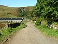 Talisker Farm road - geograph.org.uk - 954148.jpg 640 × 480; 117 KB
-
 Talisker House - geograph.org.uk - 1337352.jpg 640 × 480; 56 KB
-
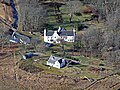 Talisker House - geograph.org.uk - 1731286.jpg 640 × 480; 204 KB
-
 Talisker House - geograph.org.uk - 798522.jpg 640 × 480; 235 KB
-
 Talisker Point - geograph.org.uk - 2391406.jpg 640 × 427; 254 KB
-
 Talisker Point - geograph.org.uk - 4615992.jpg 640 × 480; 68 KB
-
 Talisker Stony Beach - panoramio.jpg 2.400 × 1.594; 1,52 MB
-
 The sands of Talisker Bay - geograph.org.uk - 3957350.jpg 3.240 × 4.320; 2,93 MB
-
 Towards Talisker Point - geograph.org.uk - 2313596.jpg 1.024 × 768; 325 KB
-
 Track to Talisker House - geograph.org.uk - 1731238.jpg 640 × 426; 122 KB
-
 View Inland from Talisker Bay - geograph.org.uk - 2053757.jpg 640 × 480; 34 KB
-
 View of the Biod Ruadh Cliffs - geograph.org.uk - 2388346.jpg 1.600 × 1.074; 573 KB
-
 View to Talisker Bay - geograph.org.uk - 2813142.jpg 640 × 471; 46 KB
-
 Waterfall blown upwards - geograph.org.uk - 4435575.jpg 2.000 × 2.667; 3,36 MB
-


.jpg)


