Category:Tashichho Dzong
Jump to navigation
Jump to search
| Object location | | View all coordinates using: OpenStreetMap |
|---|
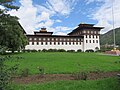
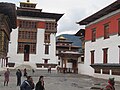
Buddhist monastery and fortress in Bhutan  | |||||
| Upload media | |||||
| Instance of | |||||
|---|---|---|---|---|---|
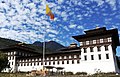
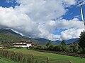
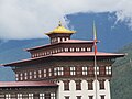
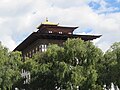
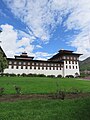
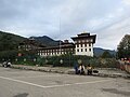
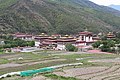
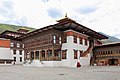
| Location | Thimphu, Thimphu District, Bhutan | ||||
 | |||||
Subcategories
This category has the following 4 subcategories, out of 4 total.
Media in category "Tashichho Dzong"
The following 200 files are in this category, out of 269 total.
(previous page) (next page)-
 100 Ngultrum Rückseite.jpg 594 × 264; 42 KB
-
 Bhutan-1546093 640.jpg 2,822 × 1,813; 1.46 MB
-
 Birds-eye view, Thimphu, Bhutan 001.JPG 640 × 480; 180 KB
-
 King's office 01.jpg 1,632 × 1,224; 517 KB
-
 King's office 02.jpg 1,632 × 1,224; 764 KB
-
 Northern end of Tashichodzong.jpg 7,012 × 4,523; 4.98 MB
-
-
-
 Tashi-Cho-Jong or Tashichoedzong 1921.jpg 1,024 × 629; 314 KB
-
 Tashichho Dzong (49690801713).jpg 2,740 × 1,867; 3.96 MB
-
 Tashichho Dzong (Thimpu Dzong) in Thimphu, July 2016 04.jpg 4,608 × 3,456; 4.29 MB
-
 Tashichho Dzong (Thimpu Dzong) in Thimphu, July 2016 05.jpg 3,456 × 4,608; 3.68 MB
-
 Tashichho Dzong (Thimpu Dzong) in Thimphu, July 2016 06.jpg 3,456 × 4,608; 2.92 MB
-
 Tashichho Dzong (Thimpu Dzong) in Thimphu, July 2016 07.jpg 3,456 × 4,608; 4.38 MB
-
 Tashichho Dzong (Thimpu Dzong) in Thimphu, July 2016 08.jpg 3,456 × 4,608; 4.39 MB
-
 Tashichho Dzong (Thimpu Dzong) in Thimphu, July 2016 10.jpg 4,608 × 3,456; 4.19 MB
-
 Tashichho Dzong (Thimpu Dzong) in Thimphu, July 2016 12.jpg 4,608 × 3,456; 4.45 MB
-
 Tashichho Dzong (Thimpu Dzong) in Thimphu, July 2016 13.jpg 4,608 × 3,456; 4.2 MB
-
 Tashichho Dzong (Thimpu Dzong) in Thimphu, July 2016 14.jpg 4,608 × 3,456; 4.56 MB
-
 Tashichho Dzong (Thimpu Dzong) in Thimphu, July 2016 15.jpg 4,608 × 3,456; 5.2 MB
-
 Tashichho Dzong (Thimpu Dzong) in Thimphu, July 2016 16.jpg 4,608 × 3,456; 3.98 MB
-
 Tashichho Dzong (Thimpu Dzong) in Thimphu, July 2016 17.jpg 4,608 × 3,456; 3.77 MB
-
 Tashichho Dzong (Thimpu Dzong) in Thimphu, July 2016 18.jpg 2,048 × 1,536; 1.05 MB
-
 Tashichho Dzong (Thimpu Dzong) in Thimphu, July 2016 19.jpg 2,048 × 1,536; 1,006 KB
-
 Tashichho Dzong (Thimpu Dzong) in Thimphu, July 2016 20.jpg 1,536 × 2,048; 1.12 MB
-
 Tashichho Dzong (Thimpu Dzong) in Thimphu, July 2016 21.jpg 2,048 × 1,536; 986 KB
-
 Tashichho Dzong (Thimpu Dzong) in Thimphu, July 2016 22.jpg 2,048 × 1,536; 865 KB
-
 Tashichho Dzong 2012-11-19.jpg 3,639 × 1,864; 4.07 MB
-
 Tashichho Dzong Fortress in Thimphu during LGFC - Bhutan 2019 (1).jpg 4,608 × 3,456; 3.57 MB
-
 Tashichho Dzong Fortress in Thimphu during LGFC - Bhutan 2019 (10).jpg 4,608 × 3,456; 4.34 MB
-
 Tashichho Dzong Fortress in Thimphu during LGFC - Bhutan 2019 (100).jpg 3,209 × 4,053; 2.79 MB
-
 Tashichho Dzong Fortress in Thimphu during LGFC - Bhutan 2019 (101).jpg 3,209 × 3,999; 2.6 MB
-
 Tashichho Dzong Fortress in Thimphu during LGFC - Bhutan 2019 (102).jpg 3,161 × 4,251; 2.64 MB
-
 Tashichho Dzong Fortress in Thimphu during LGFC - Bhutan 2019 (103).jpg 3,154 × 4,021; 2.54 MB
-
 Tashichho Dzong Fortress in Thimphu during LGFC - Bhutan 2019 (104).jpg 4,608 × 3,456; 3.75 MB
-
 Tashichho Dzong Fortress in Thimphu during LGFC - Bhutan 2019 (105).jpg 4,608 × 3,456; 3.47 MB
-
 Tashichho Dzong Fortress in Thimphu during LGFC - Bhutan 2019 (106).jpg 4,608 × 3,456; 3.43 MB
-
 Tashichho Dzong Fortress in Thimphu during LGFC - Bhutan 2019 (107).jpg 4,608 × 3,456; 3.9 MB
-
 Tashichho Dzong Fortress in Thimphu during LGFC - Bhutan 2019 (108).jpg 3,456 × 4,608; 4.64 MB
-
 Tashichho Dzong Fortress in Thimphu during LGFC - Bhutan 2019 (109).jpg 4,608 × 3,456; 4.57 MB
-
 Tashichho Dzong Fortress in Thimphu during LGFC - Bhutan 2019 (11).jpg 4,608 × 3,456; 3.74 MB
-
 Tashichho Dzong Fortress in Thimphu during LGFC - Bhutan 2019 (110).jpg 4,608 × 3,456; 3.6 MB
-
 Tashichho Dzong Fortress in Thimphu during LGFC - Bhutan 2019 (111).jpg 4,608 × 3,456; 2.84 MB
-
 Tashichho Dzong Fortress in Thimphu during LGFC - Bhutan 2019 (112).jpg 4,608 × 3,456; 2.77 MB
-
 Tashichho Dzong Fortress in Thimphu during LGFC - Bhutan 2019 (113).jpg 4,608 × 3,456; 4.64 MB
-
 Tashichho Dzong Fortress in Thimphu during LGFC - Bhutan 2019 (114).jpg 4,608 × 3,456; 4.07 MB
-
 Tashichho Dzong Fortress in Thimphu during LGFC - Bhutan 2019 (115).jpg 4,608 × 3,456; 3.98 MB
-
 Tashichho Dzong Fortress in Thimphu during LGFC - Bhutan 2019 (116).jpg 4,608 × 3,456; 4.6 MB
-
 Tashichho Dzong Fortress in Thimphu during LGFC - Bhutan 2019 (117).jpg 4,608 × 3,456; 4.87 MB
-
 Tashichho Dzong Fortress in Thimphu during LGFC - Bhutan 2019 (118).jpg 4,608 × 3,456; 4.77 MB
-
 Tashichho Dzong Fortress in Thimphu during LGFC - Bhutan 2019 (119).jpg 4,608 × 3,456; 4.75 MB
-
 Tashichho Dzong Fortress in Thimphu during LGFC - Bhutan 2019 (12).jpg 4,608 × 3,456; 3.74 MB
-
 Tashichho Dzong Fortress in Thimphu during LGFC - Bhutan 2019 (120).jpg 4,608 × 3,456; 4 MB
-
 Tashichho Dzong Fortress in Thimphu during LGFC - Bhutan 2019 (121).jpg 4,608 × 3,456; 3.79 MB
-
 Tashichho Dzong Fortress in Thimphu during LGFC - Bhutan 2019 (122).jpg 4,608 × 3,456; 4.84 MB
-
 Tashichho Dzong Fortress in Thimphu during LGFC - Bhutan 2019 (123).jpg 4,608 × 3,456; 4.9 MB
-
 Tashichho Dzong Fortress in Thimphu during LGFC - Bhutan 2019 (124).jpg 3,456 × 4,608; 4.98 MB
-
 Tashichho Dzong Fortress in Thimphu during LGFC - Bhutan 2019 (125).jpg 3,456 × 4,608; 5.68 MB
-
 Tashichho Dzong Fortress in Thimphu during LGFC - Bhutan 2019 (126).jpg 3,456 × 4,608; 4.35 MB
-
 Tashichho Dzong Fortress in Thimphu during LGFC - Bhutan 2019 (127).jpg 4,608 × 3,456; 4.43 MB
-
 Tashichho Dzong Fortress in Thimphu during LGFC - Bhutan 2019 (128).jpg 4,608 × 3,456; 4.07 MB
-
 Tashichho Dzong Fortress in Thimphu during LGFC - Bhutan 2019 (129).jpg 4,608 × 3,456; 4.27 MB
-
 Tashichho Dzong Fortress in Thimphu during LGFC - Bhutan 2019 (13).jpg 4,608 × 3,456; 3.39 MB
-
 Tashichho Dzong Fortress in Thimphu during LGFC - Bhutan 2019 (130).jpg 4,608 × 3,456; 4.43 MB
-
 Tashichho Dzong Fortress in Thimphu during LGFC - Bhutan 2019 (131).jpg 4,608 × 3,456; 3.89 MB
-
 Tashichho Dzong Fortress in Thimphu during LGFC - Bhutan 2019 (132).jpg 4,608 × 3,456; 3.98 MB
-
 Tashichho Dzong Fortress in Thimphu during LGFC - Bhutan 2019 (133).jpg 4,608 × 3,456; 5.21 MB
-
 Tashichho Dzong Fortress in Thimphu during LGFC - Bhutan 2019 (134).jpg 4,608 × 3,456; 4.94 MB
-
 Tashichho Dzong Fortress in Thimphu during LGFC - Bhutan 2019 (135).jpg 4,608 × 3,456; 3.52 MB
-
 Tashichho Dzong Fortress in Thimphu during LGFC - Bhutan 2019 (136).jpg 4,608 × 3,456; 3.05 MB
-
 Tashichho Dzong Fortress in Thimphu during LGFC - Bhutan 2019 (137).jpg 4,608 × 3,456; 3.73 MB
-
 Tashichho Dzong Fortress in Thimphu during LGFC - Bhutan 2019 (138).jpg 4,608 × 3,456; 5.82 MB
-
 Tashichho Dzong Fortress in Thimphu during LGFC - Bhutan 2019 (139).jpg 4,608 × 3,456; 3.13 MB
-
 Tashichho Dzong Fortress in Thimphu during LGFC - Bhutan 2019 (14).jpg 4,608 × 3,456; 3.24 MB
-
 Tashichho Dzong Fortress in Thimphu during LGFC - Bhutan 2019 (140).jpg 4,608 × 3,456; 2.88 MB
-
 Tashichho Dzong Fortress in Thimphu during LGFC - Bhutan 2019 (141).jpg 4,608 × 3,456; 3.14 MB
-
 Tashichho Dzong Fortress in Thimphu during LGFC - Bhutan 2019 (142).jpg 4,608 × 3,456; 3.04 MB
-
 Tashichho Dzong Fortress in Thimphu during LGFC - Bhutan 2019 (143).jpg 3,456 × 4,608; 4.07 MB
-
 Tashichho Dzong Fortress in Thimphu during LGFC - Bhutan 2019 (144).jpg 3,456 × 4,608; 3.65 MB
-
 Tashichho Dzong Fortress in Thimphu during LGFC - Bhutan 2019 (145).jpg 3,456 × 4,608; 3.35 MB
-
 Tashichho Dzong Fortress in Thimphu during LGFC - Bhutan 2019 (146).jpg 3,456 × 4,608; 3.23 MB
-
 Tashichho Dzong Fortress in Thimphu during LGFC - Bhutan 2019 (147).jpg 3,456 × 4,608; 4.59 MB
-
 Tashichho Dzong Fortress in Thimphu during LGFC - Bhutan 2019 (148).jpg 4,608 × 3,456; 4.48 MB
-
 Tashichho Dzong Fortress in Thimphu during LGFC - Bhutan 2019 (149).jpg 4,608 × 3,456; 4.1 MB
-
 Tashichho Dzong Fortress in Thimphu during LGFC - Bhutan 2019 (15).jpg 4,608 × 3,456; 4.09 MB
-
 Tashichho Dzong Fortress in Thimphu during LGFC - Bhutan 2019 (150).jpg 4,608 × 3,456; 4.55 MB
-
 Tashichho Dzong Fortress in Thimphu during LGFC - Bhutan 2019 (151).jpg 4,608 × 3,456; 3.93 MB
-
 Tashichho Dzong Fortress in Thimphu during LGFC - Bhutan 2019 (152).jpg 4,608 × 3,456; 3.78 MB
-
 Tashichho Dzong Fortress in Thimphu during LGFC - Bhutan 2019 (153).jpg 4,608 × 3,456; 3.47 MB
-
 Tashichho Dzong Fortress in Thimphu during LGFC - Bhutan 2019 (154).jpg 3,456 × 4,608; 4.51 MB
-
 Tashichho Dzong Fortress in Thimphu during LGFC - Bhutan 2019 (155).jpg 4,608 × 3,456; 4.18 MB
-
 Tashichho Dzong Fortress in Thimphu during LGFC - Bhutan 2019 (156).jpg 4,608 × 3,456; 3.79 MB
-
 Tashichho Dzong Fortress in Thimphu during LGFC - Bhutan 2019 (157).jpg 4,608 × 3,456; 3.17 MB
-
 Tashichho Dzong Fortress in Thimphu during LGFC - Bhutan 2019 (158).jpg 4,608 × 3,456; 3.11 MB
-
 Tashichho Dzong Fortress in Thimphu during LGFC - Bhutan 2019 (159).jpg 4,608 × 3,456; 3.83 MB
-
 Tashichho Dzong Fortress in Thimphu during LGFC - Bhutan 2019 (16).jpg 4,608 × 3,456; 3.87 MB
-
 Tashichho Dzong Fortress in Thimphu during LGFC - Bhutan 2019 (160).jpg 4,608 × 3,456; 3.77 MB
-
 Tashichho Dzong Fortress in Thimphu during LGFC - Bhutan 2019 (161).jpg 4,608 × 3,456; 3.25 MB
-
 Tashichho Dzong Fortress in Thimphu during LGFC - Bhutan 2019 (162).jpg 3,456 × 4,608; 3.06 MB
-
 Tashichho Dzong Fortress in Thimphu during LGFC - Bhutan 2019 (163).jpg 4,608 × 3,456; 4.01 MB
-
 Tashichho Dzong Fortress in Thimphu during LGFC - Bhutan 2019 (164).jpg 4,608 × 3,456; 4.03 MB
-
 Tashichho Dzong Fortress in Thimphu during LGFC - Bhutan 2019 (165).jpg 4,608 × 3,456; 4.59 MB
-
 Tashichho Dzong Fortress in Thimphu during LGFC - Bhutan 2019 (17).jpg 4,608 × 3,456; 3.57 MB
-
 Tashichho Dzong Fortress in Thimphu during LGFC - Bhutan 2019 (18).jpg 4,608 × 3,456; 3.38 MB
-
 Tashichho Dzong Fortress in Thimphu during LGFC - Bhutan 2019 (19).jpg 4,608 × 3,456; 2.88 MB
-
 Tashichho Dzong Fortress in Thimphu during LGFC - Bhutan 2019 (2).jpg 4,330 × 3,004; 2.25 MB
-
 Tashichho Dzong Fortress in Thimphu during LGFC - Bhutan 2019 (20).jpg 4,608 × 3,456; 3.34 MB
-
 Tashichho Dzong Fortress in Thimphu during LGFC - Bhutan 2019 (21).jpg 4,608 × 3,456; 3.1 MB
-
 Tashichho Dzong Fortress in Thimphu during LGFC - Bhutan 2019 (22).jpg 4,608 × 3,456; 3.14 MB
-
 Tashichho Dzong Fortress in Thimphu during LGFC - Bhutan 2019 (23).jpg 4,608 × 3,456; 3.42 MB
-
 Tashichho Dzong Fortress in Thimphu during LGFC - Bhutan 2019 (24).jpg 3,456 × 4,608; 4.11 MB
-
 Tashichho Dzong Fortress in Thimphu during LGFC - Bhutan 2019 (25).jpg 3,456 × 4,608; 3.87 MB
-
 Tashichho Dzong Fortress in Thimphu during LGFC - Bhutan 2019 (26).jpg 4,608 × 3,456; 5.3 MB
-
 Tashichho Dzong Fortress in Thimphu during LGFC - Bhutan 2019 (27).jpg 4,608 × 3,456; 4.61 MB
-
 Tashichho Dzong Fortress in Thimphu during LGFC - Bhutan 2019 (28).jpg 4,608 × 3,456; 4.51 MB
-
 Tashichho Dzong Fortress in Thimphu during LGFC - Bhutan 2019 (29).jpg 4,608 × 3,456; 3.23 MB
-
 Tashichho Dzong Fortress in Thimphu during LGFC - Bhutan 2019 (3).jpg 4,608 × 3,456; 3.1 MB
-
 Tashichho Dzong Fortress in Thimphu during LGFC - Bhutan 2019 (30).jpg 4,608 × 3,456; 3.18 MB
-
 Tashichho Dzong Fortress in Thimphu during LGFC - Bhutan 2019 (31).jpg 3,456 × 4,608; 3.41 MB
-
 Tashichho Dzong Fortress in Thimphu during LGFC - Bhutan 2019 (32).jpg 4,608 × 3,456; 4.74 MB
-
 Tashichho Dzong Fortress in Thimphu during LGFC - Bhutan 2019 (33).jpg 4,608 × 3,456; 4.4 MB
-
 Tashichho Dzong Fortress in Thimphu during LGFC - Bhutan 2019 (34).jpg 4,608 × 3,456; 5.37 MB
-
 Tashichho Dzong Fortress in Thimphu during LGFC - Bhutan 2019 (35).jpg 3,456 × 4,608; 5 MB
-
 Tashichho Dzong Fortress in Thimphu during LGFC - Bhutan 2019 (36).jpg 3,456 × 4,608; 5.5 MB
-
 Tashichho Dzong Fortress in Thimphu during LGFC - Bhutan 2019 (37).jpg 4,608 × 3,456; 3.75 MB
-
 Tashichho Dzong Fortress in Thimphu during LGFC - Bhutan 2019 (38).jpg 4,608 × 3,456; 3.51 MB
-
 Tashichho Dzong Fortress in Thimphu during LGFC - Bhutan 2019 (39).jpg 4,464 × 3,197; 3.46 MB
-
 Tashichho Dzong Fortress in Thimphu during LGFC - Bhutan 2019 (4).jpg 4,608 × 3,456; 3.43 MB
-
 Tashichho Dzong Fortress in Thimphu during LGFC - Bhutan 2019 (40).jpg 4,407 × 3,299; 3.78 MB
-
 Tashichho Dzong Fortress in Thimphu during LGFC - Bhutan 2019 (41).jpg 4,476 × 3,197; 3.57 MB
-
 Tashichho Dzong Fortress in Thimphu during LGFC - Bhutan 2019 (42).jpg 4,608 × 3,456; 3.98 MB
-
 Tashichho Dzong Fortress in Thimphu during LGFC - Bhutan 2019 (43).jpg 4,608 × 3,456; 3.52 MB
-
 Tashichho Dzong Fortress in Thimphu during LGFC - Bhutan 2019 (44).jpg 4,608 × 3,456; 4.31 MB
-
 Tashichho Dzong Fortress in Thimphu during LGFC - Bhutan 2019 (45).jpg 4,608 × 3,456; 5.63 MB
-
 Tashichho Dzong Fortress in Thimphu during LGFC - Bhutan 2019 (46).jpg 4,608 × 3,456; 5.66 MB
-
 Tashichho Dzong Fortress in Thimphu during LGFC - Bhutan 2019 (47).jpg 4,419 × 3,233; 3.91 MB
-
 Tashichho Dzong Fortress in Thimphu during LGFC - Bhutan 2019 (48).jpg 4,608 × 3,456; 3.36 MB
-
 Tashichho Dzong Fortress in Thimphu during LGFC - Bhutan 2019 (49).jpg 4,608 × 3,456; 4.23 MB
-
 Tashichho Dzong Fortress in Thimphu during LGFC - Bhutan 2019 (5).jpg 4,608 × 3,456; 3.25 MB
-
 Tashichho Dzong Fortress in Thimphu during LGFC - Bhutan 2019 (50).jpg 4,608 × 3,456; 4.2 MB
-
 Tashichho Dzong Fortress in Thimphu during LGFC - Bhutan 2019 (51).jpg 4,608 × 3,456; 3.44 MB
-
 Tashichho Dzong Fortress in Thimphu during LGFC - Bhutan 2019 (53).jpg 4,608 × 3,456; 4.24 MB
-
 Tashichho Dzong Fortress in Thimphu during LGFC - Bhutan 2019 (54).jpg 3,456 × 4,608; 4.48 MB
-
 Tashichho Dzong Fortress in Thimphu during LGFC - Bhutan 2019 (55).jpg 3,456 × 4,608; 4.52 MB
-
 Tashichho Dzong Fortress in Thimphu during LGFC - Bhutan 2019 (57).jpg 4,608 × 3,456; 3.6 MB
-
 Tashichho Dzong Fortress in Thimphu during LGFC - Bhutan 2019 (58).jpg 4,608 × 3,456; 4.24 MB
-
 Tashichho Dzong Fortress in Thimphu during LGFC - Bhutan 2019 (59).jpg 4,608 × 3,456; 4.77 MB
-
 Tashichho Dzong Fortress in Thimphu during LGFC - Bhutan 2019 (6).jpg 4,608 × 3,456; 3.33 MB
-
 Tashichho Dzong Fortress in Thimphu during LGFC - Bhutan 2019 (60).jpg 4,608 × 3,456; 4.32 MB
-
 Tashichho Dzong Fortress in Thimphu during LGFC - Bhutan 2019 (61).jpg 4,608 × 3,456; 3.57 MB
-
 Tashichho Dzong Fortress in Thimphu during LGFC - Bhutan 2019 (62).jpg 4,608 × 3,456; 4.93 MB
-
 Tashichho Dzong Fortress in Thimphu during LGFC - Bhutan 2019 (63).jpg 4,608 × 3,456; 4.78 MB
-
 Tashichho Dzong Fortress in Thimphu during LGFC - Bhutan 2019 (64).jpg 4,389 × 3,233; 3.21 MB
-
 Tashichho Dzong Fortress in Thimphu during LGFC - Bhutan 2019 (65).jpg 4,608 × 3,456; 4.27 MB
-
 Tashichho Dzong Fortress in Thimphu during LGFC - Bhutan 2019 (66).jpg 4,608 × 3,456; 4.04 MB
-
 Tashichho Dzong Fortress in Thimphu during LGFC - Bhutan 2019 (67).jpg 3,456 × 4,608; 4.01 MB
-
 Tashichho Dzong Fortress in Thimphu during LGFC - Bhutan 2019 (68).jpg 3,456 × 4,608; 3.99 MB
-
 Tashichho Dzong Fortress in Thimphu during LGFC - Bhutan 2019 (69).jpg 3,456 × 4,608; 4.08 MB
-
 Tashichho Dzong Fortress in Thimphu during LGFC - Bhutan 2019 (7).jpg 4,608 × 3,456; 3.34 MB
-
 Tashichho Dzong Fortress in Thimphu during LGFC - Bhutan 2019 (70).jpg 3,456 × 4,608; 3.78 MB
-
 Tashichho Dzong Fortress in Thimphu during LGFC - Bhutan 2019 (71).jpg 4,608 × 3,456; 4.36 MB
-
 Tashichho Dzong Fortress in Thimphu during LGFC - Bhutan 2019 (72).jpg 3,456 × 4,608; 4.08 MB
-
 Tashichho Dzong Fortress in Thimphu during LGFC - Bhutan 2019 (73).jpg 4,608 × 3,456; 3.41 MB
-
 Tashichho Dzong Fortress in Thimphu during LGFC - Bhutan 2019 (74).jpg 4,608 × 3,456; 3.41 MB
-
 Tashichho Dzong Fortress in Thimphu during LGFC - Bhutan 2019 (75).jpg 4,608 × 3,456; 3.71 MB
-
 Tashichho Dzong Fortress in Thimphu during LGFC - Bhutan 2019 (76).jpg 4,608 × 3,456; 3.76 MB
-
 Tashichho Dzong Fortress in Thimphu during LGFC - Bhutan 2019 (77).jpg 4,608 × 3,456; 5.07 MB
-
 Tashichho Dzong Fortress in Thimphu during LGFC - Bhutan 2019 (78).jpg 4,608 × 3,456; 3.48 MB
-
 Tashichho Dzong Fortress in Thimphu during LGFC - Bhutan 2019 (79).jpg 3,456 × 4,608; 4.44 MB
-
 Tashichho Dzong Fortress in Thimphu during LGFC - Bhutan 2019 (8).jpg 4,608 × 3,456; 3.31 MB
-
 Tashichho Dzong Fortress in Thimphu during LGFC - Bhutan 2019 (80).jpg 4,608 × 3,456; 3.52 MB
-
 Tashichho Dzong Fortress in Thimphu during LGFC - Bhutan 2019 (81).jpg 4,608 × 3,456; 3.7 MB
-
 Tashichho Dzong Fortress in Thimphu during LGFC - Bhutan 2019 (82).jpg 4,608 × 3,456; 4.2 MB
-
 Tashichho Dzong Fortress in Thimphu during LGFC - Bhutan 2019 (83).jpg 3,456 × 4,608; 4.27 MB
-
 Tashichho Dzong Fortress in Thimphu during LGFC - Bhutan 2019 (84).jpg 3,456 × 4,608; 3.06 MB
-
 Tashichho Dzong Fortress in Thimphu during LGFC - Bhutan 2019 (87).jpg 3,456 × 4,608; 4.01 MB
-
 Tashichho Dzong Fortress in Thimphu during LGFC - Bhutan 2019 (88).jpg 4,608 × 3,456; 4.44 MB
-
 Tashichho Dzong Fortress in Thimphu during LGFC - Bhutan 2019 (89).jpg 3,456 × 4,608; 4.74 MB
-
 Tashichho Dzong Fortress in Thimphu during LGFC - Bhutan 2019 (9).jpg 4,608 × 3,456; 4.25 MB
-
 Tashichho Dzong Fortress in Thimphu during LGFC - Bhutan 2019 (90).jpg 3,456 × 4,608; 3.9 MB
-
 Tashichho Dzong Fortress in Thimphu during LGFC - Bhutan 2019 (91).jpg 3,456 × 4,608; 4.68 MB
-
 Tashichho Dzong Fortress in Thimphu during LGFC - Bhutan 2019 (92).jpg 3,456 × 4,608; 4.33 MB
-
 Tashichho Dzong Fortress in Thimphu during LGFC - Bhutan 2019 (93).jpg 3,456 × 4,608; 4.66 MB
-
 Tashichho Dzong Fortress in Thimphu during LGFC - Bhutan 2019 (94).jpg 4,608 × 3,456; 3.27 MB
-
 Tashichho Dzong Fortress in Thimphu during LGFC - Bhutan 2019 (95).jpg 4,608 × 3,456; 3.2 MB
-
 Tashichho Dzong Fortress in Thimphu during LGFC - Bhutan 2019 (96).jpg 4,608 × 3,456; 3.6 MB
-
 Tashichho Dzong Fortress in Thimphu during LGFC - Bhutan 2019 (97).jpg 4,608 × 3,456; 3.78 MB
-
 Tashichho Dzong Fortress in Thimphu during LGFC - Bhutan 2019 (98).jpg 4,608 × 3,456; 3.9 MB
-
 Tashichho Dzong Fortress in Thimphu during LGFC - Bhutan 2019 (99).jpg 4,608 × 3,456; 3.47 MB
-
 Tashichho Dzong, Bhutan 01.jpg 4,595 × 3,063; 6.49 MB
-
 Tashichho Dzong, Bhutan 02.jpg 3,528 × 1,877; 4.88 MB
-
 Tashichho Dzong, Bhutan 03.jpg 4,612 × 3,075; 6.3 MB
-
 Tashichho Dzong, Bhutan 04.jpg 4,490 × 2,993; 4.81 MB
-
 Tashichho Dzong, Bhutan 05.jpg 4,640 × 3,094; 3.01 MB
-
 Tashichho Dzong, Bhutan 06.jpg 4,698 × 3,132; 7.32 MB
-
 Tashichho Dzong, Bhutan 07.jpg 4,291 × 2,861; 4.91 MB
-
 Tashichho Dzong, Bhutan 08.jpg 4,522 × 3,015; 4.78 MB
-
 Tashichho Dzong, Bhutan 09.jpg 4,437 × 2,958; 4.61 MB
-
 Tashichho Dzong, Bhutan 11.jpg 4,472 × 2,981; 6.86 MB
-
 Tashichho Dzong, Bhutan 12.jpg 5,306 × 3,532; 5.84 MB


_-_B1977.14.243_-_Yale_Center_for_British_Art.jpg)
_in_Bhutan_-_B1977.14.259_-_Yale_Center_for_British_Art.jpg)

.jpg)
_in_Thimphu,_July_2016_04.jpg)
_in_Thimphu,_July_2016_05.jpg)
_in_Thimphu,_July_2016_06.jpg)
_in_Thimphu,_July_2016_07.jpg)
_in_Thimphu,_July_2016_08.jpg)
_in_Thimphu,_July_2016_10.jpg)
_in_Thimphu,_July_2016_12.jpg)
_in_Thimphu,_July_2016_13.jpg)
_in_Thimphu,_July_2016_14.jpg)
_in_Thimphu,_July_2016_15.jpg)
_in_Thimphu,_July_2016_16.jpg)
_in_Thimphu,_July_2016_17.jpg)
_in_Thimphu,_July_2016_18.jpg)
_in_Thimphu,_July_2016_19.jpg)
_in_Thimphu,_July_2016_20.jpg)
_in_Thimphu,_July_2016_21.jpg)
_in_Thimphu,_July_2016_22.jpg)

.jpg)
.jpg)
.jpg)
.jpg)
.jpg)
.jpg)
.jpg)
.jpg)
.jpg)
.jpg)
.jpg)
.jpg)
.jpg)
.jpg)
.jpg)
.jpg)
.jpg)
.jpg)
.jpg)
.jpg)
.jpg)
.jpg)
.jpg)
.jpg)
.jpg)
.jpg)
.jpg)
.jpg)
.jpg)
.jpg)
.jpg)
.jpg)
.jpg)
.jpg)
.jpg)
.jpg)
.jpg)
.jpg)
.jpg)
.jpg)
.jpg)
.jpg)
.jpg)
.jpg)
.jpg)
.jpg)
.jpg)
.jpg)
.jpg)
.jpg)
.jpg)
.jpg)
.jpg)
.jpg)
.jpg)
.jpg)
.jpg)
.jpg)
.jpg)
.jpg)
.jpg)
.jpg)
.jpg)
.jpg)
.jpg)
.jpg)
.jpg)
.jpg)
.jpg)
.jpg)
.jpg)
.jpg)
.jpg)
.jpg)
.jpg)
.jpg)
.jpg)
.jpg)
.jpg)
.jpg)
.jpg)
.jpg)
.jpg)
.jpg)
.jpg)
.jpg)
.jpg)
.jpg)
.jpg)
.jpg)
.jpg)
.jpg)
.jpg)
.jpg)
.jpg)
.jpg)
.jpg)
.jpg)
.jpg)
.jpg)
.jpg)
.jpg)
.jpg)
.jpg)
.jpg)
.jpg)
.jpg)
.jpg)
.jpg)
.jpg)
.jpg)
.jpg)
.jpg)
.jpg)
.jpg)
.jpg)
.jpg)
.jpg)
.jpg)
.jpg)
.jpg)
.jpg)
.jpg)
.jpg)
.jpg)
.jpg)
.jpg)
.jpg)
.jpg)
.jpg)
.jpg)
.jpg)
.jpg)
.jpg)
.jpg)
.jpg)
.jpg)
.jpg)
.jpg)
.jpg)
.jpg)
.jpg)
.jpg)
.jpg)
.jpg)
.jpg)
.jpg)
.jpg)
.jpg)
.jpg)
.jpg)
.jpg)
.jpg)
.jpg)
.jpg)
.jpg)
.jpg)
.jpg)
.jpg)
.jpg)
.jpg)


