Category:Teenstraheerd
Jump to navigation
Jump to search
| Object location | | View all coordinates using: OpenStreetMap |
|---|
 | |||||
| Upload media | |||||
| Instance of | |||||
|---|---|---|---|---|---|
| Location | Lauwerzijl, Westerkwartier, Groningen, Netherlands | ||||
| Located on street |
| ||||
| Heritage designation |
| ||||
 | |||||
Nederlands: Teenstraheerd (oorspr: Oostersche plaats), Ruigezand/Lauwerzijl, Oldehove
|
This is a category about rijksmonument number 31398
|
| Address |
|
Media in category "Teenstraheerd"
The following 5 files are in this category, out of 5 total.
-
 Overzicht voorgevel en rechter zijgevel - Oldehove - 20364268 - RCE.jpg 1,186 × 1,200; 362 KB
-
 Plaats Teenstrawei.JPG 2,712 × 2,448; 2.79 MB
-
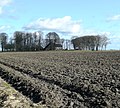
 Ruigezand - koeien onder boomsingel.jpg 3,072 × 1,728; 2.39 MB
-
 Teenstraheerd.JPG 3,264 × 2,448; 3.51 MB
-
 Voor- en zijgevel nr. 299 B-2 - Oldehove - 20495309 - RCE.jpg 1,200 × 900; 161 KB


