Category:The Maltings, York
Jump to navigation
Jump to search
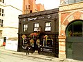
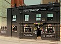
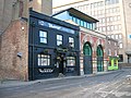
English: Opened circa 1842 as the Railway Tavern, later the Lendal Bridge, and from 1992, The Maltings.
| Object location | | View all coordinates using: OpenStreetMap |
|---|
pub in York, North Yorkshire, England  | |||||
| Upload media | |||||
| Instance of | |||||
|---|---|---|---|---|---|
| Location | York, City of York, North Yorkshire, Yorkshire and the Humber, England | ||||
| official website | |||||
 | |||||
Subcategories
This category has only the following subcategory.
I
Media in category "The Maltings, York"
The following 14 files are in this category, out of 14 total.
-
 My kind of pub^ - geograph.org.uk - 5262521.jpg 640 × 426; 59 KB
-
 Pub York - panoramio.jpg 3,000 × 4,000; 4.12 MB
-
 Tanner's Moat, York - geograph.org.uk - 411883.jpg 640 × 480; 108 KB
-
 The Maltings - Free House - geograph.org.uk - 408104.jpg 640 × 480; 78 KB
-
 The Maltings - geograph.org.uk - 1211711.jpg 640 × 426; 84 KB
-
 The Maltings - geograph.org.uk - 1984617.jpg 640 × 480; 95 KB
-
 The Maltings - geograph.org.uk - 1988795.jpg 800 × 600; 308 KB
-
 The Maltings - geograph.org.uk - 5033933.jpg 1,200 × 818; 339 KB
-
 The Maltings - geograph.org.uk - 5262518.jpg 640 × 426; 72 KB
-
 The Maltings - geograph.org.uk - 5300153.jpg 640 × 426; 67 KB
-
 THE MALTINGS PUB YORK JULY 2013 (9256058321).jpg 4,230 × 3,071; 8.36 MB
-
 The Maltings public house, York - geograph.org.uk - 2571663.jpg 800 × 600; 270 KB
-
 The Maltings, York - geograph.org.uk - 2467791.jpg 1,600 × 1,200; 539 KB
-
 The Maltings, York - geograph.org.uk - 3958703.jpg 640 × 424; 53 KB


.jpg)


