Category:Thorpe Astley
Jump to navigation
Jump to search
English: Thorpe Astley is a village on the south west outskirts of Leicester, within the boundary of Braunstone Town[1]. The first properties were built in 1995 on a greenfield site. The village is in the district of Blaby in the county of Leicestershire. The Village consists of a pharmacy/convenient store and a supermarket. There is also a number of small parks and green spaces around. It is regarded as one of Leicestershire's most desirable areas due to its proximity to the motorway networks and leisure amenities.
suburban area in Braunstone Town, Leicestershire, England, UK  | |||||
| Upload media | |||||
| Instance of | |||||
|---|---|---|---|---|---|
| Location | Braunstone Town, Braunstone, Blaby, Leicestershire, East Midlands, England | ||||
 | |||||
Media in category "Thorpe Astley"
The following 12 files are in this category, out of 12 total.
-
 Corfield Rise in Braunstone Town - geograph.org.uk - 5257215.jpg 800 × 544; 118 KB
-
 Hand Avenue in Braunstone Town - geograph.org.uk - 3755504.jpg 1,600 × 1,068; 389 KB
-
 Hand Avenue in Braunstone Town - geograph.org.uk - 3755516.jpg 1,600 × 1,200; 419 KB
-
 Path in Highway Spinney - geograph.org.uk - 5370531.jpg 800 × 566; 177 KB
-

-
 Withers Way roundabout - geograph.org.uk - 727136.jpg 640 × 413; 53 KB
-
 Foxon Way, Thorpe Astley, Leicester - geograph.org.uk - 458160.jpg 640 × 618; 109 KB
-

-
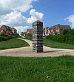
 The Bees Knees - geograph.org.uk - 458154.jpg 640 × 430; 102 KB
-
 Thorpe Astley, Leicester - geograph.org.uk - 141411.jpg 640 × 427; 99 KB
-
 Thorpe Astley, Leicester - geograph.org.uk - 458163.jpg 576 × 640; 122 KB
-
 Thorpe Astley, Leicester - geograph.org.uk - 458167.jpg 640 × 292; 81 KB


