Category:Tide gauges
Prijeđi na navigaciju
Prijeđi na pretraživanje
Deutsch: Kategorie:Mareografen. Der Mareograf (Mareograph) ist ein selbstregistrierendes Instrument zur laufenden Messung des Meeresspiegels an einer ozeanografischen Pegelstation.
English: Category:Tide gauges. A tide gauge is a device for measuring the change in sea level relative to a datum.
Español: Categoría:mareógrafos. Mareómetro o mareógrafo es el aparato que sirve para medir o registrar las mareas, se suele situar en las entradas de los puertos para orientar e informar a los barcos de la disposición de calado existente.
Français : Catégorie:Marégraphes. Un marégraphe est un instrument permettant de mesurer le niveau de la mer à un endroit donné.
Italiano: Categoria:Mareografi. Il mareografo è uno strumento che registra le variazioni del livello del mare e ne stabilisce il valore medio in un determinato luogo e in un determinato periodo.
Nederlands: Categorie:Maregrafen. Zelfregistrerende getijmeters of peilschalen. Een getijmeter is een instrument om de waterstand te meten.
Português: Categoria:Marégrafos. O marégrafo (do francês maré[o]graphe) é o instrumento que registra automaticamente o fluxo e o refluxo das marés em um determinado ponto da costa. Ao registro produzido, sob a forma de gráfico, denomina-se maregrama (do francês marégramme).
device for measuring the change in sea level relative to a datum | |||||
| Postavi datoteku | |||||
| Dio klase |
| ||||
|---|---|---|---|---|---|
| |||||
Potkategorije
Ova kategorija ima sljedećih 14 potkategorija, od ukupno 14.
A
- Aburatsubo Tide Station (10 F)
D
- Dwarsgat range front (3 F)
K
- Kronstadt tide gauge (30 F)
M
- Marégrafo de Cascais (9 F)
- Mareómetro de Portugalete (6 F)
- Marégrafo do Porto (7 F)
N
- Newlyn Tidal Observatory (10 F)
O
- Oulu Mareograph (7 F)
T
Mediji u kategoriji »Tide gauges«
Prikazana je 51 datoteka u ovoj kategoriji, od njih ukupno 51.
-
 099-ferreltpm.jpg 2.073 × 2.673; 1,26 MB
-
 Automatic tide gauge in Fushiki port.jpg 1.693 × 1.257; 831 KB
-
 Base F.JPG 1.840 × 1.232; 745 KB
-
 Basic-float-tide-gauge-and-chart-recording-drum-20 W640.jpg 640 × 501; 29 KB
-
 Benchmark on Barclays Bank, West Kirby.jpg 2.734 × 4.038; 8,18 MB
-
 Brough Roads - geograph.org.uk - 441874.jpg 640 × 450; 49 KB
-
 CascaisTideGauge Interior.jpg 4.608 × 3.456; 3,91 MB
-
 Cascaistidegauge3.jpg 747 × 1.150; 148 KB
-
 Cgs00888 - Flickr - NOAA Photo Library.jpg 2.288 × 1.712; 1,83 MB
-
 Eléphants de mer jouant avec un marégraphe installé près de la base de port aux Français.jpg 4.608 × 3.456; 6,59 MB
-
 Fyr5 ystad.jpg 1.944 × 2.592; 1,62 MB
-
 Getijmeter Loodswezen Antwerpen.jpg 1.430 × 1.651; 245 KB
-
 Hosojima Tide Station.jpg 3.264 × 2.448; 3,58 MB
-
 Loth Lorien39.jpg 4.157 × 3.120; 3,1 MB
-
 MareografoNro4-MDP.jpg 3.673 × 2.753; 10,03 MB
-
 Mareograph.jpg 359 × 592; 26 KB
-
 NOAA Tide Level Juneau 28.jpg 2.736 × 3.648; 3,16 MB
-
 Old lifeboat station, Hilbre Island 8.JPG 2.736 × 3.648; 3,58 MB
-
 Osaka Port Tide Measure Office 20190201.jpg 2.944 × 3.925; 2,98 MB
-
 Palmer Tide and Wind Recorder 1831 107930 01.jpg 8.401 × 5.992; 2,92 MB
-
 Palmer Tide and Wind Recorder 1831 107930 02.jpg 8.401 × 5.981; 3,97 MB
-
 Palmer Tide and Wind Recorder 1831 107930 03.jpg 5.213 × 6.426; 5,28 MB
-
 Pegelhuset, Ystad 2009.jpg 2.592 × 1.944; 2,01 MB
-
 Puntasalute.JPG 1.063 × 556; 44 KB
-
 Putting new piles in - geograph.org.uk - 650766.jpg 640 × 426; 61 KB
-
 S-Georgien 1882 25.jpg 1.500 × 1.000; 494 KB
-
 Solmsbach Pegel Bonbaden.jpg 1.024 × 768; 434 KB
-
 Storm tide monitoring equipment on the jetty at Palm Cove, 2018.jpg 1.080 × 1.920; 495 KB
-

-

-
 Tidal Depth-Safety Beacon-by-E-Pollock.jpg 480 × 640; 33 KB
-
 Tidal gauge dsc06189.jpg 900 × 1.604; 323 KB
-
 Tide clock.jpg 300 × 288; 53 KB
-
 Tide Gauge - Overland Point - geograph.org.uk - 151177.jpg 480 × 640; 65 KB
-
 Tide gauge 01.jpg 2.216 × 1.665; 1,65 MB
-
 Tide Gauge at Brough - geograph.org.uk - 1153852.jpg 640 × 448; 64 KB
-
 Tide Gauge Nautical Magazine 1832 421.png 3.553 × 6.452; 21,56 MB
-
 Tide gauge on Hilbre - geograph.org.uk - 1396842.jpg 640 × 480; 112 KB
-
 Tide gauge.jpg 1.310 × 2.643; 1,03 MB
-
 Tide Gauge.jpg 1.536 × 2.048; 236 KB
-
 Tide Level Gauge 472.jpg 3.264 × 2.448; 1,18 MB
-
 Tide level tender 22.jpg 2.266 × 1.679; 1,13 MB
-
 Tide Scale Jetty Ramp 5256.jpg 2.448 × 3.264; 957 KB
-
 Tideuhr Gezeitenuhr Schiffsuhr mit Tidenanzeige von Barigo tide clock.JPG 4.752 × 3.168; 7,1 MB
-
 Tidle Gauge in the Clock Tower, Table Bay Harbour, Cape Town BW.JPG 2.448 × 3.264; 2,35 MB
-
 Time and Tide - geograph.org.uk - 561160.jpg 640 × 480; 64 KB
-
 V&A tidal gauge.jpg 3.363 × 5.045; 11,55 MB
-
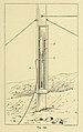 Vacuum Tide Gauge hydrographicalsu00whar 0489.jpg 1.608 × 2.561; 359 KB
-
 View near Tempozan Ferry Terminal 2.jpg 3.958 × 2.969; 3,19 MB
-

-
 БСЭ1. Мареграф.jpg 172 × 304; 25 KB


_(14770517591).jpg)


