Category:Transport maps of Peru
Jump to navigation
Jump to search
Subcategories
This category has the following 3 subcategories, out of 3 total.
P
R
- Road maps of Peru (12 F)
Media in category "Transport maps of Peru"
The following 15 files are in this category, out of 15 total.
-
 Camino De Cuzco A Paucartambo, I El Propuesto Al Puerto Fluvial.jpg 6,661 × 4,398; 3.57 MB
-
 Camino De Cuzco A Santana.jpg 6,335 × 4,474; 3.82 MB
-
 Hidrovía Amazónica.png 1,832 × 1,041; 906 KB
-
 Map for plane crash-ja.png 244 × 353; 7 KB
-
 Map for plane crash.png 258 × 367; 9 KB
-
 Mapa lunahuana.jpg 499 × 371; 39 KB
-
 PAT - Peru.gif 800 × 1,060; 202 KB
-
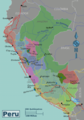 Peru regions map pt.png 387 × 554; 161 KB
-
 Peru sud osmarender big map.png 820 × 724; 318 KB
-
 Peru Transportation.jpg 1,985 × 2,454; 1.09 MB
-
 Roadmap for GalileoMobile expedition (iau0920a).jpg 4,000 × 2,250; 2.05 MB
-
 Roadmap for GalileoMobile expedition (iau0920a).tiff 4,000 × 2,250; 9.06 MB
-
 Teleférico Kuelap5.JPG 2,592 × 3,456; 1.52 MB
-
 Un-peru.png 2,348 × 2,947; 1.65 MB
-
 Viajes peru poblacion.jpg 190 × 286; 23 KB


.jpg)


