Category:Transport maps of the United States
Jump to navigation
Jump to search
States of the United States: Alabama · Alaska · Arizona · Arkansas · California · Colorado · Connecticut · Delaware · Florida · Georgia (U.S. state) · Hawaii · Idaho · Illinois · Indiana · Iowa · Kansas · Kentucky · Louisiana · Maine · Maryland · Massachusetts · Michigan · Minnesota · Mississippi (state) · Missouri · Montana · Nebraska · Nevada · New Hampshire · New Jersey · New Mexico · New York (state) · North Carolina · North Dakota · Ohio · Oklahoma · Oregon · Pennsylvania · Rhode Island · South Carolina · South Dakota · Tennessee · Texas · Utah · Vermont · Virginia · Washington (state) · West Virginia · Wisconsin · Wyoming – the District of Columbia: Washington, D.C.
the insular areas of the United States: American Samoa · Guam · the Northern Mariana Islands · Puerto Rico · the United States Virgin Islands – the United States Minor Outlying Islands: Bajo Nuevo Bank · Baker Island · Howland Island · Jarvis Island · Johnston Atoll · Kingman Reef · Midway Atoll · Navassa Island · Palmyra Atoll · Serranilla Bank · Wake Island
the insular areas of the United States: American Samoa · Guam · the Northern Mariana Islands · Puerto Rico · the United States Virgin Islands – the United States Minor Outlying Islands: Bajo Nuevo Bank · Baker Island · Howland Island · Jarvis Island · Johnston Atoll · Kingman Reef · Midway Atoll · Navassa Island · Palmyra Atoll · Serranilla Bank · Wake Island
Subcategories
This category has the following 13 subcategories, out of 13 total.
*
A
C
P
R
T
W
Media in category "Transport maps of the United States"
The following 93 files are in this category, out of 93 total.
-

-
 500 Pacific Coast Highway.SVG 200 × 230; 60 KB
-
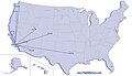
 Air Routes of the United States in 1925.jpg 1,798 × 1,143; 497 KB
-
 Alaska Highway1.png 2,083 × 2,028; 58 KB
-
 Ambassador Bridge Detroit Windsor.svg 935 × 1,022; 139 KB
-
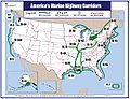 America's Marine Highway long term plan.jpg 1,204 × 928; 347 KB
-

-
 Appleton's illustrated hand-book of American cities; (1876) (14597180840).jpg 3,344 × 2,004; 1.49 MB
-
 Appleton's illustrated hand-book of American cities; (1876) (14780721101).jpg 3,344 × 1,872; 1.6 MB
-
 AZO Airline Route Map-2010 Nov.png 759 × 495; 108 KB
-

-

-

-
 Butterfield-Overland (cropped).gif 915 × 1,018; 383 KB
-
 Butterfield-Overland.gif 2,509 × 1,021; 1.04 MB
-
 Chicago Express.png 740 × 428; 51 KB
-
 Corridor fla.PNG 503 × 380; 134 KB
-
 Diagrama das linhas de alta velocidade projectadas nos EUA.png 1,440 × 862; 53 KB
-
 Dirt Roads of Fort Assinniboine.png 667 × 719; 24 KB
-

-

-
 Estimated Average Annual Daily Truck Traffic (1998).PNG 964 × 718; 244 KB
-
 FileMegabus Routes 2011.png 508 × 327; 28 KB
-
 Glenn Highway Map.gif 600 × 400; 44 KB
-

-
 Hwy 87 Overview to Fort Assinniboine.png 789 × 708; 22 KB
-
 I-35 Rejoin.png 943 × 884; 261 KB
-
 I-35 Split.png 453 × 499; 69 KB
-
 Left on red US.png 1,513 × 983; 33 KB
-
 Map Baltimore SHA 1988 Old HarfordRd LABELED.gif 1,120 × 807; 689 KB
-

-
 Map of principal transportation lines of the United States LOC 2007627464.jpg 8,395 × 6,258; 8.98 MB
-

-

-
 Map-WA-SSH7.svg 900 × 581; 55 KB
-
 Michigan 22 mapV2.png 2,091 × 1,286; 58 KB
-

-
-
 Minnesota Interstate Map.png 500 × 568; 21 KB
-
 MLI Route Map 085.jpg 1,005 × 703; 211 KB
-
 National Highway System Map.pdf 2,550 × 1,650; 6.41 MB
-

-
 Non-stop Routes from MLI 2012.png 799 × 494; 99 KB
-
 Non-stop Routes from MLI.png 1,005 × 703; 539 KB
-

-

-

-
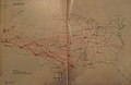
 Routes between New-York & Washington (NYPL b14951935-434652).jpg 1,776 × 6,300; 2.31 MB
-

-

-
 Map of the United States showing canals & railways, some proposed (NYPL b15050951-434836).tiff 4,904 × 5,755; 80.75 MB
-

-

-

-

-

-

-

-

-
-

-
-

-

-

-

-

-
 Transportation lines tributary to the commercial interests of St. Louis and of New Orleans (NYPL b18984139-5365481).tiff 10,328 × 7,760, 2 pages; 229.57 MB
-
 Transportation lines tributary to the commercial interests of St. Louis and of New Orleans (NYPL b18984139-5365482).tiff 10,328 × 7,760, 2 pages; 229.57 MB
-

-
 Transportation lines tributary to the commercial interests of St. Louis and of New Orleans (NYPL b18984139-5365484).tiff 10,328 × 7,760, 2 pages; 229.57 MB
-
 Transportation lines tributary to the commercial interests of St. Louis and of New Orleans (NYPL b18984139-5365485).tiff 10,328 × 7,760, 2 pages; 229.57 MB
-

-

-

-
 Map of Massachusetts, Connecticut and Rhode Island (NYPL b20644111-5831484).tiff 10,328 × 7,760, 2 pages; 229.61 MB
-
 Map of Massachusetts, Connecticut and Rhode Island (NYPL b20644111-5831484).jpg 9,167 × 7,279; 61.23 MB
-
 Permitted Longer Combination Vehicles on the National Highway System 2017 22Oct2018.png 3,900 × 2,850; 637 KB
-
 Salt belt.svg 959 × 593; 90 KB
-
 Salt-Belt.svg 1,000 × 589; 74 KB
-
 SBAmap.JPG 740 × 428; 28 KB
-
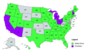 Self Driving Cars Legalized States in USA Map.png 1,504 × 947; 359 KB
-
 Southwest Airlines Destination Map 20110327.png 2,000 × 1,301; 76 KB
-
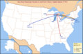
 Southwest Airlines Route 1971.png 2,000 × 1,301; 60 KB
-
 Southwest Airlines Route 20110327.png 1,998 × 1,300; 153 KB
-
 Southwest route map (11 90) (9357014078).jpg 2,553 × 1,658; 1.47 MB
-
 Strategic Highway Network.gif 600 × 395; 30 KB
-
 Tonnage on highways, railroads, and inland waterways.jpeg 2,072 × 1,554; 484 KB
-
 TVC Airline Route Map-2010 Jun.png 759 × 495; 106 KB
-
 TVC Airline Route Map-2012 Jun.png 759 × 495; 107 KB
-
 TVC Airline Route Map-2013 Jul.png 759 × 495; 108 KB
-
 Virginia Division.png 999 × 814; 91 KB
-
 Yellowbook.jpg 866 × 640; 205 KB
_-_Geographicus_-_UnitedStates-phelps-1848.jpg)


.jpg)
_(14597180840).jpg)
_(14780721101).jpg)

.jpg)
.jpg)
.jpg)
.gif)


.PNG)


._Route_of_the_Air-Conditionned_Empire_Builder_-_btv1b531895664_(1_of_2).jpg)


.jpg)
.jpg)


.jpg)
.jpg)
.jpg)
.jpg)
.jpg)
.jpg)
.jpg)
.jpg)
.jpg)
.jpg)


_(9357014078).jpg)


_(14757591691).jpg)
_(14758425914).jpg)
.jpg)
.jpg)
.jpg)
.jpg)
.jpg)
.jpg)
.jpg)