Category:Travel maps of the Faroe Islands
Jump to navigation
Jump to search
Media in category "Travel maps of the Faroe Islands"
The following 6 files are in this category, out of 6 total.
-
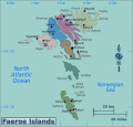
 Faeroe Islands Regions map.png 2,500 × 2,384; 966 KB
-
 Faeroe Islands Regions map.svg 1,398 × 1,333; 850 KB
-
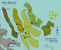 Norðoyar regions map.png 3,909 × 3,262; 1.73 MB
-
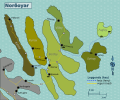 Norðoyar regions map.svg 750 × 625; 3.29 MB
-
 Vágar static map.png 3,909 × 3,258; 1.37 MB
-
 Vágar static map.svg 750 × 625; 2.89 MB


