Category:United Kingdom photographs taken on 2007-08-14
Jump to navigation
Jump to search
| ← | Tuesday 14 August 2007 | → | ||
| ← | August 2007 | → | ||

United Kingdom photographs taken on 14 August 2007.
Image files should be categorized here automatically using {{taken on}} template. Direct categorisation is also possible, if automatic is impossible.
Subcategories
This category has only the following subcategory.
S
Media in category "United Kingdom photographs taken on 2007-08-14"
The following 200 files are in this category, out of 403 total.
(previous page) (next page)-
 "De Lacy Arms" Whalley - geograph.org.uk - 530367.jpg 640 × 480; 221 KB
-
 "The Portrush Puffer" - geograph.org.uk - 529076.jpg 640 × 479; 61 KB
-
 Norwoodjunction2.JPG 2,816 × 2,112; 776 KB
-

-
 A Happy Family on the Sankey Canal! - geograph.org.uk - 529053.jpg 640 × 451; 23 KB
-
 A track into the conifer woodland. - geograph.org.uk - 527569.jpg 640 × 430; 168 KB
-
 A390 at Butterdon - geograph.org.uk - 530607.jpg 640 × 480; 198 KB
-
 Abandoned croft at Clave, Westing - geograph.org.uk - 525730.jpg 640 × 426; 85 KB
-
 Abandoned croft at Collaster - geograph.org.uk - 525695.jpg 640 × 426; 82 KB
-
 Abandoned croft at Collaster - geograph.org.uk - 525703.jpg 640 × 426; 69 KB
-
 Abandoned Croft, Melvaig - geograph.org.uk - 531164.jpg 640 × 427; 74 KB
-
-
 Activity at Portrush Harbour - geograph.org.uk - 529081.jpg 640 × 479; 50 KB
-
 "Alma Inn" Manchester Road, Accrington - geograph.org.uk - 530306.jpg 612 × 460; 151 KB
-
 Angel of the north2 (1241377725).jpg 2,052 × 1,830; 2.39 MB
-
 Angel of the north3 (1241386763).jpg 1,849 × 3,115; 3.37 MB
-
 Angel of the north4 (1241393723).jpg 3,456 × 2,304; 2.61 MB
-
 Angel of the north5 (1242267650).jpg 3,456 × 2,304; 4.14 MB
-
 Angel of the north6 (1242278880).jpg 3,456 × 2,304; 4.24 MB
-
 Approaching Whitehead station - geograph.org.uk - 525463.jpg 640 × 426; 91 KB
-
 "Arden Inn" Abbey Street, Accrington - geograph.org.uk - 530330.jpg 640 × 480; 218 KB
-
 Artikelly - geograph.org.uk - 528890.jpg 640 × 479; 58 KB
-
 Auchinleck railway station in 2007.jpg 640 × 480; 89 KB
-
 Barnailt Road - geograph.org.uk - 528875.jpg 640 × 479; 67 KB
-
 Barrow Haven. - Flickr - riffraff1.jpg 2,592 × 1,944; 1.26 MB
-

-
 Beach Huts, Bulverhythe - geograph.org.uk - 526262.jpg 640 × 479; 132 KB
-
 Beach Huts, Bulverhythe - geograph.org.uk - 526264.jpg 640 × 502; 176 KB
-
 Beach, St Leonards - geograph.org.uk - 526182.jpg 640 × 477; 101 KB
-
-

-

-
 Big bird, small pony - geograph.org.uk - 535304.jpg 640 × 480; 95 KB
-
 Blackburn Road, Accrington - geograph.org.uk - 525049.jpg 640 × 480; 93 KB
-
 Blackwater River - geograph.org.uk - 1543639.jpg 427 × 640; 111 KB
-

-
 Boat on Loch Dubh at Tarbet - geograph.org.uk - 1025145.jpg 640 × 480; 104 KB
-
 Boats at Carrickfergus harbour - geograph.org.uk - 525431.jpg 640 × 426; 84 KB
-
 Boats moored on Sankey Canal - geograph.org.uk - 529015.jpg 640 × 367; 24 KB
-
 Bogligarths Geo - geograph.org.uk - 525709.jpg 640 × 426; 95 KB
-
 Boyton Bridge - geograph.org.uk - 533974.jpg 640 × 480; 99 KB
-
 Bridge over Lynher Tributary - geograph.org.uk - 532347.jpg 640 × 480; 201 KB
-
 Brinkburn Mill - geograph.org.uk - 577743.jpg 640 × 480; 146 KB
-
 Bus Shelter, Melvaig - geograph.org.uk - 561142.jpg 640 × 451; 87 KB
-
 By the Lynher, Bathpool - geograph.org.uk - 530661.jpg 640 × 480; 191 KB
-
 Cambridge Crescent - geograph.org.uk - 527392.jpg 480 × 640; 63 KB
-
 Canal basin - geograph.org.uk - 533986.jpg 640 × 480; 91 KB
-
 Carn Dearg Youth Hostel - geograph.org.uk - 531183.jpg 640 × 427; 73 KB
-
 Carrickfergus harbour - geograph.org.uk - 525381.jpg 640 × 426; 84 KB
-
 Cascade at Loch Maree - geograph.org.uk - 1574348.jpg 427 × 640; 132 KB
-
 Chepstow - the tidal river Wye - geograph.org.uk - 525469.jpg 640 × 268; 82 KB
-
 Church Road Accrington - geograph.org.uk - 525086.jpg 640 × 480; 87 KB
-
 Clashnessie viewed from the beach - geograph.org.uk - 1022732.jpg 640 × 480; 71 KB
-
 Clave Stack - geograph.org.uk - 525723.jpg 640 × 426; 92 KB
-
 Coleraine Courthouse - geograph.org.uk - 528925.jpg 640 × 479; 48 KB
-
 Colourful cart, Carrickfergus - geograph.org.uk - 525438.jpg 640 × 426; 116 KB
-
 Combe Haven Outfalls - geograph.org.uk - 526258.jpg 640 × 474; 159 KB
-
 Cows near Woodcock's Eye - geograph.org.uk - 531518.jpg 640 × 480; 204 KB
-
 Creagan a Choire Etchachan - geograph.org.uk - 544406.jpg 640 × 480; 81 KB
-
 Cullercoats Bay from the beach - geograph.org.uk - 525548.jpg 640 × 480; 64 KB
-
 Cullercoats Lifeboat Station - geograph.org.uk - 525507.jpg 640 × 480; 80 KB
-

-
 Derry More Townland - geograph.org.uk - 528894.jpg 640 × 479; 78 KB
-
 Dirtagh - geograph.org.uk - 528897.jpg 640 × 479; 52 KB
-
 Dirtagh Townland - geograph.org.uk - 528896.jpg 640 × 479; 65 KB
-
 "Dog and Partridge, Back Lane, Accrington - geograph.org.uk - 530300.jpg 612 × 460; 157 KB
-

-
 Earl Morrison Memorial Orange Hall.jpg 640 × 479; 62 KB
-
 Edinburgh Airport - Control Tower - geograph.org.uk - 525284.jpg 480 × 640; 40 KB
-

-
 Entrance to the Beach, Glynne Gap - geograph.org.uk - 526538.jpg 479 × 640; 120 KB
-
 Eroded Cliff Remains, Glynne Gap - geograph.org.uk - 526517.jpg 640 × 479; 85 KB
-
 Evening at New Quay bay - geograph.org.uk - 531204.jpg 640 × 480; 97 KB
-
 Farm sheds, Hammett - geograph.org.uk - 621525.jpg 640 × 480; 201 KB
-
-
 Fiddlers Ferry Lock, St Helens Canal - geograph.org.uk - 950610.jpg 640 × 480; 81 KB
-
 Fiddlers Ferry Lock, St Helens Canal - geograph.org.uk - 950620.jpg 640 × 480; 79 KB
-
 Fidler's Ferry Power Station - geograph.org.uk - 529009.jpg 640 × 380; 18 KB
-
 Footbridge over tributary of River Lynher - geograph.org.uk - 531536.jpg 640 × 480; 187 KB
-
 Footpath and paddocks in Hermitage - geograph.org.uk - 525428.jpg 640 × 480; 122 KB
-
 Former linoleum factory (2) - geograph.org.uk - 725688.jpg 640 × 424; 36 KB
-
 Former linoleum factory (3) - geograph.org.uk - 725694.jpg 640 × 424; 71 KB
-
 Former linoleum factory - geograph.org.uk - 725452.jpg 640 × 424; 52 KB
-
 Foul Weather over Bulverhythe Beach - geograph.org.uk - 526436.jpg 640 × 486; 64 KB
-

-
 Gate, Whitehead - geograph.org.uk - 525474.jpg 640 × 426; 92 KB
-
 Gileston11.jpg 640 × 479; 92 KB
-
 Gileston12.jpg 640 × 479; 108 KB
-
 Gileston13.jpg 640 × 495; 104 KB
-
 Gileston14.jpg 640 × 611; 117 KB
-
 Gileston15.jpg 640 × 464; 119 KB
-
 Golf course at Sconser - geograph.org.uk - 525567.jpg 640 × 425; 299 KB
-
 Gort na Annan - geograph.org.uk - 528877.jpg 640 × 479; 78 KB
-
 Grave of Somhairle MacGill-Eain - geograph.org.uk - 525535.jpg 425 × 640; 403 KB
-
 Hairpin Bend, Lighthouse Access Road - geograph.org.uk - 532116.jpg 640 × 427; 104 KB
-
 Harlyn - geograph.org.uk - 796185.jpg 640 × 480; 65 KB
-

-
 Harlyn Beach - geograph.org.uk - 796173.jpg 640 × 480; 77 KB
-
 Haslingden Town Centre - geograph.org.uk - 527208.jpg 640 × 547; 97 KB
-
 Hillside Above Little Sand Farm - geograph.org.uk - 532122.jpg 640 × 427; 71 KB
-

-

-

-
 Holy Trinity, Llandow, Glamorgan - geograph.org.uk - 539557.jpg 640 × 480; 101 KB
-
 Holy Trinity, Llandow, Glamorgan - geograph.org.uk - 539559.jpg 640 × 479; 121 KB
-
 Holy Trinity, Llandow, Glamorgan - geograph.org.uk - 539584.jpg 479 × 640; 73 KB
-
 Holy Trinity, Llandow, Glamorgan - geograph.org.uk - 539591.jpg 640 × 462; 149 KB
-

-
 Holy Trinity, Llandow, Glamorgan - Porch - geograph.org.uk - 539580.jpg 640 × 479; 139 KB
-

-

-

-
 House at Scourie Pier - geograph.org.uk - 1022764.jpg 640 × 480; 94 KB
-

-
 Humber Bridge - North Tower - geograph.org.uk - 525594.jpg 480 × 640; 51 KB
-
 Kidna Water - geograph.org.uk - 525714.jpg 640 × 426; 31 KB
-
 Kirk Syke Lane - geograph.org.uk - 525293.jpg 640 × 480; 142 KB
-
 Kirkaby - geograph.org.uk - 525657.jpg 640 × 426; 73 KB
-
 Langstone Harbour, high tide - geograph.org.uk - 525391.jpg 640 × 480; 76 KB
-
 Lifeguard, Portrush - geograph.org.uk - 529084.jpg 640 × 479; 51 KB
-
 Holy Trinity, Llandow, Glamorgan - geograph.org.uk - 539588.jpg 479 × 640; 82 KB
-

-
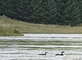 Loch Ailsh divers - geograph.org.uk - 1160875.jpg 640 × 469; 80 KB
-
 Loch Eyre - geograph.org.uk - 525509.jpg 640 × 425; 352 KB
-
 Loch of Collaster - geograph.org.uk - 525706.jpg 640 × 426; 58 KB
-
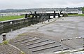
 Lock Gates - Sankey Canal - geograph.org.uk - 529071.jpg 640 × 325; 34 KB
-
 Lock on Sankey Canal - geograph.org.uk - 529020.jpg 640 × 413; 34 KB
-
 Longa Geo - geograph.org.uk - 525717.jpg 426 × 640; 73 KB
-
 Look on the bright side - geograph.org.uk - 530686.jpg 640 × 480; 95 KB
-

-
 Looking out to Eilean Reilean - geograph.org.uk - 1258367.jpg 640 × 437; 67 KB
-
 Looking towards the Cheshire Plain - geograph.org.uk - 529386.jpg 640 × 302; 75 KB
-
 Lothian Buses Edinburgh Shuttle Ford Transit airport minibus.jpg 504 × 387; 134 KB
-
 Loughermore Forest - geograph.org.uk - 528881.jpg 640 × 479; 112 KB
-
 Loughermore Forest East - geograph.org.uk - 528885.jpg 640 × 479; 52 KB
-
 Loughermore River - geograph.org.uk - 528882.jpg 640 × 479; 78 KB
-
 Lunch spot next to Dùn Bàn - geograph.org.uk - 1257622.jpg 640 × 400; 90 KB
-
 Lynher tributary - looking downstream - geograph.org.uk - 532350.jpg 480 × 640; 201 KB
-
 Market Hall - geograph.org.uk - 525071.jpg 640 × 480; 133 KB
-
 Market Hall. - geograph.org.uk - 525056.jpg 640 × 480; 118 KB
-

-
 Milking time - geograph.org.uk - 525389.jpg 640 × 480; 115 KB
-
 Model village - geograph.org.uk - 536754.jpg 640 × 480; 118 KB
-
 Mornick - geograph.org.uk - 530641.jpg 640 × 424; 196 KB
-
 Mountsandel Fort - geograph.org.uk - 528928.jpg 640 × 285; 27 KB
-
 Must be climate change - geograph.org.uk - 525749.jpg 640 × 512; 127 KB
-
 Near Windy Hall - geograph.org.uk - 529054.jpg 640 × 479; 70 KB
-
 New A299 cuts across fields and footpath - geograph.org.uk - 527518.jpg 640 × 480; 122 KB
-
 New houses in Glenoe - geograph.org.uk - 525680.jpg 640 × 426; 77 KB
-
 Newfield Bridge - geograph.org.uk - 525288.jpg 640 × 480; 115 KB
-
 Nissen hut above Boyton Bridge - geograph.org.uk - 533977.jpg 640 × 480; 71 KB
-
 North Darley, Looking south from junction - geograph.org.uk - 531539.jpg 640 × 480; 172 KB
-
 North Erradale - geograph.org.uk - 532852.jpg 640 × 427; 81 KB
-
 Oldshoremore Beach - geograph.org.uk - 1022775.jpg 640 × 480; 69 KB
-
 On Higher Colgarth Hill - geograph.org.uk - 525289.jpg 640 × 480; 78 KB
-
 On Kirk Syke Lane - geograph.org.uk - 525298.jpg 640 × 480; 98 KB
-
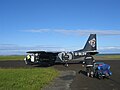 Papa Westray Airport.jpg 2,048 × 1,536; 1.26 MB
-

-
 Pennine Way at Newfield - geograph.org.uk - 525282.jpg 640 × 480; 91 KB
-
 Penny Lane - geograph.org.uk - 525433.jpg 640 × 480; 91 KB
-
 Pinus sylvestris youngcone.jpg 1,693 × 1,529; 1.5 MB
-
 Playhouse Theatre from front - geograph.org.uk - 525558.jpg 640 × 480; 70 KB
-
 Playhouse Theatre from Rear - geograph.org.uk - 525552.jpg 640 × 480; 57 KB
-
 Portrush - geograph.org.uk - 529102.jpg 640 × 479; 71 KB
-
 Portrush Harbour - geograph.org.uk - 529104.jpg 640 × 479; 44 KB
-
 Portrush seafront, west strand - geograph.org.uk - 529093.jpg 640 × 479; 48 KB
-
 Portrush west strand - geograph.org.uk - 529088.jpg 640 × 479; 33 KB
-
 Portrush Yacht Club - geograph.org.uk - 529079.jpg 640 × 479; 46 KB
-
 Rawtenstall Corporation Motors Garage - geograph.org.uk - 531464.jpg 640 × 428; 189 KB
-
 Rex Hotel - Whitley Bay - geograph.org.uk - 525631.jpg 640 × 480; 72 KB
-
 River Mersey off Widnes - geograph.org.uk - 950161.jpg 640 × 480; 74 KB
-
 Road at Coleraine - geograph.org.uk - 528917.jpg 640 × 479; 55 KB
-
 Road at Drumraghland - geograph.org.uk - 528887.jpg 640 × 479; 47 KB
-
 Road at Gortilea - geograph.org.uk - 528872.jpg 640 × 479; 72 KB
-
 Road at Knockmult - geograph.org.uk - 528900.jpg 640 × 479; 57 KB
-
 Road at Knockmult - geograph.org.uk - 528902.jpg 479 × 640; 81 KB
-
 Road at Knockmult - geograph.org.uk - 528903.jpg 479 × 640; 99 KB
-
 Road junction, North Darley - geograph.org.uk - 530655.jpg 640 × 402; 199 KB
-
 Road near Loughermore Forest - geograph.org.uk - 528886.jpg 640 × 479; 46 KB
-
 Road near Mountsandel, Coleraine - geograph.org.uk - 528921.jpg 640 × 289; 28 KB
-

-
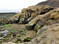
 Rocks off Trevone - geograph.org.uk - 796193.jpg 640 × 480; 98 KB
-
 Rocky Inlet, Rubha Rèidh - geograph.org.uk - 532097.jpg 427 × 640; 81 KB
-
 Rubha Bhrisdeadh-ramh - geograph.org.uk - 1257654.jpg 640 × 480; 74 KB
-
 Ruin, Melvaig - geograph.org.uk - 565557.jpg 640 × 427; 81 KB
-

-
 Sconser pier - geograph.org.uk - 525550.jpg 640 × 425; 309 KB
-
 Scottish thistle over Badcall Bay - geograph.org.uk - 1022761.jpg 480 × 640; 95 KB
-

-
 Shilbottle Village Cooperative Store - geograph.org.uk - 527602.jpg 640 × 430; 139 KB
-
 Short cut - geograph.org.uk - 530357.jpg 480 × 640; 168 KB
-
 Silt and Mud in Lock on Sankey Canal - geograph.org.uk - 529062.jpg 640 × 373; 33 KB
-
 Site of West Marina Station - geograph.org.uk - 526216.jpg 640 × 479; 136 KB
-
 Smuggler's Cave - Cullercoats - geograph.org.uk - 525529.jpg 640 × 480; 97 KB
-
 Spitfire - geograph.org.uk - 525277.jpg 640 × 480; 91 KB
-

-
 Spoo Ness - geograph.org.uk - 525662.jpg 640 × 426; 75 KB
-

-

-


.jpg)
.jpg)
.jpg)
.jpg)
.jpg)


_WB2103-3_-_geograph.org.uk_-_1202511.jpg)
_WB2103-3_-_geograph.org.uk_-_1202512.jpg)


_-_geograph.org.uk_-_725688.jpg)
_-_geograph.org.uk_-_725694.jpg)


