Category:Upton Pyne
Aller à la navigation
Aller à la recherche
English: Upton Pyne is a parish and village in Devon, England. The parish lies just north west of Exeter, mainly between the River Exe and River Creedy. The village is located north of Cowley and west of Brampford Speke and Stoke Canon.
village britannique  | |||||
| Téléverser des médias | |||||
| Nature de l’élément | |||||
|---|---|---|---|---|---|
| Lieu | East Devon, Devon, Angleterre du Sud-Ouest, Angleterre | ||||
| Population |
| ||||
| Superficie |
| ||||
 | |||||
Sous-catégories
Cette catégorie comprend 6 sous-catégories, dont les 6 ci-dessous.
Média dans la catégorie « Upton Pyne »
Cette catégorie comprend 275 fichiers, dont les 200 ci-dessous.
(page précédente) (page suivante)-
 A Christmas welcome to Exeter - geograph.org.uk - 636882.jpg 640 × 480 ; 112 kio
-
 A377, Three Horse Shoes - geograph.org.uk - 2479517.jpg 640 × 480 ; 71 kio
-
 Access track to Hayne Barton - geograph.org.uk - 1612078.jpg 640 × 480 ; 96 kio
-
 Along the rails - geograph.org.uk - 2448769.jpg 2 048 × 1 536 ; 540 kio
-

-
 Barnstaple train, passes Cowley - geograph.org.uk - 1366928.jpg 640 × 480 ; 94 kio
-
 Beer Cottage - geograph.org.uk - 5428120.jpg 640 × 426 ; 40 kio
-
 Beer Cottage - geograph.org.uk - 5450232.jpg 640 × 426 ; 40 kio
-
 Beer Cottages - geograph.org.uk - 5679440.jpg 640 × 426 ; 48 kio
-
 Bernaville Garden Centre - geograph.org.uk - 1285952.jpg 640 × 480 ; 172 kio
-
 Bramble Lane running west from Starved Oak Cross - geograph.org.uk - 2242632.jpg 640 × 480 ; 303 kio
-
 Brampford Cross - geograph.org.uk - 1369744.jpg 640 × 480 ; 91 kio
-
 Brampford Cross - geograph.org.uk - 1612117.jpg 640 × 480 ; 70 kio
-
 Bridge over Jackmoor Brook - geograph.org.uk - 2298979.jpg 640 × 480 ; 128 kio
-
 Building on Star Barton Lane - geograph.org.uk - 190046.jpg 640 × 480 ; 114 kio
-
 Cep by the side of the road - geograph.org.uk - 2623706.jpg 2 048 × 1 536 ; 1,11 Mio
-
 Church for sale, Cowley - geograph.org.uk - 3911441.jpg 1 024 × 768 ; 157 kio
-
 Country lane on a dull December day - geograph.org.uk - 636889.jpg 640 × 480 ; 94 kio
-
 Cowley , Newbridge Hill A377 - geograph.org.uk - 6339874.jpg 6 000 × 4 000 ; 7,37 Mio
-
 Cowley , Newbridge Hill A377 - geograph.org.uk - 6339876.jpg 6 000 × 4 000 ; 7,74 Mio
-
 Cowley , Redside Terrace - geograph.org.uk - 6339878.jpg 6 000 × 4 000 ; 7,63 Mio
-
 Cowley , River Creedy - geograph.org.uk - 6339838.jpg 6 000 × 4 000 ; 6,38 Mio
-
 Cowley , River Creedy - geograph.org.uk - 6339840.jpg 6 000 × 4 000 ; 6,01 Mio
-
 Cowley , River Exe - geograph.org.uk - 6339836.jpg 6 000 × 4 000 ; 6,5 Mio
-
 Cowley , Star Barton Lane - geograph.org.uk - 6339844.jpg 6 000 × 4 000 ; 7,44 Mio
-
 Cowley , Star Barton Lane - geograph.org.uk - 6339847.jpg 6 000 × 4 000 ; 7,17 Mio
-
 Cowley , Star Barton Lane - geograph.org.uk - 6339849.jpg 6 000 × 4 000 ; 6,43 Mio
-
 Cowley , Star Barton Lane - geograph.org.uk - 6339852.jpg 6 000 × 4 000 ; 7,51 Mio
-
 Cowley , Star Barton Lane - geograph.org.uk - 6339854.jpg 6 000 × 4 000 ; 6,85 Mio
-
 Cowley , Star Barton Lane - geograph.org.uk - 6339856.jpg 6 000 × 4 000 ; 7,57 Mio
-
 Cowley , Star Barton Lane - geograph.org.uk - 6339860.jpg 6 000 × 4 000 ; 6,78 Mio
-
 Cowley , Star Barton Lane - geograph.org.uk - 6339862.jpg 4 000 × 6 000 ; 6,82 Mio
-
 Cowley , Star Barton Lane - geograph.org.uk - 6339863.jpg 6 000 × 4 000 ; 7,22 Mio
-
 Cowley , Star Barton Lane - geograph.org.uk - 6339871.jpg 6 000 × 4 000 ; 6,83 Mio
-
 Cowley , Upton Pyne Hill - geograph.org.uk - 6339873.jpg 6 000 × 4 000 ; 7,27 Mio
-
 Cowley Bridge, Exeter - geograph.org.uk - 6386798.jpg 1 024 × 778 ; 662 kio
-
 Devonshire Heartland Way approaching Upton Pyne - geograph.org.uk - 3102036.jpg 640 × 480 ; 105 kio
-
 East Devon , -Little Nettacott - geograph.org.uk - 4536111.jpg 4 288 × 2 848 ; 6,2 Mio
-
 East Devon , Bushy Footpath - geograph.org.uk - 3148097.jpg 2 848 × 4 288 ; 6,76 Mio
-
 East Devon , Country Lane - geograph.org.uk - 4536108.jpg 4 288 × 2 848 ; 7,03 Mio
-
 East Devon , Country Lane - geograph.org.uk - 4536109.jpg 4 288 × 2 848 ; 5,75 Mio
-
 East Devon , Country Lane - geograph.org.uk - 4537548.jpg 4 288 × 2 848 ; 6,47 Mio
-
 East Devon , Country Lane - geograph.org.uk - 4537551.jpg 4 288 × 2 848 ; 6,18 Mio
-
 East Devon , Country Road - geograph.org.uk - 4537468.jpg 4 288 × 2 848 ; 6,37 Mio
-
 East Devon , Country Road - geograph.org.uk - 4537470.jpg 4 288 × 2 848 ; 5,59 Mio
-
 East Devon , Countryside Scenery - geograph.org.uk - 4536039.jpg 4 288 × 2 848 ; 6,18 Mio
-
 East Devon , Countryside Scenery - geograph.org.uk - 4536047.jpg 4 165 × 2 766 ; 5,94 Mio
-
 East Devon , Countryside Scenery - geograph.org.uk - 4536113.jpg 4 288 × 2 848 ; 4,96 Mio
-
 East Devon , Countryside Scenery - geograph.org.uk - 4536114.jpg 4 288 × 2 848 ; 7,46 Mio
-
 East Devon , Countryside Scenery - geograph.org.uk - 4537488.jpg 4 288 × 2 848 ; 5,83 Mio
-
 East Devon , Five Oaks Cross - geograph.org.uk - 4536107.jpg 4 288 × 2 848 ; 6,76 Mio
-
 East Devon , Grassy Field - geograph.org.uk - 3148130.jpg 4 288 × 2 848 ; 4,24 Mio
-
 East Devon , Grassy Field - geograph.org.uk - 4535903.jpg 4 288 × 2 848 ; 6,3 Mio
-
 East Devon , Grassy Field - geograph.org.uk - 4535905.jpg 3 613 × 2 400 ; 5,03 Mio
-
 East Devon , Grassy Field - geograph.org.uk - 4535908.jpg 4 288 × 2 848 ; 7,91 Mio
-
 East Devon , Grassy Field - geograph.org.uk - 4535960.jpg 4 288 × 2 848 ; 6,81 Mio
-
 East Devon , Grassy Field - geograph.org.uk - 4536042.jpg 4 288 × 2 848 ; 5,98 Mio
-
 East Devon , Grassy Field - geograph.org.uk - 4536043.jpg 4 288 × 2 848 ; 6,3 Mio
-
 East Devon , Grassy Field - geograph.org.uk - 4536044.jpg 4 288 × 2 848 ; 5,54 Mio
-
 East Devon , Grassy Field - geograph.org.uk - 4536049.jpg 4 288 × 2 848 ; 6,21 Mio
-
 East Devon , Grassy Field - geograph.org.uk - 4537479.jpg 4 288 × 2 848 ; 6,22 Mio
-
 East Devon , Grassy Field ^ Cattle - geograph.org.uk - 3148118.jpg 4 288 × 2 848 ; 6,27 Mio
-
 East Devon , Grassy Field ^ Countryside - geograph.org.uk - 3148107.jpg 4 288 × 2 848 ; 6,29 Mio
-
 East Devon , Grassy Field ^ Footpath - geograph.org.uk - 3148124.jpg 4 288 × 2 848 ; 5,71 Mio
-
 East Devon , Grassy Field ^ Gate - geograph.org.uk - 4536110.jpg 4 288 × 2 848 ; 6,47 Mio
-
 East Devon , Grassy Field ^ Hay-bales - geograph.org.uk - 3148078.jpg 4 288 × 2 848 ; 6,08 Mio
-
 East Devon , Grassy Field ^ Horses - geograph.org.uk - 3147997.jpg 4 288 × 2 848 ; 5,9 Mio
-
 East Devon , Grassy Field ^ Tree - geograph.org.uk - 3148064.jpg 2 848 × 4 288 ; 4,26 Mio
-
 East Devon , Hayne Barton Track - geograph.org.uk - 4537476.jpg 4 288 × 2 848 ; 6,19 Mio
-
 East Devon , Home Farm - geograph.org.uk - 3148086.jpg 4 288 × 2 848 ; 5,31 Mio
-
 East Devon , Pynes House - geograph.org.uk - 3148109.jpg 4 288 × 2 848 ; 5,96 Mio
-
 East Devon , Railway Line - geograph.org.uk - 3148050.jpg 4 288 × 2 848 ; 6,28 Mio
-
 East Devon , River Creedy - geograph.org.uk - 3147970.jpg 4 288 × 2 848 ; 6,35 Mio
-
 East Devon , The River Creedy - geograph.org.uk - 3147975.jpg 4 288 × 2 848 ; 4,2 Mio
-
 East Devon , The River Creedy - geograph.org.uk - 3147990.jpg 4 288 × 2 848 ; 6,66 Mio
-
 East Devon , Upton Pyne Hill - geograph.org.uk - 3148056.jpg 4 288 × 2 848 ; 6,27 Mio
-
 East Devon , Upton Pyne Hill - geograph.org.uk - 4666903.jpg 3 806 × 2 528 ; 4,66 Mio
-
 Entrance driveway, Pynes - geograph.org.uk - 1366958.jpg 640 × 473 ; 89 kio
-
 Entrance to Bernaville Nursery - geograph.org.uk - 6152139.jpg 1 024 × 768 ; 183 kio
-
 Entrance to Burleycoombe Wood above Pynes Weir - geograph.org.uk - 1198645.jpg 640 × 427 ; 101 kio
-
 Exe valley at Pynes - geograph.org.uk - 6234611.jpg 3 039 × 1 580 ; 618 kio
-
 Exe Valley Way passing Pynes - geograph.org.uk - 2278720.jpg 800 × 600 ; 421 kio
-
 Exeter , The River Exe - geograph.org.uk - 3147953.jpg 4 288 × 2 848 ; 6,32 Mio
-
 Exeter boundary, Crediton Road (A377) - geograph.org.uk - 3911522.jpg 1 024 × 768 ; 246 kio
-
 Exeter Water Works 1856 - geograph.org.uk - 2623691.jpg 2 048 × 1 536 ; 1,07 Mio
-
 Farm track, leading north, from Bramble Lane - geograph.org.uk - 2000201.jpg 1 024 × 768 ; 233 kio
-
 Farm track, near Stevenstone Barton - geograph.org.uk - 2000216.jpg 1 024 × 768 ; 210 kio
-
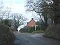
 Farm, Upton Pyne - geograph.org.uk - 260012.jpg 640 × 480 ; 196 kio
-
 Farmyard near Pynes House - geograph.org.uk - 4163537.jpg 1 024 × 768 ; 467 kio
-
 Field at Great Oak Cross, and Stevenstone Barton - geograph.org.uk - 2242650.jpg 640 × 480 ; 205 kio
-
 Field by Starved Oak Cross - geograph.org.uk - 1852582.jpg 640 × 480 ; 99 kio
-
 Field in mid Devon - geograph.org.uk - 1393405.jpg 640 × 480 ; 172 kio
-
 Field near Nettacott - geograph.org.uk - 1443057.jpg 640 × 480 ; 170 kio
-

-
 Field opposite Sevenstone Barton - geograph.org.uk - 1603277.jpg 640 × 480 ; 58 kio
-
 Fields near No Mans Chapel - geograph.org.uk - 1852723.jpg 640 × 453 ; 84 kio
-
 Fields near Sevenstone Barton, looking east - geograph.org.uk - 1443076.jpg 640 × 480 ; 168 kio
-
 Five Oaks cross looking towards Jackmoor - geograph.org.uk - 1443047.jpg 640 × 480 ; 175 kio
-
 Flooded River Exe, looking towards Pynes - geograph.org.uk - 2233444.jpg 640 × 480 ; 53 kio
-
 Flooding of low lying land near River Creedy - geograph.org.uk - 5313260.jpg 2 048 × 1 536 ; 765 kio
-
 Footpath past a field of sows - geograph.org.uk - 3669825.jpg 1 536 × 1 152 ; 1,05 Mio
-
 Ford at Star Barton Farm - geograph.org.uk - 4194367.jpg 3 872 × 2 592 ; 4,86 Mio
-
 Ford on Star Barton Lane - geograph.org.uk - 1442143.jpg 640 × 480 ; 154 kio
-

-
 Gates into field south of Nettacott - geograph.org.uk - 2298961.jpg 800 × 600 ; 399 kio
-
 Gateway, on the road to Star Barton - geograph.org.uk - 1997520.jpg 1 024 × 768 ; 206 kio
-
 Glebe Close, Upton Pyne - geograph.org.uk - 2000742.jpg 1 024 × 768 ; 151 kio
-
 Gratton Plantation - geograph.org.uk - 2278713.jpg 800 × 600 ; 390 kio
-
 Great Oak Cross - geograph.org.uk - 1852597.jpg 640 × 480 ; 99 kio
-
 Great Oak Farm - geograph.org.uk - 2242653.jpg 640 × 480 ; 281 kio
-
 Green lane neat Nettacott - geograph.org.uk - 1443064.jpg 640 × 480 ; 171 kio
-
 Green lane neat Nettacott, looking south - geograph.org.uk - 1443074.jpg 640 × 480 ; 162 kio
-
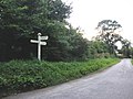
 Hedge and signpost at Jackmoor - geograph.org.uk - 1443041.jpg 640 × 480 ; 164 kio
-
 Hill behind the Three Horseshoes - geograph.org.uk - 2762427.jpg 2 048 × 1 536 ; 997 kio
-
 House on a hill - geograph.org.uk - 2516770.jpg 640 × 480 ; 49 kio
-
 House on Cowley Hill - geograph.org.uk - 4731975.jpg 640 × 477 ; 140 kio
-
 House on the hilltop, Cowley Barton - geograph.org.uk - 3911456.jpg 1 024 × 768 ; 144 kio
-
 Houses in the main street of Upton Pyne - geograph.org.uk - 2242607.jpg 640 × 480 ; 230 kio
-
 Houses on Star Barton Lane, Cowley - geograph.org.uk - 1997560.jpg 640 × 480 ; 75 kio
-
 Inscribed stone at Jackmoor Cross - geograph.org.uk - 3259916.jpg 1 024 × 768 ; 739 kio
-
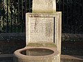 Inscription on obelisk in Upton Pyne - geograph.org.uk - 2299022.jpg 800 × 600 ; 438 kio
-
 Jackmoor Bridge - geograph.org.uk - 2298991.jpg 800 × 600 ; 519 kio
-
 Jackmoor Cross - geograph.org.uk - 2000648.jpg 1 024 × 768 ; 171 kio
-
-
 Junction at No Mans Chapel - geograph.org.uk - 2242665.jpg 640 × 480 ; 299 kio
-
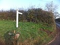
 Junction to Bramford Speke N of Upton Pyne - geograph.org.uk - 35006.jpg 640 × 480 ; 163 kio
-
 Lane at Great Oak Cross - geograph.org.uk - 1852675.jpg 640 × 480 ; 96 kio
-
 Lane from Nettacott to Five Oaks Cross - geograph.org.uk - 2298972.jpg 800 × 600 ; 398 kio
-
 Lane from Starved Oak Cross - geograph.org.uk - 1852540.jpg 480 × 640 ; 126 kio
-
 Lane near Sevenstone Barton, looking north - geograph.org.uk - 1443080.jpg 640 × 480 ; 169 kio
-
 Lane south of Nettacott - geograph.org.uk - 2298964.jpg 800 × 600 ; 381 kio
-
 Lane to Newton St Cyres and Crediton at Jackmoor - geograph.org.uk - 1443039.jpg 640 × 480 ; 169 kio
-
 Lane to Pye Corner - geograph.org.uk - 1852558.jpg 640 × 480 ; 125 kio
-

-
 Lane to Starved Oak cross at Jackmoor - geograph.org.uk - 1443032.jpg 640 × 480 ; 164 kio
-
 Lane with a gate - geograph.org.uk - 2516769.jpg 640 × 480 ; 108 kio
-

-
 Lane with two names, west of the A377 - geograph.org.uk - 3911486.jpg 960 × 768 ; 160 kio
-
 LarderArms.png 926 × 1 065 ; 70 kio
-
 Looking north from Great Oak Cross - geograph.org.uk - 2242642.jpg 640 × 480 ; 210 kio
-
-
 Main street, Upton Pyne - geograph.org.uk - 2000674.jpg 1 024 × 768 ; 152 kio
-
 Making hay while the sun shines - geograph.org.uk - 1443071.jpg 640 × 480 ; 166 kio
-
 Mid Devon , Grassy Field - geograph.org.uk - 4537500.jpg 4 288 × 2 848 ; 6,26 Mio
-
 Mid Devon , Grassy Field - geograph.org.uk - 4537520.jpg 4 288 × 2 848 ; 6,06 Mio
-
 Mid Devon , Grassy Field ^ Sheep - geograph.org.uk - 4537532.jpg 4 288 × 2 848 ; 6,11 Mio
-
 Mid Devon , Rivenford Lane - geograph.org.uk - 4537503.jpg 4 288 × 2 848 ; 5,98 Mio
-
 Mid Devon , Rivenford Lane - geograph.org.uk - 4537515.jpg 4 288 × 2 848 ; 6,64 Mio
-
 Mid Devon , Rivenford Lane - geograph.org.uk - 4537530.jpg 4 288 × 2 848 ; 6,18 Mio
-
 Mid Devon , Rixenford Lane - geograph.org.uk - 4537535.jpg 4 288 × 2 848 ; 7,43 Mio
-
 Minor road from Upton Pyne to Thorverton - geograph.org.uk - 3195837.jpg 640 × 480 ; 113 kio
-
 Monument in Upton Pyne - geograph.org.uk - 2299009.jpg 800 × 600 ; 483 kio
-
 Moxey's Copse - geograph.org.uk - 1432620.jpg 640 × 480 ; 76 kio
-
 Newton St Cyres , Countryside Scenery - geograph.org.uk - 6340461.jpg 6 000 × 4 000 ; 7,2 Mio
-
 Newton St Cyres , Countryside Scenery - geograph.org.uk - 6340463.jpg 6 000 × 4 000 ; 5,85 Mio
-
 Newton St Cyres , Countryside Scenery - geograph.org.uk - 6340588.jpg 6 000 × 4 000 ; 5,38 Mio
-
 Newton St Cyres , Exeter Scenery - geograph.org.uk - 6340459.jpg 6 000 × 4 000 ; 5,51 Mio
-
 Newton St Cyres , Grassy Field - geograph.org.uk - 6340593.jpg 6 000 × 4 000 ; 7,59 Mio
-
 Newton St Cyres , Grassy Field - geograph.org.uk - 6340605.jpg 6 000 × 4 000 ; 6,05 Mio
-
 Newton St Cyres , Track - geograph.org.uk - 6340602.jpg 6 000 × 4 000 ; 6,27 Mio
-
 Oakford Lodge - geograph.org.uk - 643504.jpg 640 × 480 ; 115 kio
-
 Obelisk and horse trough - geograph.org.uk - 2299014.jpg 600 × 800 ; 527 kio
-

-

-
 Old farm machinery at Star Barton - geograph.org.uk - 1442152.jpg 640 × 480 ; 174 kio
-

-
 On Stafford Bridge, Train Approaching - geograph.org.uk - 4163563.jpg 1 024 × 768 ; 431 kio
-
 Ordnance Survey Bench Mark - geograph.org.uk - 6417886.jpg 576 × 1 024 ; 234 kio
-
 Pasture land, near Nettacott - geograph.org.uk - 2000176.jpg 1 024 × 768 ; 216 kio
-
 Pasture land, near the River Creedy - geograph.org.uk - 1366944.jpg 480 × 640 ; 119 kio
-
 Pig farm on a wet afternoon - geograph.org.uk - 1019742.jpg 640 × 480 ; 183 kio
-
 Poor old starved oak - geograph.org.uk - 1019734.jpg 640 × 480 ; 213 kio
-
 Postbox alongside Turlake Mews - geograph.org.uk - 3911509.jpg 1 024 × 768 ; 162 kio
-
 Poultry accommodation at Upton Pyne - geograph.org.uk - 137697.jpg 640 × 480 ; 92 kio
-
 Pye Corner and sign to Jackmoor - geograph.org.uk - 2242615.jpg 640 × 480 ; 274 kio
-
 Pylon by the River Exe - geograph.org.uk - 5450222.jpg 640 × 325 ; 54 kio
-
 Pylons Near Exeter - geograph.org.uk - 5535383.jpg 640 × 480 ; 91 kio
-
 Pynes Bridge over the River Creedy (geograph 2242579).jpg 640 × 480 ; 234 kio
-
 Pynes House - geograph.org.uk - 5450226.jpg 640 × 426 ; 45 kio
-
 Pynes Lodge - geograph.org.uk - 1198589.jpg 640 × 427 ; 102 kio
-
 Pynes Lodge - geograph.org.uk - 4161271.jpg 1 024 × 768 ; 420 kio
-
 Pynes, 2000 - geograph.org.uk - 5576420.jpg 2 185 × 1 359 ; 337 kio
-
 Railway at Pynes Bridge - geograph.org.uk - 3865156.jpg 1 200 × 806 ; 1,16 Mio
-
 Rivenford Lane - geograph.org.uk - 1852785.jpg 512 × 640 ; 145 kio
-
 River Creedy - geograph.org.uk - 2299037.jpg 800 × 600 ; 353 kio
-
 River Creedy and the parapet of Pynes Bridge - geograph.org.uk - 2242583.jpg 640 × 480 ; 268 kio
-
 River Creedy from Pynes Bridge - geograph.org.uk - 3195797.jpg 640 × 480 ; 112 kio
-
 River Exe - geograph.org.uk - 4842114.jpg 640 × 426 ; 66 kio
-
 River Exe - geograph.org.uk - 5298784.jpg 640 × 426 ; 64 kio
-
 River Exe valley - geograph.org.uk - 2519228.jpg 640 × 470 ; 168 kio
-
 River Exe, Stafford Bridge - geograph.org.uk - 6234582.jpg 3 941 × 2 158 ; 840 kio
-
 Rixenford Lane to Shute - geograph.org.uk - 2242705.jpg 640 × 480 ; 207 kio
-
 Rixenford Lane to Shute - geograph.org.uk - 2242711.jpg 640 × 418 ; 229 kio
-
 Road from Jackmoor to Ley - geograph.org.uk - 2298994.jpg 800 × 600 ; 509 kio
-
 Road north from Pye Corner - geograph.org.uk - 2299003.jpg 800 × 600 ; 514 kio
-
 Road north of Pye Corner - geograph.org.uk - 2242623.jpg 640 × 480 ; 272 kio
-
 Road running north from Starved Oak Cross - geograph.org.uk - 2242635.jpg 640 × 480 ; 282 kio
-
 Road south of Nettacott - geograph.org.uk - 2298967.jpg 800 × 600 ; 340 kio
-
 Road to Jackmoor from Jackmoor Cross - geograph.org.uk - 2298954.jpg 800 × 600 ; 453 kio
-
 Road to Nettacott and houses at Nettacott Cross - geograph.org.uk - 2298957.jpg 800 × 600 ; 420 kio


_-_geograph.org.uk_-_3911522.jpg)


_with_sign_to_Brampford_Speke_-_geograph.org.uk_-_2242590.jpg)


.jpg)


