Category:Városmajor 59, Elementary school
Jump to navigation
Jump to search
| Object location | | View all coordinates using: OpenStreetMap |
|---|
 | |||||
| Upload media | |||||
| Instance of | |||||
|---|---|---|---|---|---|
| Subclass of | |||||
| Location | Budapest District XII, Budapest, Hungary | ||||
| Architectural style | |||||
| Inception |
| ||||
| official website | |||||
 | |||||
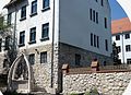
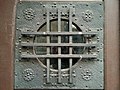
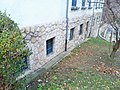
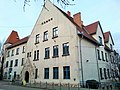
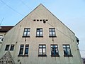
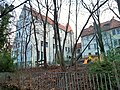
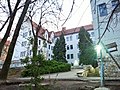
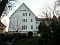
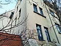
- Kós Károly Ének-zene Emeltszintű Általános Iskola (épült: 1913, tervező: Kós Károly és Györgyi Dénes, stílus: népies szecesszió), Budapest, Városmajor u. 59, 1122
Media in category "Városmajor 59, Elementary school"
The following 49 files are in this category, out of 49 total.
-
 Kós Károly emlékműve XII kerület Temes lépcső.JPG 4,610 × 3,331; 11.55 MB
-
 Kós Károly Ének-zene Emeltszintű Általános Iskola1.jpg 3,264 × 2,448; 2.24 MB
-
 Kós Károly Ének-zene Emeltszintű Általános Iskola10.jpg 3,264 × 2,448; 2.08 MB
-
 Kós Károly Ének-zene Emeltszintű Általános Iskola11.jpg 2,448 × 3,264; 1.5 MB
-
 Kós Károly Ének-zene Emeltszintű Általános Iskola12.jpg 3,121 × 2,341; 1.7 MB
-
 Kós Károly Ének-zene Emeltszintű Általános Iskola13.jpg 3,264 × 2,448; 1.52 MB
-
 Kós Károly Ének-zene Emeltszintű Általános Iskola14.jpg 3,264 × 2,448; 1.99 MB
-
 Kós Károly Ének-zene Emeltszintű Általános Iskola15.jpg 2,448 × 3,264; 1.67 MB
-
 Kós Károly Ének-zene Emeltszintű Általános Iskola16.jpg 3,264 × 2,448; 1.82 MB
-
 Kós Károly Ének-zene Emeltszintű Általános Iskola17.jpg 3,264 × 2,448; 1.86 MB
-
 Kós Károly Ének-zene Emeltszintű Általános Iskola18.jpg 2,448 × 3,264; 1.54 MB
-
 Kós Károly Ének-zene Emeltszintű Általános Iskola19.jpg 2,448 × 3,264; 1.97 MB
-
 Kós Károly Ének-zene Emeltszintű Általános Iskola2.jpg 2,367 × 3,155; 2.01 MB
-
 Kós Károly Ének-zene Emeltszintű Általános Iskola20.jpg 2,448 × 3,264; 1.49 MB
-
 Kós Károly Ének-zene Emeltszintű Általános Iskola21.jpg 3,264 × 2,448; 2.04 MB
-
 Kós Károly Ének-zene Emeltszintű Általános Iskola22.jpg 2,448 × 3,264; 2.24 MB
-
 Kós Károly Ének-zene Emeltszintű Általános Iskola23.jpg 2,448 × 3,264; 1.53 MB
-
 Kós Károly Ének-zene Emeltszintű Általános Iskola24.jpg 3,264 × 2,448; 1.37 MB
-
 Kós Károly Ének-zene Emeltszintű Általános Iskola25.jpg 3,264 × 2,448; 1.48 MB
-
 Kós Károly Ének-zene Emeltszintű Általános Iskola26.jpg 3,183 × 2,387; 1,000 KB
-
 Kós Károly Ének-zene Emeltszintű Általános Iskola27.jpg 3,264 × 2,448; 1.49 MB
-
 Kós Károly Ének-zene Emeltszintű Általános Iskola28.jpg 3,264 × 2,448; 2.42 MB
-
 Kós Károly Ének-zene Emeltszintű Általános Iskola29.jpg 3,264 × 2,448; 1.6 MB
-
 Kós Károly Ének-zene Emeltszintű Általános Iskola3.jpg 3,264 × 2,448; 2.58 MB
-
 Kós Károly Ének-zene Emeltszintű Általános Iskola30.jpg 3,264 × 2,448; 2.34 MB
-
 Kós Károly Ének-zene Emeltszintű Általános Iskola31.jpg 3,264 × 2,137; 1.91 MB
-
 Kós Károly Ének-zene Emeltszintű Általános Iskola32.jpg 3,141 × 2,355; 1.38 MB
-
 Kós Károly Ének-zene Emeltszintű Általános Iskola33.jpg 3,264 × 2,448; 2.5 MB
-
 Kós Károly Ének-zene Emeltszintű Általános Iskola34.jpg 3,264 × 2,448; 2.76 MB
-
 Kós Károly Ének-zene Emeltszintű Általános Iskola35.jpg 3,264 × 2,448; 1.92 MB
-
 Kós Károly Ének-zene Emeltszintű Általános Iskola36.jpg 3,264 × 2,448; 2.49 MB
-
 Kós Károly Ének-zene Emeltszintű Általános Iskola37.jpg 3,264 × 2,448; 1.87 MB
-
 Kós Károly Ének-zene Emeltszintű Általános Iskola38.jpg 3,264 × 2,448; 2.54 MB
-
 Kós Károly Ének-zene Emeltszintű Általános Iskola39.jpg 2,448 × 3,264; 2.61 MB
-
 Kós Károly Ének-zene Emeltszintű Általános Iskola4.jpg 3,264 × 2,448; 2.46 MB
-
 Kós Károly Ének-zene Emeltszintű Általános Iskola40.jpg 3,264 × 2,448; 1.96 MB
-
 Kós Károly Ének-zene Emeltszintű Általános Iskola41.jpg 3,264 × 2,448; 2.29 MB
-
 Kós Károly Ének-zene Emeltszintű Általános Iskola42.jpg 3,161 × 2,371; 2.13 MB
-
 Kós Károly Ének-zene Emeltszintű Általános Iskola43.jpg 3,264 × 2,448; 1.74 MB
-
 Kós Károly Ének-zene Emeltszintű Általános Iskola44.jpg 3,264 × 2,448; 2.09 MB
-
 Kós Károly Ének-zene Emeltszintű Általános Iskola45.jpg 3,264 × 2,448; 2.09 MB
-
 Kós Károly Ének-zene Emeltszintű Általános Iskola46.jpg 2,448 × 3,264; 1.58 MB
-
 Kós Károly Ének-zene Emeltszintű Általános Iskola47.jpg 3,264 × 2,448; 2.44 MB
-
 Kós Károly Ének-zene Emeltszintű Általános Iskola5.jpg 3,264 × 2,448; 2.27 MB
-
 Kós Károly Ének-zene Emeltszintű Általános Iskola6.jpg 3,219 × 2,415; 2.04 MB
-
 Kós Károly Ének-zene Emeltszintű Általános Iskola7.jpg 3,264 × 2,448; 2.39 MB
-
 Kós Károly Ének-zene Emeltszintű Általános Iskola8.jpg 3,264 × 2,448; 2.2 MB
-
 Kós Károly Ének-zene Emeltszintű Általános Iskola9.jpg 3,264 × 2,448; 2.19 MB
-
 Általános iskola és óvoda (1175. számú műemlék).jpg 1,600 × 1,062; 806 KB


.jpg)