Category:Valleys of Washington (state)
Jump to navigation
Jump to search
States of the United States: Alabama · Alaska · Arizona · Arkansas · California · Colorado · Connecticut · Delaware · Georgia · Hawaii · Idaho · Illinois · Indiana · Iowa · Kansas · Kentucky · Maine · Maryland · Massachusetts · Mississippi · Missouri · Montana · Nebraska · Nevada · New Hampshire · New Jersey · New Mexico · New York · North Carolina · North Dakota · Oklahoma · Oregon · Pennsylvania · Rhode Island · South Carolina · South Dakota · Tennessee · Texas · Utah · Vermont · Virginia · Washington · West Virginia · Wyoming
Wikimedia category | |||||
| Upload media | |||||
| Instance of | |||||
|---|---|---|---|---|---|
| Category combines topics | |||||
| Washington | |||||
state of the United States of America someja satełitar in setenbre    | |||||
| Pronunciation audio | |||||
| Instance of | |||||
| Part of | |||||
| Named after | |||||
| Location |
| ||||
| Located in or next to body of water | |||||
| Capital | |||||
| Legislative body | |||||
| Executive body | |||||
| Highest judicial authority | |||||
| Head of government |
| ||||
| Inception |
| ||||
| Highest point | |||||
| Population |
| ||||
| Area |
| ||||
| Elevation above sea level |
| ||||
| Replaces | |||||
| Different from | |||||
| Maximum temperature record |
| ||||
| Minimum temperature record |
| ||||
| official website | |||||
 | |||||
Subcategories
This category has the following 7 subcategories, out of 7 total.
H
Q
S
Y
Media in category "Valleys of Washington (state)"
The following 60 files are in this category, out of 60 total.
-
 -23 Upper Methow Valley, Wash (22134127554).jpg 3,021 × 1,757; 1.99 MB
-
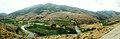
 02-27-11, valley - panoramio.jpg 2,109 × 1,400; 1.21 MB
-
 02-27-24, valley - panoramio.jpg 2,077 × 1,400; 2.04 MB
-
 02-28-08, valley - panoramio.jpg 2,052 × 1,400; 1.16 MB
-
 Aerial view of Beaver Creek (56a33a56-1b3e-4d19-8e6b-abba23d6989e).tif 5,658 × 4,564; 36.2 MB
-

-
 Agnes Creek with Needle Peak (703ea63c-16b1-4504-9b29-fad58c54d96b).tif 8,347 × 6,576; 314.08 MB
-
 Black Lake in Pasayten Wilderness (731cb825-4c3b-4d31-975a-9d1bbce20752).tif 6,560 × 6,505; 244.18 MB
-
-
-

-

-
 Cloudy Peak from east of Suiattle Pass (d985ab52-6598-410f-8e97-95d37632e0e5).tif 2,835 × 2,247; 10.48 MB
-
 Cloudy Peak from east of Suiattle Pass (df865c84-c3c1-4a2f-9c35-7dab3c282183).tif 2,800 × 2,254; 10.35 MB
-
 December Fog 01 edit.JPG 2,000 × 1,500; 1.04 MB
-
 December Fog 01 edit2.jpg 2,000 × 1,302; 2.17 MB
-
 December Fog 01.jpg 2,272 × 1,704; 1.09 MB
-
 December Fog edit 2.JPG 2,000 × 1,500; 980 KB
-
 Duwamishvalley1899-1959.png 1,369 × 2,149; 74 KB
-
 Eldorado Peak and Marble Creek watershed (04b3f453-738a-418e-9ba6-94d5af02162f).tif 2,814 × 2,233; 9.8 MB
-
 Enchanted Valley, East Fork Quinault River.JPG 2,304 × 3,072; 1.32 MB
-
 From Artist's Point (33233592183).jpg 948 × 628; 381 KB
-
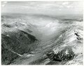
 Goat Rocks Wilderness, Goat Ridge - Pano - Flickr - Joe Parks.jpg 1,280 × 387; 507 KB
-

-

-

-

-
 Klickitat Valley WA.jpg 6,584 × 1,972; 6.93 MB
-
 Klickitat, Washington - panoramio.jpg 1,024 × 767; 436 KB
-

-
 Little Annapurna over Rune Lake.jpg 1,200 × 1,600; 472 KB
-
 Looking into Grand Valley - Flickr - brewbooks.jpg 3,264 × 1,836; 2.14 MB
-
 Methow Valley near Pateros.jpg 5,475 × 1,792; 2.14 MB
-
 Methow Valley SE of Twisp WA.jpg 11,786 × 1,842; 5.98 MB
-
 Methowsouth.JPG 7,165 × 4,674; 3.29 MB
-

-
 Morton WA from Dog Mountain.jpg 3,464 × 2,309; 2.44 MB
-
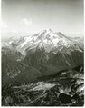
 Mount Adams from East Canyon Ridge.jpg 1,024 × 768; 340 KB
-
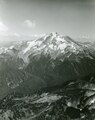
 Mount Adams from East Canyon Ridge.png 1,024 × 768; 1.27 MB
-
-

-

-
 Okanogan-Wenatchee National Forest, Naches, United States Aug 15, 2021 08-10-15 PM.jpeg 4,032 × 3,024; 2.42 MB
-
 PalouseRiver.jpg 1,228 × 1,818; 1.53 MB
-
-

-
 Rattlesnake-Mt-Lower-Ledge-rocks-3985.jpg 1,536 × 2,048; 1.12 MB
-

-
-

-
 Stehekin River Valley.jpg 3,648 × 2,736; 4.67 MB
-
 Swamp Creek Valley (5038430454).jpg 1,154 × 866; 163 KB
-

-
 Tucannon-midvalley.JPG 1,801 × 1,118; 656 KB
-

-

-
 View from Dirty Harry's Peak - panoramio.jpg 4,675 × 2,400; 1.88 MB
-
 View into Napeequa Valley from High Pass.jpg 3,871 × 2,096; 14.69 MB
-
 View of Napeequa from Boulder Pass.jpg 3,186 × 2,718; 19.61 MB
-
 WashingtonPassHwy20WA.jpg 3,782 × 2,837; 4.45 MB
.jpg)


.jpg)
.jpeg)
.jpeg)
.jpeg)


.jpeg)


.jpg)
.jpeg)


.jpg)
.jpg)


