Category:Viitaniemen koulu
Jump to navigation
Jump to search
| Object location | | View all coordinates using: OpenStreetMap |
|---|
primary school  | |||||
| Upload media | |||||
| Instance of | |||||
|---|---|---|---|---|---|
| Part of | |||||
| Location | Jyväskylä, Central Finland, Western and Central Finland Regional State Administrative Agency, Finland | ||||
| Inception |
| ||||
 | |||||
Media in category "Viitaniemen koulu"
The following 4 files are in this category, out of 4 total.
-
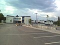 Viitaniemen koulu.jpg 1,600 × 1,200; 404 KB
-
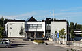 Viitaniemen koulu2.jpg 1,248 × 775; 331 KB
-
 Viitaniemen koulu3.jpg 3,808 × 2,216; 1.81 MB
-
 Viitaniemi School in winter.jpg 3,072 × 1,728; 1.98 MB


