Category:Warsop
Jump to navigation
Jump to search
English: Warsop is a civil parish in the District of Mansfield in Nottinghamshire, England, located on the outskirts of Sherwood Forest. According to the 2001 census it had a population of 12,365.

civil parish in Mansfield, Nottinghamshire, England | |||||
| Upload media | |||||
| Instance of | |||||
|---|---|---|---|---|---|
| Location | Mansfield, Nottinghamshire, East Midlands, England | ||||
 | |||||
Subcategories
This category has the following 7 subcategories, out of 7 total.
1
- 18, Church Street, Warsop (5 F)
C
M
S
W
- Warsop Town Hall (4 F)
- Warsop Vale (3 F)
- Welbeck Cricket Club (6 F)
Media in category "Warsop"
The following 200 files are in this category, out of 523 total.
(previous page) (next page)-
 'Warsop FP15' footpath - geograph.org.uk - 2335654.jpg 1,280 × 959; 220 KB
-
 'Warsop FP3' footpath - geograph.org.uk - 2335714.jpg 1,280 × 959; 248 KB
-
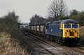 56014 Warsop.jpg 2,048 × 1,348; 547 KB
-
 6 And 6A, Church Street (1).jpg 4,048 × 3,036; 5.14 MB
-
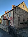 6 And 6A, Church Street (2).jpg 3,036 × 4,048; 4.62 MB
-
 A bend in the A6075 - geograph.org.uk - 3892460.jpg 640 × 480; 51 KB
-
 A crosspath^ - geograph.org.uk - 3450272.jpg 4,000 × 2,248; 2.83 MB
-
 A dismal day - geograph.org.uk - 5101461.jpg 3,000 × 1,586; 2.95 MB
-
 A last view of the Welbeck headstocks - geograph.org.uk - 2335510.jpg 1,280 × 853; 164 KB
-
 A last view of the Welbeck headstocks - geograph.org.uk - 2335511.jpg 1,280 × 853; 174 KB
-
 A narrow section of NCN route 6 - geograph.org.uk - 5814979.jpg 1,024 × 768; 277 KB
-
 A winter scene on Church Road - geograph.org.uk - 3300936.jpg 1,600 × 1,033; 339 KB
-
 A60 Church Street, Market Warsop - geograph.org.uk - 3475417.jpg 1,024 × 768; 107 KB
-
 A60 to Church Warsop - geograph.org.uk - 1409167.jpg 640 × 480; 60 KB
-
 A6075, Peafield Lane - geograph.org.uk - 3978624.jpg 1,024 × 768; 239 KB
-
 Approaching Assarts Farm - geograph.org.uk - 3299000.jpg 1,600 × 1,063; 299 KB
-
 Approaching Assarts Farm, Meden Vale - geograph.org.uk - 5101241.jpg 3,072 × 1,728; 4.15 MB
-
 Approaching Warsop Vale - geograph.org.uk - 4997143.jpg 800 × 600; 116 KB
-
 Are they trout in there^ - geograph.org.uk - 4976921.jpg 3,072 × 1,728; 2.39 MB
-
 Are we sure this is the right path^ - geograph.org.uk - 5101309.jpg 3,072 × 1,728; 3.92 MB
-
 Ash tree on Broomhill Lane - geograph.org.uk - 3290602.jpg 1,600 × 1,063; 666 KB
-
 Assarts Farm, Meden Vale - geograph.org.uk - 5101281.jpg 3,024 × 1,636; 3.28 MB
-
 At the corner of the woodland - geograph.org.uk - 3979022.jpg 1,024 × 768; 323 KB
-

-
 Barn (part of Gleadthorpe Grange) - geograph.org.uk - 940668.jpg 640 × 480; 100 KB
-
 Bath Lane, Sookholme, Notts. - geograph.org.uk - 4807534.jpg 3,364 × 2,902; 1.54 MB
-
 Bath Lane, Sookholme, Notts. - geograph.org.uk - 4807574.jpg 2,496 × 2,177; 943 KB
-
 Beeches near Gleadthorpe Grange - geograph.org.uk - 5843407.jpg 1,280 × 719; 459 KB
-
 Below power - geograph.org.uk - 5000753.jpg 3,072 × 1,728; 3.49 MB
-
 Bend in Coggins Lane, Church Warsop - geograph.org.uk - 3893490.jpg 640 × 480; 51 KB
-
 Between innings at Welbeck - geograph.org.uk - 5048605.jpg 1,024 × 732; 830 KB
-
 Birch Lane, Church Warsop, Notts. - geograph.org.uk - 4808012.jpg 2,922 × 2,516; 1.17 MB
-
 Bishops Walk, Church Warsop (B6031) - geograph.org.uk - 3891362.jpg 640 × 480; 60 KB
-
 Bluebells in Gleadthorpe Plantation - geograph.org.uk - 3452019.jpg 800 × 533; 200 KB
-
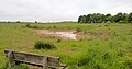
 Boggy field edge - geograph.org.uk - 3891401.jpg 640 × 480; 46 KB
-
 Braided stream - geograph.org.uk - 2335711.jpg 1,280 × 959; 409 KB
-
 Bridleway adjacent to Hanger Hill Drive - geograph.org.uk - 3290567.jpg 712 × 1,000; 422 KB
-
 Bridleway near Church Warsop - geograph.org.uk - 2335719.jpg 1,280 × 959; 244 KB
-
 Bridleway near Warsop Vale - geograph.org.uk - 5101465.jpg 2,986 × 1,558; 3.23 MB
-
 Broomhill Lane - geograph.org.uk - 3979041.jpg 1,024 × 768; 182 KB
-
 Broomhill Lane - geograph.org.uk - 5101295.jpg 3,072 × 1,728; 3.29 MB
-

-
 Broomhill Lane towards Warsop - geograph.org.uk - 3979037.jpg 1,024 × 768; 229 KB
-
 Budby Drive - geograph.org.uk - 2742329.jpg 640 × 427; 147 KB
-
 Budby Drive - geograph.org.uk - 3451868.jpg 800 × 533; 182 KB
-
 Budby Lake - geograph.org.uk - 2742343.jpg 640 × 427; 100 KB
-
 Budby Lake - geograph.org.uk - 2742349.jpg 640 × 427; 76 KB
-
 Budby Reservoir - geograph.org.uk - 3451880.jpg 800 × 533; 118 KB
-
 Building at sewage works - geograph.org.uk - 521414.jpg 640 × 480; 132 KB
-
 Buildings at Nettleworth Manor - geograph.org.uk - 5617918.jpg 2,234 × 1,675; 1,018 KB
-
 Bully Lane - geograph.org.uk - 2335675.jpg 1,280 × 959; 370 KB
-
 Bully Lane bridge - geograph.org.uk - 2335681.jpg 957 × 1,280; 311 KB
-
 Bully Lane Bridge, Warsop Vale Vicinity, Notts. - geograph.org.uk - 4807945.jpg 3,613 × 2,598; 1.46 MB
-
 Bully Lane Bridge, Warsop Vale Vicinity, Notts. - geograph.org.uk - 4807980.jpg 3,089 × 2,644; 1.87 MB
-
 Burns Farm - geograph.org.uk - 3298926.jpg 1,600 × 1,014; 490 KB
-
 Burns Lane, Warsop - geograph.org.uk - 3978177.jpg 1,024 × 772; 206 KB
-
 Byway towards Shirebrook - geograph.org.uk - 4941254.jpg 1,600 × 1,200; 1.16 MB
-
 Cakes and cricket - geograph.org.uk - 5048618.jpg 1,024 × 732; 947 KB
-
 Carr Lane Social Club, Warsop - geograph.org.uk - 3891382.jpg 640 × 480; 57 KB
-
 Carrs Park, Market Warsop, Notts. - geograph.org.uk - 4802466.jpg 2,904 × 2,932; 1.29 MB
-
 Carter Lane near Warsop Vale - geograph.org.uk - 2335729.jpg 1,280 × 959; 301 KB
-
 Cherry Grove, Warsop - geograph.org.uk - 3978362.jpg 1,024 × 639; 159 KB
-
 Church and Donkey Field, Sookholme, Notts. - geograph.org.uk - 4807413.jpg 3,330 × 2,765; 2.37 MB
-
 Church Road - Eastlands Lane junction - geograph.org.uk - 3300933.jpg 1,600 × 1,063; 394 KB
-
 Church Road, Church Warsop, Notts. - geograph.org.uk - 4803142.jpg 3,574 × 2,479; 1.86 MB
-
 Church Road, Church Warsop, Notts. - geograph.org.uk - 4803150.jpg 3,152 × 1,987; 1.51 MB
-
 Church Road, Church Warsop, Notts. - geograph.org.uk - 4803164.jpg 2,065 × 2,362; 991 KB
-
 Church Road, Church Warsop, Notts. - geograph.org.uk - 4803196.jpg 3,491 × 2,799; 1.83 MB
-
 Church Road, Church Warsop, Notts. - geograph.org.uk - 4803496.jpg 3,561 × 3,014; 2.54 MB
-
 Church Street, Market Warsop, Notts. - geograph.org.uk - 4802346.jpg 4,020 × 2,022; 1.46 MB
-
 Church Street, Market Warsop, Notts. - geograph.org.uk - 4802384.jpg 3,015 × 2,849; 1.34 MB
-
 Church Street, Market Warsop, Notts. - geograph.org.uk - 4802391.jpg 3,816 × 2,266; 1.69 MB
-
 Church Street, Market Warsop, Notts. - geograph.org.uk - 4802415.jpg 3,169 × 1,573; 998 KB
-
 Church Street, Market Warsop, Notts. - geograph.org.uk - 4802532.jpg 3,038 × 2,784; 1.36 MB
-
 Church Street, Market Warsop, Notts. - geograph.org.uk - 4802551.jpg 3,330 × 2,442; 1.51 MB
-
 Church Street, Market Warsop, Notts. - geograph.org.uk - 4803102.jpg 3,324 × 2,511; 1.54 MB
-
 Church Warsop Cemetery - geograph.org.uk - 4997152.jpg 800 × 600; 137 KB
-
 Church Warsop Memorial Club - geograph.org.uk - 3893497.jpg 640 × 480; 53 KB
-
 Churchyard and Parish Centre, Warsop - geograph.org.uk - 5939526.jpg 1,024 × 768; 186 KB
-

-
 Clean bowled at Welbeck - geograph.org.uk - 6181297.jpg 1,024 × 1,024; 1.05 MB
-
 Closed shop on the corner of West Street - geograph.org.uk - 2335524.jpg 1,280 × 959; 345 KB
-
 Clumber Street, Market Warsop, Notts. - geograph.org.uk - 4802207.jpg 2,727 × 1,994; 971 KB
-
 Clumber Street, Market Warsop, Notts. - geograph.org.uk - 4802220.jpg 3,892 × 2,578; 1.73 MB
-
 Coggins Lane, Church Warsop - geograph.org.uk - 3893493.jpg 640 × 480; 58 KB
-
 Corn blowing in the wind - geograph.org.uk - 855104.jpg 640 × 427; 99 KB
-
 Cottage on Netherfield Lane - geograph.org.uk - 3451087.jpg 3,990 × 2,230; 1.97 MB
-
 Cottages at Nettleworth Manor - geograph.org.uk - 5617915.jpg 1,501 × 1,126; 532 KB
-
 Country bridleway - geograph.org.uk - 855089.jpg 640 × 427; 81 KB
-
 Cow parsley beside a field of rapeseed - geograph.org.uk - 4997157.jpg 800 × 600; 184 KB
-
 Crop field near Church Warsop - geograph.org.uk - 3893507.jpg 640 × 480; 100 KB
-
 Crossroads in the forest - geograph.org.uk - 6040692.jpg 1,024 × 768; 258 KB
-
 Cuckney Hill (A60) - geograph.org.uk - 3891356.jpg 640 × 480; 67 KB
-
 Cuckney Hill, view towards Warsop - geograph.org.uk - 3304304.jpg 1,600 × 1,031; 620 KB
-
 Cycling through Windmill Plantation - geograph.org.uk - 3452006.jpg 533 × 800; 187 KB
-
 December view of Oakfield Lane - geograph.org.uk - 5618070.jpg 2,272 × 1,704; 1.22 MB
-
 Demolition of Welbeck Headframes - geograph.org.uk - 2343205.jpg 3,456 × 2,304; 4.37 MB
-
 Demolition of Welbeck Headframes - geograph.org.uk - 2343231.jpg 1,280 × 853; 227 KB
-
 Demolition of Welbeck Headframes - going . . . - geograph.org.uk - 2343215.jpg 1,280 × 703; 118 KB
-
 Demolition of Welbeck Headframes - going . . . - geograph.org.uk - 2343216.jpg 1,280 × 703; 116 KB
-
 Demolition of Welbeck Headframes - going . . . - geograph.org.uk - 2343218.jpg 1,280 × 703; 114 KB
-
 Demolition of Welbeck Headframes - going . . . - geograph.org.uk - 2343220.jpg 1,280 × 703; 118 KB
-
 Demolition of Welbeck Headframes - going . . . - geograph.org.uk - 2343222.jpg 1,280 × 703; 109 KB
-
 Demolition of Welbeck Headframes - gone - geograph.org.uk - 2343226.jpg 1,280 × 703; 104 KB
-

-
 Descending Hanger Hill Drive - geograph.org.uk - 3451074.jpg 4,000 × 2,248; 3.04 MB
-
 Dismantled railway and a railway bridge - geograph.org.uk - 5008125.jpg 800 × 600; 171 KB
-
 Disused entrance - geograph.org.uk - 5618064.jpg 2,204 × 1,653; 1.1 MB
-
 Disused railway line to Welbeck Colliery - geograph.org.uk - 5101336.jpg 3,072 × 1,728; 4.26 MB
-
 Double archway - geograph.org.uk - 2335685.jpg 966 × 1,280; 428 KB
-
 Duck pond - geograph.org.uk - 2335627.jpg 1,280 × 959; 404 KB
-
 Dukeries Trail Multi User Route - geograph.org.uk - 4940393.jpg 1,600 × 1,200; 783 KB
-
 Dukeries Trail multi-user route - geograph.org.uk - 2335610.jpg 1,280 × 959; 245 KB
-
 Dukeries Trail multi-user route - geograph.org.uk - 2335613.jpg 1,280 × 959; 442 KB
-
 Dukeries Trail multi-user route - geograph.org.uk - 2335617.jpg 1,280 × 959; 492 KB
-
 Dukeries Trail multi-user route - geograph.org.uk - 2335629.jpg 1,280 × 959; 294 KB
-
 Early arrivals at Welbeck - geograph.org.uk - 5048642.jpg 1,024 × 731; 937 KB
-
 Eastlands Lane - geograph.org.uk - 3891369.jpg 640 × 480; 58 KB
-
 Eastlands Lane, Church Warsop, Notts. - geograph.org.uk - 4803396.jpg 3,722 × 2,290; 1.8 MB
-
 Eastlands Lane, Church Warsop, Notts. - geograph.org.uk - 4803417.jpg 3,554 × 3,019; 2.24 MB
-
 Eastlands Lane, Church Warsop, Notts. - geograph.org.uk - 4803427.jpg 3,324 × 2,206; 1.27 MB
-
 Eastlands Lane, Church Warsop, Notts. - geograph.org.uk - 4803440.jpg 3,261 × 2,298; 1.08 MB
-
 Eastlands Lane, Church Warsop, Notts. - geograph.org.uk - 4803446.jpg 2,638 × 2,389; 1.1 MB
-
 Eastlands Road, Church Warsop - geograph.org.uk - 3979047.jpg 1,024 × 622; 131 KB
-
 Egmanton Road, Eden Vale - geograph.org.uk - 1170087.jpg 640 × 480; 58 KB
-
 Emergency access point to forest - geograph.org.uk - 1241947.jpg 640 × 480; 136 KB
-
 End of a power line - geograph.org.uk - 6046688.jpg 768 × 1,024; 233 KB
-
 End of the road - geograph.org.uk - 5342520.jpg 1,280 × 853; 416 KB
-
 Entering Mansfield Woodhouse - geograph.org.uk - 3891422.jpg 640 × 420; 50 KB
-
 Entrance to ADAS at Gleadthorpe - geograph.org.uk - 1202255.jpg 640 × 480; 76 KB
-
 Entrance to Oakfield Plantation - geograph.org.uk - 3304319.jpg 1,600 × 1,063; 633 KB
-
 Farm accommodation bridge - geograph.org.uk - 2335619.jpg 1,280 × 959; 421 KB
-
 Farmland near Shirebrook - geograph.org.uk - 2335621.jpg 1,280 × 959; 452 KB
-
 Farmland near Sookholme Lodge Farm - geograph.org.uk - 4302063.jpg 640 × 480; 84 KB
-
 Farmland near Spion Cop - geograph.org.uk - 3978403.jpg 1,024 × 768; 181 KB
-
 Farmland off Mansfield Road - geograph.org.uk - 3891395.jpg 640 × 480; 63 KB
-
 Farmland off Peafield Lane - geograph.org.uk - 3892459.jpg 640 × 480; 69 KB
-

-
 Farmland track towards Warsop - geograph.org.uk - 3979033.jpg 1,024 × 768; 225 KB
-
 Farmland, Gleadthorpe Grange - geograph.org.uk - 3892993.jpg 640 × 480; 74 KB
-
 Field by a path to Warsop - geograph.org.uk - 3979027.jpg 1,024 × 536; 143 KB
-
 Field of plastic - geograph.org.uk - 3451884.jpg 800 × 533; 151 KB
-
 Fields above Assarts Farm - geograph.org.uk - 3979029.jpg 1,024 × 768; 219 KB
-
 Fields and countryside view from Peafield Lane - geograph.org.uk - 3978423.jpg 1,024 × 768; 137 KB
-
 Fields and view to Meden Vale - geograph.org.uk - 3979020.jpg 1,024 × 765; 244 KB
-
 Fields by Oakfield Lane - geograph.org.uk - 3978397.jpg 1,024 × 768; 229 KB
-
 Fire in the field - geograph.org.uk - 4453881.jpg 5,093 × 2,966; 6.47 MB
-

-
 Footpath at the top of Mosscar Close - geograph.org.uk - 5617818.jpg 2,272 × 1,704; 987 KB
-
 Footpath close to the River Meden - geograph.org.uk - 3298919.jpg 1,358 × 1,026; 492 KB
-
 Footpath junction - geograph.org.uk - 2335668.jpg 1,280 × 959; 245 KB
-
 Footpath near Church Warsop - geograph.org.uk - 2335723.jpg 1,280 × 959; 455 KB
-
 Footpath near Market Warsop - geograph.org.uk - 3978349.jpg 1,024 × 916; 231 KB
-
 Footpath near Rock House - geograph.org.uk - 2335727.jpg 959 × 1,280; 392 KB
-
 Footpath to Carter Lane - geograph.org.uk - 3893506.jpg 640 × 480; 109 KB
-
 Forest Mill, Bradmer Hill, Warsop - geograph.org.uk - 473853.jpg 480 × 640; 74 KB
-
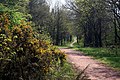
 Forest ride, Holborn Hill Plantation - geograph.org.uk - 3978945.jpg 1,024 × 768; 302 KB
-
 Former colliery railway at Market Warsop - geograph.org.uk - 4997175.jpg 800 × 600; 214 KB
-
 Former sandstone quarry - geograph.org.uk - 2335702.jpg 1,280 × 959; 313 KB
-
 Former Strand cinema, Market Warsop - geograph.org.uk - 5914279.jpg 1,024 × 768; 174 KB
-
 Freezing fog and the River Meden - geograph.org.uk - 6040660.jpg 1,024 × 768; 44 KB
-
 Frozen field - geograph.org.uk - 6040688.jpg 1,024 × 768; 185 KB
-
 Frozen field below Meadow Bank - geograph.org.uk - 6046696.jpg 1,024 × 768; 131 KB
-
 Gas extraction - geograph.org.uk - 2335745.jpg 1,280 × 838; 328 KB
-
 Gleadthorpe Grange - geograph.org.uk - 3893474.jpg 640 × 480; 65 KB
-
 Gleadthorpe Grange - geograph.org.uk - 940681.jpg 480 × 640; 94 KB
-
 Gleadthorpe New Plantation - Boundary - geograph.org.uk - 1036672.jpg 640 × 480; 109 KB
-

-

-

-

-

-

-

-
 Gleadthorpe New Plantation - geograph.org.uk - 3290625.jpg 1,920 × 1,276; 677 KB
-

-
-
 Gravestones in Warsop churchyard - geograph.org.uk - 4291551.jpg 1,800 × 1,308; 1.68 MB
-
 Grazing, Spion Kop - geograph.org.uk - 3891414.jpg 640 × 480; 51 KB
-
 Gun emplacement , WW2 (Gleadthorpe) - geograph.org.uk - 940759.jpg 640 × 480; 110 KB
-
 Gun Emplacement Earthwork (Gleadthorpe) - geograph.org.uk - 940745.jpg 640 × 480; 113 KB
-
 Hall Farm, Sookholme, Notts. - geograph.org.uk - 4807434.jpg 3,016 × 2,023; 1.13 MB
-
 Hall Farm, Sookholme, Notts. - geograph.org.uk - 4807463.jpg 2,971 × 2,730; 1.68 MB
-
 Hangar Hill Drive - geograph.org.uk - 6047436.jpg 1,024 × 768; 275 KB
-
 Hazel Gap - geograph.org.uk - 3451865.jpg 800 × 533; 115 KB
-
 Hedgerow beside the A60 - geograph.org.uk - 3891398.jpg 640 × 480; 89 KB
-
 Herring Cottage from Bully Lane - geograph.org.uk - 2335680.jpg 1,280 × 959; 258 KB
-
 Herrings Farm on Sookholme Lane - geograph.org.uk - 5101435.jpg 3,072 × 1,728; 3.56 MB
-
 Herrings Farm, Sookholme - geograph.org.uk - 4940399.jpg 1,600 × 1,200; 674 KB
-
 Herrings Farm, Sookholme, Notts. - geograph.org.uk - 4807921.jpg 3,032 × 2,479; 1.61 MB
-
 Hetts Lane, Market Warsop, Notts. - geograph.org.uk - 4802428.jpg 3,111 × 2,090; 1.64 MB
-
 Hetts Lane, Market Warsop, Notts. - geograph.org.uk - 4802439.jpg 3,825 × 2,143; 1.95 MB
-
 High Street, Market Warsop, Notts. - geograph.org.uk - 4802136.jpg 3,548 × 2,764; 1.66 MB
-
 High Street, Market Warsop, Notts. - geograph.org.uk - 4802179.jpg 2,439 × 2,562; 1.39 MB
-
 High Street, Market Warsop, Notts. - geograph.org.uk - 4802247.jpg 2,945 × 2,615; 1.51 MB
-
 High Street, Market Warsop, Notts. - geograph.org.uk - 4802565.jpg 2,696 × 2,302; 1.14 MB
-
 High Street, Market Warsop, Notts. - geograph.org.uk - 4802874.jpg 2,805 × 2,361; 990 KB
-
 High Street, Market Warsop, Notts. - geograph.org.uk - 4802881.jpg 3,519 × 2,764; 1.74 MB
-
 High Street, Market Warsop, Notts. - geograph.org.uk - 4803045.jpg 3,490 × 2,503; 1.23 MB
-
 High Street, Market Warsop, Notts. - geograph.org.uk - 4803054.jpg 3,232 × 2,102; 1.6 MB


.jpg)
.jpg)


_-_geograph.org.uk_-_940668.jpg)


_-_geograph.org.uk_-_3891362.jpg)


_-_geograph.org.uk_-_3891356.jpg)


_-_geograph.org.uk_-_940759.jpg)
_-_geograph.org.uk_-_940745.jpg)


