Category:Whittingehame
Aller à la navigation
Aller à la recherche
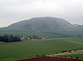
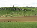
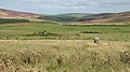
English: Whittingehame is a parish with a small village in East Lothian, Scotland, about halfway between Haddington and Dunbar, and near East Linton. The area is on the slopes of the Lammermuir Hills. The old castle, or Tower house of Whittingehame, circa 15th century, is a grand specimen of an old and massive baronial building and remains a residence.
village britannique .jpg) | |||||
| Téléverser des médias | |||||
| Nature de l’élément | |||||
|---|---|---|---|---|---|
| Lieu |
| ||||
 | |||||
Sous-catégories
Cette catégorie comprend 3 sous-catégories, dont les 3 ci-dessous.
W
- Whittingehame Church (2 F)
- Whittingehame House (4 F)
- Whittingehame Tower (2 F)
Média dans la catégorie « Whittingehame »
Cette catégorie comprend 900 fichiers, dont les 200 ci-dessous.
(page précédente) (page suivante)-
 'L' for Lammermuir - in a heart in the Heather - geograph.org.uk - 6583261.jpg 5 184 × 3 888 ; 4,72 Mio
-
 441m summit, Lammermuir Hills - geograph.org.uk - 4998090.jpg 1 024 × 683 ; 361 kio
-
 A dark day over the Whiteadder Reservoir - geograph.org.uk - 3372553.jpg 640 × 480 ; 52 kio
-
 A distant view of Mayshiel - geograph.org.uk - 6596614.jpg 5 184 × 3 888 ; 4,13 Mio
-
 A field adjacent to Luggate Burn - geograph.org.uk - 3932770.jpg 640 × 480 ; 60 kio
-
 A Gate on the track to Johnscleugh - geograph.org.uk - 6253727.jpg 4 608 × 3 456 ; 5,24 Mio
-
 A Hard Slog - geograph.org.uk - 6620029.jpg 3 284 × 2 463 ; 3,6 Mio
-
-

-
 A ruined skyline - geograph.org.uk - 3662605.jpg 640 × 360 ; 184 kio
-
 A small woodland - geograph.org.uk - 5232046.jpg 1 024 × 576 ; 476 kio
-
 A stream at Johnscleugh above Garvald - geograph.org.uk - 6253712.jpg 4 608 × 3 456 ; 5,19 Mio
-
 A visit from the muckspreader - geograph.org.uk - 3599648.jpg 640 × 360 ; 238 kio
-
 Above Deuchrie Edge - geograph.org.uk - 5229758.jpg 1 024 × 576 ; 185 kio
-
 Above Faseny - geograph.org.uk - 6572225.jpg 3 648 × 2 736 ; 4,66 Mio
-
 Above Killpallet - geograph.org.uk - 6619914.jpg 3 648 × 2 736 ; 4,71 Mio
-
 Across the Faseny Water and estate march^ - geograph.org.uk - 6670060.jpg 1 024 × 683 ; 261 kio
-
 Along the Faseny Water - geograph.org.uk - 5991536.jpg 1 024 × 575 ; 277 kio
-
 An horizon of wind turbines - geograph.org.uk - 6597641.jpg 5 184 × 3 888 ; 4,85 Mio
-
 Another view of Priest Cleugh - geograph.org.uk - 3396798.jpg 640 × 480 ; 47 kio
-
 Arable ground, Whitingehame Mains - geograph.org.uk - 2717622.jpg 640 × 360 ; 202 kio
-
 Arable Land at Papple - geograph.org.uk - 6304394.jpg 640 × 427 ; 360 kio
-

-
 Arms of the House Douglas of Whittinghame.svg 410 × 476 ; 61 kio
-
 Autumn lane in East Lothian - geograph.org.uk - 2145771.jpg 1 024 × 768 ; 210 kio
-
 B6355 and Kingside Hill - geograph.org.uk - 3636413.jpg 640 × 360 ; 203 kio
-
 B6355 approaching Whiteadder Reservoir - geograph.org.uk - 5480085.jpg 640 × 480 ; 53 kio
-
 B6355 crossing the Whiteadder Reservoir - geograph.org.uk - 5480092.jpg 640 × 480 ; 55 kio
-
 B6355 south-east of Gifford - geograph.org.uk - 6124037.jpg 1 024 × 768 ; 230 kio
-
 B6355 towards Chirnside - geograph.org.uk - 5480076.jpg 640 × 480 ; 45 kio
-
 B6355, Kingside Hill - geograph.org.uk - 5480083.jpg 640 × 480 ; 51 kio
-
 Back Burn - geograph.org.uk - 5229133.jpg 1 024 × 576 ; 272 kio
-
 Bale stash, Stoneypath - geograph.org.uk - 5229800.jpg 1 024 × 576 ; 200 kio
-
 Balfour Memorial - geograph.org.uk - 6304337.jpg 427 × 640 ; 275 kio
-
 Balfour Monument - geograph.org.uk - 1714621.jpg 3 072 × 2 304 ; 2,86 Mio
-
 Barley fields, New Mains - geograph.org.uk - 949847.jpg 640 × 480 ; 94 kio
-
 Barley near Newmains - geograph.org.uk - 2585647.jpg 2 592 × 1 944 ; 1,92 Mio
-
 Barley, near Stoneypath Tower - geograph.org.uk - 5795454.jpg 1 024 × 683 ; 231 kio
-
 Barn conversion at Luggate - geograph.org.uk - 2879770.jpg 3 264 × 2 448 ; 4,16 Mio
-
 Beech and Pine shelter belt at Mayshiel - geograph.org.uk - 6555447.jpg 5 184 × 3 888 ; 7,45 Mio
-
 Beehives by the Faseny Water - geograph.org.uk - 6583267.jpg 4 391 × 3 290 ; 3,02 Mio
-
 Below Newmains Hill - geograph.org.uk - 1096729.jpg 640 × 426 ; 63 kio
-
 Between Clints Dod and Rook Law - geograph.org.uk - 5229146.jpg 1 024 × 576 ; 203 kio
-
 Between South Grain and Hazelly Burn - geograph.org.uk - 5755247.jpg 1 024 × 576 ; 223 kio
-
 Beware of the notices - geograph.org.uk - 5991398.jpg 1 024 × 575 ; 350 kio
-
 Birks Plantation - geograph.org.uk - 955715.jpg 480 × 640 ; 152 kio
-
 Black Knowe Plantation - geograph.org.uk - 4733854.jpg 1 024 × 683 ; 513 kio
-
 Blaikie Heugh - geograph.org.uk - 425408.jpg 640 × 480 ; 102 kio
-
 Blaikie Heugh - geograph.org.uk - 425643.jpg 640 × 480 ; 79 kio
-
 Blaikie Heugh from near Standingstone - geograph.org.uk - 2878908.jpg 3 264 × 2 448 ; 3,7 Mio
-
 Bleak Law - geograph.org.uk - 3140131.jpg 640 × 480 ; 77 kio
-
 Bleak Law - geograph.org.uk - 5755245.jpg 1 024 × 576 ; 318 kio
-
 Bleak Law - geograph.org.uk - 6670063.jpg 1 024 × 683 ; 255 kio
-
 Bleak Law from Rangely Kip - geograph.org.uk - 6726214.jpg 1 024 × 683 ; 210 kio
-
 Bog, Killpallet Heights - geograph.org.uk - 2959229.jpg 640 × 359 ; 227 kio
-
 Bridge at the end of the Reservoir - geograph.org.uk - 1243819.jpg 640 × 480 ; 60 kio
-
 Bridge over the Whittingehame Water - geograph.org.uk - 2145994.jpg 1 024 × 768 ; 217 kio
-
 Bridge over the Whittingehame Water - geograph.org.uk - 864432.jpg 640 × 480 ; 135 kio
-
 Bridge over Whittingehame Water - geograph.org.uk - 4879200.jpg 640 × 480 ; 361 kio
-
 Burnt heather - geograph.org.uk - 3603785.jpg 640 × 360 ; 242 kio
-
 Butt, Wanside Rig - geograph.org.uk - 4998087.jpg 1 024 × 683 ; 338 kio
-
 Butts, Priest Cleugh Rig - geograph.org.uk - 4743655.jpg 1 024 × 576 ; 241 kio
-
 Byre, Luggate - geograph.org.uk - 2458427.jpg 640 × 480 ; 293 kio
-
 Can I help you^ You seem to be lost - geograph.org.uk - 4743227.jpg 1 024 × 1 024 ; 302 kio
-
 Cattle grid near Gamelshiel Castle - geograph.org.uk - 2622875.jpg 640 × 480 ; 63 kio
-
 Cattle grid on the B6355 near Mayshiel - geograph.org.uk - 5480074.jpg 640 × 480 ; 81 kio
-
 Cattlegrid, Whiteadder Reservoir - geograph.org.uk - 4406795.jpg 800 × 600 ; 393 kio
-
 Chapel Stone - geograph.org.uk - 1627527.jpg 640 × 359 ; 84 kio
-
 Chapel Stone - geograph.org.uk - 4258035.jpg 800 × 600 ; 459 kio
-
 Chesters Wood - geograph.org.uk - 2691726.jpg 640 × 360 ; 236 kio
-
 Chesters Wood - geograph.org.uk - 2691741.jpg 640 × 360 ; 273 kio
-
 Chimney work at Luggate - geograph.org.uk - 2879781.jpg 3 264 × 2 448 ; 3,88 Mio
-
 Clubmoss in the Lammermuir Hills - geograph.org.uk - 6584934.jpg 4 260 × 3 185 ; 6,52 Mio
-
 Clubmoss in the Lammermuir Hills - geograph.org.uk - 6584942.jpg 3 883 × 3 879 ; 3,2 Mio
-
 Coniferous plantation beside Whiteadder Reservoir - geograph.org.uk - 3140431.jpg 1 500 × 1 125 ; 1,6 Mio
-
 Cottage in the woods - geograph.org.uk - 2145986.jpg 1 024 × 768 ; 216 kio
-
 Cottages at Eastfield - geograph.org.uk - 4879175.jpg 640 × 480 ; 333 kio
-
 Cottages at Luggate - geograph.org.uk - 2879787.jpg 3 264 × 2 448 ; 3,99 Mio
-
 Cottages at Luggate - geograph.org.uk - 4879137.jpg 640 × 480 ; 257 kio
-
 Cottages at West Mains - geograph.org.uk - 2878309.jpg 3 264 × 2 448 ; 5,81 Mio
-
 Country lane near Stenton - geograph.org.uk - 6261236.jpg 1 600 × 1 067 ; 899 kio
-

-

-
 Crop field towards woodland - geograph.org.uk - 4493439.jpg 640 × 480 ; 59 kio
-
 Crop field, Luggate - geograph.org.uk - 4492839.jpg 640 × 480 ; 57 kio
-
 Crop fields, Luggate - geograph.org.uk - 4493417.jpg 640 × 408 ; 30 kio
-
 Crossroads - geograph.org.uk - 2460879.jpg 640 × 359 ; 213 kio
-
 Crossroads near Rucklaw Mains - geograph.org.uk - 3828471.jpg 640 × 480 ; 340 kio
-
 Crossroads, West Mains - geograph.org.uk - 5572803.jpg 1 024 × 683 ; 302 kio
-
 Crow Stones - geograph.org.uk - 905357.jpg 640 × 480 ; 138 kio
-
 Crystal Rig wind farm - geograph.org.uk - 5229151.jpg 1 024 × 576 ; 142 kio
-
 Crystal Rig Wind Farm on Dunbar Common - geograph.org.uk - 6598283.jpg 5 184 × 3 888 ; 3,76 Mio
-
 Deep ford, Faseny Water - geograph.org.uk - 6669785.jpg 1 024 × 683 ; 202 kio
-
 Degraded Lammermuir - geograph.org.uk - 4101833.jpg 640 × 360 ; 200 kio
-
 Degraded Lammermuir - geograph.org.uk - 4101835.jpg 640 × 360 ; 193 kio
-
 Descent to Faseny Cottage - geograph.org.uk - 6669779.jpg 1 024 × 683 ; 163 kio
-
 Deuchrie Dod from Newmains Hill - geograph.org.uk - 5232278.jpg 1 024 × 576 ; 333 kio
-
 Direction Sign – Signpost - geograph.org.uk - 6562542.jpg 720 × 960 ; 54 kio
-
 Direction Sign – Signpost - geograph.org.uk - 6566281.jpg 720 × 960 ; 148 kio
-
 Direction Sign – Signpost near Luggate, East Lothian - geograph.org.uk - 6584914.jpg 768 × 1 024 ; 167 kio
-

-
 Dod Hill near Mayshiel - geograph.org.uk - 6670145.jpg 1 024 × 683 ; 224 kio
-
 Dog Law near Cranshaws - geograph.org.uk - 6358118.jpg 5 184 × 3 888 ; 4,69 Mio
-
 Drift, Marlion Grain - geograph.org.uk - 6743856.jpg 1 024 × 768 ; 86 kio
-
 Drifts on the Craig Burn - geograph.org.uk - 3385383.jpg 640 × 360 ; 161 kio
-
 Drive bridge, Whittinghame - geograph.org.uk - 6733839.jpg 1 024 × 768 ; 377 kio
-
 Duddy Bank - geograph.org.uk - 6340644.jpg 1 024 × 683 ; 335 kio
-
 Dunbar Common - geograph.org.uk - 4454945.jpg 800 × 533 ; 358 kio
-
 Dunbar Common - geograph.org.uk - 5814269.jpg 1 024 × 576 ; 282 kio
-
 East Lothian Architecture , Central Archway, Papple Steading - geograph.org.uk - 4149332.jpg 1 200 × 1 600 ; 353 kio
-

-

-
 East Lothian Architecture , Farm Steading At Papple - geograph.org.uk - 4149336.jpg 1 600 × 1 200 ; 413 kio
-
 East Lothian Architecture , Luggate House, near East Linton - geograph.org.uk - 2341723.jpg 2 560 × 1 920 ; 3,44 Mio
-
 East Lothian Architecture , Papple Steading - geograph.org.uk - 4149318.jpg 1 600 × 1 200 ; 373 kio
-
 East Lothian CC fingerpost, Whittinghame - geograph.org.uk - 6733835.jpg 1 024 × 1 024 ; 224 kio
-
 East Lothian County Council Fingerposts , Luggate Junction - geograph.org.uk - 4134908.jpg 1 600 × 1 200 ; 271 kio
-

-
 East Lothian County Council Fingerposts , Oak Corner, Yarrow - geograph.org.uk - 4022039.jpg 1 200 × 1 600 ; 607 kio
-
 East Lothian farmland - geograph.org.uk - 2878272.jpg 3 264 × 2 448 ; 5,43 Mio
-
 East Lothian Farms , Luggate, near East Linton - geograph.org.uk - 2341727.jpg 2 560 × 1 920 ; 2,79 Mio
-
 East Lothian farmscape - geograph.org.uk - 2878847.jpg 3 264 × 2 448 ; 4,61 Mio
-
 East Lothian farmscape in spring - geograph.org.uk - 2880337.jpg 3 264 × 2 448 ; 4,62 Mio
-
 East Lothian Landscape , A Sheepfold With A View - geograph.org.uk - 2564460.jpg 1 600 × 1 200 ; 252 kio
-
 East Lothian Landscape , A View North From Near Blaikie Heugh - geograph.org.uk - 3508197.jpg 1 600 × 1 200 ; 242 kio
-
 East Lothian Landscape , Another Bloody Windfarm^ - geograph.org.uk - 2564633.jpg 1 600 × 1 200 ; 371 kio
-
 East Lothian Landscape , Cycling Country - geograph.org.uk - 4021996.jpg 1 600 × 1 200 ; 563 kio
-
 East Lothian Landscape , Field Boundary Leading To Lawhead Hill - geograph.org.uk - 3507981.jpg 1 600 × 1 200 ; 394 kio
-
 East Lothian Landscape , Heading For Home - geograph.org.uk - 4022010.jpg 1 600 × 1 200 ; 554 kio
-
 East Lothian Landscape , Looking Down The Deuchrie Edge Track - geograph.org.uk - 2564562.jpg 1 600 × 1 200 ; 295 kio
-
 East Lothian Landscape , On Deuchrie Edge - geograph.org.uk - 2564667.jpg 1 600 × 1 200 ; 247 kio
-

-
 East Lothian Landscape , on the road near Whittingehame Mains - geograph.org.uk - 3508240.jpg 1 600 × 1 200 ; 332 kio
-
 East Lothian Landscape , Redcliff Junction, Whittingehame - geograph.org.uk - 4149754.jpg 1 200 × 1 600 ; 326 kio
-
 East Lothian Landscape , Sheepfold Below Deuchrie Edge - geograph.org.uk - 2564427.jpg 1 600 × 1 200 ; 430 kio
-
 East Lothian Landscape , Tree And Traprain - geograph.org.uk - 4184404.jpg 1 600 × 1 200 ; 306 kio
-
 East Lothian Landscape , Up Amongst The Heather On Deuchrie Edge - geograph.org.uk - 2584683.jpg 1 600 × 1 200 ; 281 kio
-
 East Lothian Landscape , View South-West From Deuchrie Edge - geograph.org.uk - 2564691.jpg 1 600 × 1 200 ; 341 kio
-
 East side of Moss Law - geograph.org.uk - 5755242.jpg 1 024 × 576 ; 313 kio
-
 Easter Hare Cleugh - geograph.org.uk - 1756185.jpg 640 × 359 ; 103 kio
-
 Easter Lamb Burn - geograph.org.uk - 6669790.jpg 1 024 × 683 ; 180 kio
-
 Easter Lamb Burn - geograph.org.uk - 995237.jpg 480 × 640 ; 105 kio
-
 Easter Mossy Burn - geograph.org.uk - 6744285.jpg 1 024 × 768 ; 213 kio
-
 Eastfield chimney stalk - geograph.org.uk - 3756990.jpg 1 067 × 1 600 ; 377 kio
-
 Eastfield Steading, East Lothian.jpg 4 000 × 3 000 ; 4,84 Mio
-
 Empty hymn board @ Whittingehame (6042836682).jpg 683 × 1 024 ; 209 kio
-
 En Route To Lawhead Hill - geograph.org.uk - 4452813.jpg 2 560 × 1 920 ; 2,21 Mio
-
 Enclosure above Johnscleugh - geograph.org.uk - 5228907.jpg 1 024 × 576 ; 299 kio
-
 Engineer, Fallago Rig - geograph.org.uk - 4106687.jpg 640 × 360 ; 226 kio
-
 Ephemeral Pond - geograph.org.uk - 6304294.jpg 640 × 427 ; 362 kio
-

-
 Evidence of change - geograph.org.uk - 136008.jpg 640 × 480 ; 104 kio
-
 Fallago Rig power station - geograph.org.uk - 3604007.jpg 640 × 360 ; 180 kio
-
 Fallago Rig Wind Farm - geograph.org.uk - 6531554.jpg 4 148 × 2 765 ; 1,99 Mio
-
 Fallago Rig wind farm - geograph.org.uk - 6670033.jpg 1 024 × 683 ; 144 kio
-
 Fallago Rig Wind Farm - geograph.org.uk - 6743864.jpg 1 024 × 768 ; 51 kio
-
 Fallago Rig wind farm from the B6355 - geograph.org.uk - 3571118.jpg 3 264 × 2 448 ; 2,58 Mio
-
 Fallago Rig windfarm - geograph.org.uk - 5991550.jpg 1 024 × 575 ; 233 kio
-
 Farm and chimney at Overfield - geograph.org.uk - 2145802.jpg 1 024 × 768 ; 108 kio
-
 Farm buildings at Overfield. - geograph.org.uk - 2145810.jpg 1 024 × 768 ; 81 kio
-
 Farm buildings near Whittingehame Mains - geograph.org.uk - 2879755.jpg 3 264 × 2 448 ; 5,28 Mio
-
 Farm engine chimney at Overfield - geograph.org.uk - 2145793.jpg 576 × 768 ; 56 kio
-
 Farm equipment at Ruchlaw Mains - geograph.org.uk - 2146242.jpg 1 024 × 768 ; 163 kio
-
 Farm road - geograph.org.uk - 5572813.jpg 1 024 × 578 ; 326 kio
-
 Farm steading at Luggate - geograph.org.uk - 2879792.jpg 3 264 × 2 448 ; 4,11 Mio
-
 Farmland at Newmains - geograph.org.uk - 1093811.jpg 640 × 448 ; 87 kio
-
 Farmland at Ruchlaw Mains - geograph.org.uk - 2146248.jpg 1 024 × 768 ; 187 kio
-
 Farmland at Stoneypath - geograph.org.uk - 1096674.jpg 426 × 640 ; 49 kio
-
 Farmland near Stenton - geograph.org.uk - 2146202.jpg 1 024 × 768 ; 162 kio
-
 Farmland near Whittingehame - geograph.org.uk - 2146218.jpg 1 024 × 768 ; 155 kio
-
 Faseny - geograph.org.uk - 992852.jpg 640 × 480 ; 77 kio
-
 Faseny Bridge - geograph.org.uk - 1749422.jpg 640 × 359 ; 92 kio
-
 Faseny Bridge - geograph.org.uk - 1749429.jpg 640 × 480 ; 119 kio
-
 Faseny Bridge - geograph.org.uk - 1756667.jpg 640 × 359 ; 89 kio
-
 Faseny Bridge - geograph.org.uk - 3140638.jpg 640 × 480 ; 102 kio
-
 Faseny Bridge - geograph.org.uk - 3385733.jpg 640 × 360 ; 174 kio
-
 Faseny Bridge - geograph.org.uk - 3572056.jpg 3 264 × 2 448 ; 4,69 Mio
-
 Faseny Bridge - geograph.org.uk - 3572067.jpg 3 264 × 2 448 ; 5 Mio
-
 Faseny Bridge - geograph.org.uk - 3603804.jpg 640 × 360 ; 231 kio
-
 Faseny Bridge and Minor Road - geograph.org.uk - 6572262.jpg 3 648 × 2 736 ; 4,37 Mio
-
 Faseny Cottage - geograph.org.uk - 4751907.jpg 800 × 522 ; 87 kio
-
 Faseny Cottage in snow - geograph.org.uk - 3134013.jpg 1 500 × 1 125 ; 1,68 Mio
-
 Faseny Water - geograph.org.uk - 1627534.jpg 640 × 480 ; 102 kio
-
 Faseny Water - geograph.org.uk - 1756171.jpg 640 × 359 ; 100 kio
-
 Faseny Water - geograph.org.uk - 1756659.jpg 640 × 359 ; 94 kio
-
 Faseny Water - geograph.org.uk - 2959172.jpg 640 × 480 ; 312 kio
-
 Faseny Water - geograph.org.uk - 2959180.jpg 640 × 480 ; 341 kio
-
 Faseny Water - geograph.org.uk - 3385390.jpg 640 × 360 ; 174 kio
-
 Faseny Water - geograph.org.uk - 3603814.jpg 640 × 360 ; 216 kio
-
 Faseny Water - geograph.org.uk - 4100604.jpg 800 × 450 ; 375 kio
-
 Faseny Water - geograph.org.uk - 4100606.jpg 640 × 360 ; 264 kio
-
 Faseny Water - geograph.org.uk - 4101824.jpg 640 × 360 ; 205 kio
-
 Faseny Water - geograph.org.uk - 4247801.jpg 800 × 600 ; 404 kio
-
 Faseny Water - geograph.org.uk - 4247807.jpg 800 × 600 ; 378 kio
-
 Faseny Water - geograph.org.uk - 4247813.jpg 800 × 533 ; 339 kio
-
 Faseny Water - geograph.org.uk - 4258087.jpg 800 × 600 ; 394 kio
-
 Faseny Water - geograph.org.uk - 4258088.jpg 800 × 600 ; 387 kio
-
 Faseny Water - geograph.org.uk - 4751891.jpg 800 × 423 ; 70 kio
-
 Faseny Water - geograph.org.uk - 6583288.jpg 5 184 × 3 888 ; 4,97 Mio
-
 Faseny Water - geograph.org.uk - 6669786.jpg 1 024 × 683 ; 212 kio


_-_geograph.org.uk_-_4022041.jpg)


.jpg)