Category:Wiay, Outer Hebrides
Jump to navigation
Jump to search
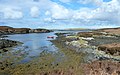
English: Wiay is an island in the council area of the Outer Hebrides, Scotland.
island of the Outer Hebrides, Scotland, UK, south-east of Benbecula  Vista áerea con Puerto Peter en Eilean na Cille en primer plano | |||||
| Upload media | |||||
| Instance of | |||||
|---|---|---|---|---|---|
| Part of | |||||
| Location | Outer Hebrides, Scotland | ||||
| Located in or next to body of water | |||||
 | |||||
Media in category "Wiay, Outer Hebrides"
The following 17 files are in this category, out of 17 total.
-
 Bagh na Murla, Wiay - geograph.org.uk - 2903946.jpg 4,000 × 3,000; 2.15 MB
-
 Bonnie Prince Charlie's cave on Wiay - geograph.org.uk - 2903361.jpg 1,200 × 896; 585 KB
-
 Bonnie Prince Charlie's Cave, Wiay - geograph.org.uk - 2902190.jpg 4,000 × 3,000; 5.01 MB
-
 Derelict croft house on Wiay - geograph.org.uk - 2902055.jpg 1,200 × 599; 201 KB
-
 Eastern end of Fuidheigh - geograph.org.uk - 4974582.jpg 640 × 486; 87 KB
-
 Gregor and Meg by the Prince's Cave, Wiay - geograph.org.uk - 2903937.jpg 4,000 × 3,000; 3.14 MB
-
 Headland at northern limit of Beinn a Tuath - geograph.org.uk - 2902091.jpg 1,200 × 795; 179 KB
-
 Mooring at Bagh na Murla, Wiay - geograph.org.uk - 2903994.jpg 4,000 × 3,000; 1.67 MB
-
 Mooring at Wiay - geograph.org.uk - 2902461.jpg 3,929 × 2,440; 1.37 MB
-
 Old Croft House, Wiay - geograph.org.uk - 2902650.jpg 4,000 × 3,000; 2.65 MB
-
 Old Croft House, Wiay - geograph.org.uk - 2903934.jpg 3,995 × 2,756; 2.13 MB
-
 Rocks off Rubha Cam nan Gall - geograph.org.uk - 4974574.jpg 640 × 460; 68 KB
-
 Ruined Croft House, Wiay - geograph.org.uk - 2902663.jpg 4,000 × 3,000; 2.68 MB
-
 Sgaracleit - geograph.org.uk - 4974577.jpg 640 × 412; 73 KB
-
 Wiay from the air.jpg 926 × 547; 358 KB
-
 Wiay OH.svg 1,083 × 1,424; 2.36 MB
-
 Wiay, Disembarking - geograph.org.uk - 2902448.jpg 4,000 × 3,000; 2.31 MB


