Category:Yaddlethorpe
Jump to navigation
Jump to search
village in United Kingdom  | |||||
| Upload media | |||||
| Instance of | |||||
|---|---|---|---|---|---|
| Location | Bottesford, North Lincolnshire, Lincolnshire, Yorkshire and the Humber, England | ||||
 | |||||
Media in category "Yaddlethorpe"
The following 61 files are in this category, out of 61 total.
-
 A unknown farm near Yaddlethorpe - geograph.org.uk - 2134935.jpg 800 × 600; 194 KB
-
 Bolingbroke Road - geograph.org.uk - 4174341.jpg 640 × 480; 51 KB
-
 Brankwell Crescent, Yaddlethorpe (geograph 2044092).jpg 640 × 480; 251 KB
-
 Car dealership, Yaddlethorpe - geograph.org.uk - 4174322.jpg 640 × 480; 48 KB
-
 Church of the Holy Spirit, Riddings - geograph.org.uk - 4174343.jpg 536 × 640; 81 KB
-

-
 Dragonby Road, Riddings - geograph.org.uk - 3310103.jpg 1,024 × 768; 180 KB
-
 Endcliffe Avenue, Yaddlethorpe - geograph.org.uk - 2047158.jpg 640 × 480; 223 KB
-
 Enderby Road - geograph.org.uk - 4174335.jpg 640 × 480; 58 KB
-
 Green Corridor, Yaddlethorpe - geograph.org.uk - 704879.jpg 640 × 384; 46 KB
-
 High Street, Yaddlethorpe - geograph.org.uk - 2047171.jpg 640 × 480; 223 KB
-

-
 Moorwell Farm, Yaddlethorpe - geograph.org.uk - 1996394.jpg 1,024 × 768; 192 KB
-
 Moorwell Road, Yaddlethorpe - geograph.org.uk - 4174320.jpg 640 × 480; 65 KB
-
 Newdown Road, Yaddlethorpe, Scunthorpe - geograph.org.uk - 4013408.jpg 1,024 × 768; 150 KB
-
 Nursery Close, Yaddlethorpe - geograph.org.uk - 2135297.jpg 800 × 600; 212 KB
-
 Nursery unit, Willoughby Road School, Riddings - geograph.org.uk - 3310108.jpg 1,024 × 768; 124 KB
-
 Ogilvy Drive, Yaddlethorpe - geograph.org.uk - 1981196.jpg 1,024 × 768; 109 KB
-
 Opencast Way on Croft Lane, Yaddlethorpe - geograph.org.uk - 4881425.jpg 1,200 × 799; 356 KB
-
 Opencast Way on Croft Lane, Yaddlethorpe - geograph.org.uk - 4881430.jpg 1,200 × 799; 357 KB
-
 Opencast Way on Croft Lane, Yaddlethorpe - geograph.org.uk - 4881436.jpg 1,200 × 799; 259 KB
-
 Opencast Way on Croft Lane, Yaddlethorpe - geograph.org.uk - 4881441.jpg 1,200 × 799; 312 KB
-
 Opencast Way on Hurst Lane, Yaddlethorpe - geograph.org.uk - 4881444.jpg 1,200 × 799; 264 KB
-
 Opencast Way on Hurst Lane, Yaddlethorpe - geograph.org.uk - 4881447.jpg 1,200 × 799; 297 KB
-
 Opencast Way on The Dales, Yaddlethorpe - geograph.org.uk - 4881530.jpg 1,200 × 799; 372 KB
-
 Opencast Way towards Croft Lane, Yaddlethorpe - geograph.org.uk - 4881416.jpg 1,200 × 799; 378 KB
-
 Opencast Way towards Croft Lane, Yaddlethorpe - geograph.org.uk - 4881420.jpg 1,200 × 799; 514 KB
-
 Opencast Way towards Yaddlethorpe - geograph.org.uk - 4880770.jpg 1,600 × 1,065; 989 KB
-
 Opencast Way towards Yaddlethorpe - geograph.org.uk - 4880774.jpg 1,600 × 1,065; 1.11 MB
-
 Opencast Way towards Yaddlethorpe - geograph.org.uk - 4881257.jpg 800 × 533; 188 KB
-
 Opencast Way towards Yaddlethorpe - geograph.org.uk - 4881260.jpg 1,200 × 799; 350 KB
-
 Opencast Way towards Yaddlethorpe - geograph.org.uk - 4881266.jpg 1,200 × 799; 421 KB
-
 Opencast Way towards Yaddlethorpe - geograph.org.uk - 4881268.jpg 1,200 × 799; 442 KB
-
 Opencast Way towards Yaddlethorpe - geograph.org.uk - 4881270.jpg 1,200 × 799; 431 KB
-
 Opencast Way towards Yaddlethorpe - geograph.org.uk - 4881272.jpg 1,200 × 799; 364 KB
-
 Opencast Way towards Yaddlethorpe - geograph.org.uk - 4881273.jpg 1,200 × 799; 403 KB
-
 Opencast Way towards Yaddlethorpe - geograph.org.uk - 4881286.jpg 1,200 × 799; 449 KB
-
 Opencast Way towards Yaddlethorpe - geograph.org.uk - 4881287.jpg 1,200 × 799; 389 KB
-
 Opencast Way towards Yaddlethorpe - geograph.org.uk - 4881291.jpg 1,200 × 799; 504 KB
-
 Opencast Way towards Yaddlethorpe - geograph.org.uk - 4881292.jpg 1,200 × 799; 483 KB
-
 Opencast Way towards Yaddlethorpe - geograph.org.uk - 4881293.jpg 1,200 × 799; 534 KB
-
 Parade of shops, Riddings - geograph.org.uk - 3310100.jpg 1,024 × 768; 135 KB
-
 Recycling bins, Willoughby Road - geograph.org.uk - 3310123.jpg 1,024 × 768; 138 KB
-
 Riddings Clinic - geograph.org.uk - 3310131.jpg 1,024 × 768; 146 KB
-
 Riddings Library - geograph.org.uk - 3310094.jpg 1,024 × 768; 131 KB
-
 Riddings Youth Centre - geograph.org.uk - 3310119.jpg 1,024 × 768; 105 KB
-
 Sunningdale Road, Yaddlethorpe - geograph.org.uk - 1757520.jpg 640 × 480; 64 KB
-
 The church of the Holy Spirit, Riddings - geograph.org.uk - 3310088.jpg 768 × 1,024; 153 KB
-
 The Dale, Yaddlethorpe - geograph.org.uk - 4881535.jpg 1,200 × 799; 359 KB
-
 The Dales, Yaddlethorpe - geograph.org.uk - 4881541.jpg 1,200 × 799; 334 KB
-
 The interior of Yaddlethorpe Methodist Church - geograph.org.uk - 2332129.jpg 768 × 1,024; 194 KB
-
 The Pied Piper Public House - geograph.org.uk - 4881611.jpg 1,200 × 799; 311 KB
-
 The Pied Piper Public House - geograph.org.uk - 4881615.jpg 984 × 1,200; 236 KB
-
 The Pied Piper, Riddings - geograph.org.uk - 3310097.jpg 1,024 × 768; 127 KB
-
 The rear of the Church of the Holy Spirit - geograph.org.uk - 3988884.jpg 1,024 × 768; 189 KB
-
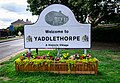 Welcome to Yaddlethorpe.jpg 4,701 × 3,264; 12.24 MB
-
 Willoughby Road, Scunthorpe - geograph.org.uk - 4881591.jpg 1,200 × 799; 397 KB
-
 Willoughby Road, Scunthorpe - geograph.org.uk - 4881605.jpg 1,200 × 799; 302 KB
-
 Yaddlethorpe Methodist Church - geograph.org.uk - 181813.jpg 640 × 427; 49 KB
-
 Yaddlethorpe Methodist Church - geograph.org.uk - 4174276.jpg 640 × 480; 57 KB
-
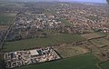 Yaddlethorpe, aerial 2015 - geograph.org.uk - 4419988.jpg 2,496 × 1,578; 1,008 KB


.jpg)


