Category:Zentraler Hauptkamm (Allgäu Alps)
Jump to navigation
Jump to search
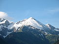
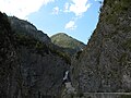
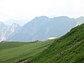
Deutsch: Der Zentrale Hauptkamm ist eine Untergruppe der Allgäuer Alpen. Grenzen: Oberstdorf — Trettachtal — Sperrbachtobel — Mädelejoch (1973 m) — Roßgumpental — Höhenbachtal — Lechtal — Krumbach — Schrofenpass (1688 m) — Rappenalptal — Stillachtal — Oberstdorf.
English: The Zentraler Hauptkamm (Central Major-range) is a sub-range of the Allgäu Alps. Borders: Oberstdorf — Trettach-Valley — Sperrbach-Ravine — Mädelejoch (1973 m) — Roßgumpen-Valley — Höhenbach-Valley — Lech-Valley — Krumbach-Valley— Schrofen-Pass (1688 m) — Rappenalpbach-Valley — Stillach-Valley — Oberstdorf.
mountain range of the Alps along the border Tyrol / Bavaria | |||||
| Upload media | |||||
| Instance of |
| ||||
|---|---|---|---|---|---|
| Location | |||||
| Mountain range | |||||
| Highest point | |||||
 | |||||
Subcategories
This category has the following 37 subcategories, out of 37 total.
B
- Biberkopf (76 F)
- Bockkarkopf (12 F)
C
- Christlessee (78 F)
E
- Ellbognerspitze (9 F)
- Enzianhütte (Oberstdorf) (15 F)
G
- Grüner (Allgäu Alps) (3 F)
H
- Himmelschrofen (32 F)
- Hinterer Wildgundkopf (6 F)
- Hochfrottspitze (19 F)
- Hochgundspitze (10 F)
- Hochrappenkopf (16 F)
- Hohes Licht (16 F)
K
- Kemptner Hütte (29 F)
- Kleiner Rappenkopf (14 F)
- Klupper (3 F)
- Kratzer (15 F)
L
- Linkerskopf (30 F)
M
- Mädelegabel (41 F)
- Mädelekopf (1 F)
- Muttekopf (4 F)
P
- Peischelspitze (5 F)
R
- Rappensee (1 P, 23 F)
- Rappenseekopf (11 F)
- Riefenkopf (8 F)
- Rotgundspitze (16 F)
S
- Schmalhorn (9 F)
- Schrofenpass (13 F)
- Schwarzmilzferner (3 F)
- Steinschartenkopf (11 F)
T
- Trettachspitze (45 F)
V
- Vorderer Wildgundkopf (7 F)
W
- Wilder Kasten (6 F)
- Wilder Mann (Allgäu Alps) (6 F)
- Wildmahdspitze (4 F)
Media in category "Zentraler Hauptkamm (Allgäu Alps)"
The following 46 files are in this category, out of 46 total.
-
 Allgaeuer Alpen.jpg 1,592 × 1,054; 714 KB
-
 Bacherloch.jpg 2,296 × 1,528; 1.39 MB
-
 Berge der guten Hoffnung.jpg 1,482 × 988; 238 KB
-
 Bergpanorama (1).jpg 1,600 × 1,200; 409 KB
-
 Bockkarkopf.JPG 3,264 × 2,448; 3.34 MB
-
 Deutsch-oesterreichische Grenze, gut erkennbar - panoramio.jpg 1,193 × 1,590; 372 KB
-
 Dritter Schafalpenkopf.JPG 3,264 × 2,448; 3.1 MB
-
 Ellbognerspitze Hohes Licht.JPG 3,264 × 2,448; 3.71 MB
-
 Eule-wildes-maennle.jpg 6,000 × 4,000; 6.13 MB
-
 Geissfuss vom Entschenkopf.jpg 2,912 × 1,932; 835 KB
-
 Gries- Alp- Roßgundkopf03.JPG 3,264 × 2,448; 2.99 MB
-
 Hoehenbach Hoehenbachtal.JPG 3,264 × 2,448; 3.23 MB
-
 Hoehenbachtal.JPG 3,264 × 2,448; 2.18 MB
-
 Ifen-Plateau Allgaeuer Hauptkamm.JPG 3,264 × 2,448; 3.84 MB
-
 Kaenzele vom Habaum.jpg 1,442 × 956; 169 KB
-
 Kemptner Huette02.JPG 3,264 × 2,448; 2.94 MB
-
 Kemptner Huette03.JPG 3,264 × 2,448; 3.93 MB
-
 Kogelsee.JPG 3,264 × 2,448; 2.3 MB
-
 Kuh am Rappensee.JPG 1,888 × 2,935; 166 KB
-
 Lechtal.Febr.März.2006 120.jpg 1,024 × 768; 709 KB
-
 Linkerskopf.JPG 3,264 × 2,448; 3.11 MB
-
 Muskopf Schafalpenkoepfe.JPG 3,264 × 2,448; 3.12 MB
-
 Mutzenkopf.JPG 3,264 × 2,448; 4.25 MB
-
 Nebelhornpanorama.jpg 4,946 × 694; 2.25 MB
-
 Oberstdorf - Allgäuer Hauptkamm 02.jpg 4,000 × 3,000; 1.25 MB
-
 Oberstdorf - Allgäuer Hauptkamm.jpg 4,000 × 3,000; 1.1 MB
-
 Oberstdorf - Vom Fellhorngipfel zum Allgäuer Hauptkamm.JPG 5,472 × 3,080; 3.83 MB
-
 Rappenseehuette Kleiner Rappensee.JPG 3,264 × 2,448; 4.19 MB
-
 Rossgundkopf Rappenseekopf.JPG 3,264 × 2,448; 2.82 MB
-
 Schafalpenkoepfe.JPG 3,264 × 2,448; 2.87 MB
-
 Schafalpenkoepfe02.JPG 3,264 × 2,448; 2.88 MB
-
 Schmalhorn.jpg 6,000 × 4,000; 8.15 MB
-
 Schneck Hoefats Grosser Wilder.JPG 2,845 × 2,134; 3.21 MB
-
 Seebichel Hochrappenkopf Kleiner Rappenkopf.JPG 3,264 × 2,448; 3.45 MB
-
 Seebichel Hochrappenkopf Kleiner Rappenkopf02.JPG 3,264 × 2,448; 3.29 MB
-
 Seebichel.jpg 6,000 × 4,000; 8.94 MB
-
 Simms-Waterfall03.JPG 3,264 × 2,448; 2.03 MB
-
 Steinschartenkopf02.JPG 3,264 × 2,448; 4.44 MB
-
 Stillach bei Faistenoy.JPG 3,264 × 2,448; 3.36 MB
-
 Stillachtal 180806.jpg 1,600 × 1,193; 645 KB
-
 Sunset Wildengundkopf.JPG 2,592 × 1,944; 1.46 MB
-
 Trettachtal.jpg 1,484 × 988; 148 KB
-
 Widderstein from Hoeferspitze.JPG 3,648 × 2,736; 2.97 MB
-
 Widdersteinhütte.JPG 2,719 × 2,039; 3.32 MB
-
 Wildgundkoepfe Christoph 17.JPG 3,264 × 2,448; 2.9 MB
-
 Zweiter Schafalpenkopf Summit.JPG 3,264 × 2,448; 3.31 MB


.jpg)


