Category:Zlaté Hory
Jump to navigation
Jump to search
town in the Jeseník District, Olomouc Region, Czech Republic | |||||
| Upload media | |||||
| Instance of |
| ||||
|---|---|---|---|---|---|
| Location |
| ||||
| Population |
| ||||
| Area |
| ||||
| Elevation above sea level |
| ||||
| Different from | |||||
| official website | |||||
 | |||||
Subcategories
This category has the following 13 subcategories, out of 13 total.
Media in category "Zlaté Hory"
The following 10 files are in this category, out of 10 total.
-
Zlaté Hory znak.jpg 523 × 600; 165 KB
-
2020 - Biskupia Kopa Bischofskoppe Zlaté Hory.jpg 6,000 × 4,000; 6.42 MB
-
Bohemaland.JPG 4,912 × 1,080; 806 KB
-
Lutcherův kříž.jpg 6,000 × 8,000; 15.89 MB
-
Rychleby 1817.jpg 9,924 × 7,652; 11.36 MB
-
Slepýš křehký v Dětské léčebně Edel Zlaté Hory.jpg 3,000 × 4,000; 4.2 MB
-
Zlate hory.jpg 2,560 × 1,920; 1.08 MB
-
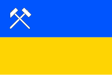
Zlaté Hory vlajka.jpg 600 × 400; 16 KB
-
Zlaté Hory vlajka.svg 600 × 400; 5 KB
-
Zukmantel 15 6233.jpg 3,543 × 1,860; 2.52 MB


