Commons:Wiki Loves Monuments in Switzerland/Bern/F-J
Jump to navigation
Jump to search
Ferenbalm
| Location | Upload | Photo | Object | Cat. | Coordinates | KGS-Nr | |
|---|---|---|---|---|---|---|---|
| Ferenbalm | 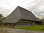
|
Althus Jerisberghof | A | 46°57′30″N 7°12′50″E / 46.958319444°N 7.213822222°E | 893 | ||
| Ferenbalm | 
|
Bauernhaus, Statthalterhof | A | 46°57′29″N 7°12′53″E / 46.958066666°N 7.214625°E | 9218 | ||
| Ferenbalm | 
|
Eisenbahn-Viadukt BN über die Saane (vgl. Mühlenberg/BE) | A | 46°56′10″N 7°14′33″E / 46.93607°N 7.24237°E | 10460 | ||
| Ferenbalm | 
|
Jerisberghof | ISOS | 46°57′29″N 7°12′51″E / 46.958°N 7.2141°E | |||
| Ferenbalm | 
|
Kirche und Pfarrhaus | B | 46°56′54″N 7°12′41″E / 46.94835°N 7.21131°E | 894 | ||
| Ferenbalm | 
|
Ofenhaus | A | 46°57′31″N 7°12′51″E / 46.958525°N 7.214111111°E | 9912 | ||
Fraubrunnen
| Location | Upload | Photo | Object | Cat. | Coordinates | KGS-Nr | |
|---|---|---|---|---|---|---|---|
| Fraubrunnen | 
|
Amthaus (ehem. Zisterzienserkloster) | B | 895 | |||
| Fraubrunnen | 
|
Büren zum Hof | ISOS | 47°05′44″N 7°30′49″E / 47.095555555°N 7.513611111°E | |||
| Fraubrunnen | 
|
Kloster Fraubrunnen | B | 47°05′06″N 7°31′36″E / 47.0849°N 7.52658°E | 737 | ||
| Fraubrunnen | 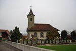
|
Limpach BE | ISOS | 47°06′30″N 7°29′38″E / 47.108333333°N 7.493888888°E | |||
| Fraubrunnen | 
|
reformierte Kirche und Pfarrhaus | B | 47°05′03″N 7°31′00″E / 47.084096542°N 7.516790178°E | 914 | ||
| Fraubrunnen | 
|
Speicher Nr. 100 und Speicher Nr. 102 | B | 896 | |||
Frauenkappelen
| Location | Upload | Photo | Object | Cat. | Coordinates | KGS-Nr | |
|---|---|---|---|---|---|---|---|
| Frauenkappelen | 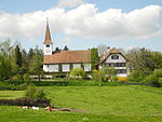
|
Kloster Frauenkappelen | B | 46°57′20″N 7°20′15″E / 46.9556°N 7.33745°E | 897 | ||
| Frauenkappelen | 
|
Wohlei | ISOS | 46°57′49″N 7°21′28″E / 46.963648°N 7.357799°E | |||
Frutigen
| Location | Upload | Photo | Object | Cat. | Coordinates | KGS-Nr | |
|---|---|---|---|---|---|---|---|
| Frutigen | 
|
Hasli, ehemaliges Wirtshaus Nr. 1655 | B | 46°34′32″N 7°39′36″E / 46.575579205°N 7.659879032°E | 899 | ||
| Frutigen | 
|
Kanderbrück | ISOS | 46°34′51″N 7°39′35″E / 46.5809°N 7.6597°E | |||
| Frutigen | 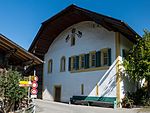
|
Kanderbrügg, Sust | B | 46°34′57″N 7°39′30″E / 46.58255411°N 7.658211447°E | 900 | ||
| Frutigen | 
|
Tellenburg | B | 46°34′33″N 7°39′07″E / 46.575954145°N 7.65205341°E | 898 | ||
Gals
| Location | Upload | Photo | Object | Cat. | Coordinates | KGS-Nr | |
|---|---|---|---|---|---|---|---|
| Gals | 
|
Gals | ISOS | 47°01′38″N 7°02′56″E / 47.0271°N 7.0489°E | |||
| Gals | 
|
Jolimont-Gut | A+ISOS | 47°02′19″N 7°05′02″E / 47.038711111°N 7.083947222°E | 9219 | ||
| Gals | 
|
Jolimont, Chlosterwald, prähist. Grabhügelgruppe | A | 47°01′55″N 7°04′30″E / 47.032002777°N 7.074877777°E | 9559 | ||
| Gals | 
|
Kloster Erlach | B+ISOS | 47°02′44″N 7°04′09″E / 47.0455°N 7.06907°E | 902 | ||
| Gals | 
|
Zihlbrügg, Château de Thielle | B | 47°01′20″N 7°02′03″E / 47.022331445°N 7.034288767°E | 903 | ||
Gampelen
| Location | Upload | Photo | Object | Cat. | Coordinates | KGS-Nr | |
|---|---|---|---|---|---|---|---|
| Gampelen | 
|
Bauernhäuser Scheurer, Oberes und Unteres Haus | B | 47°00′56″N 7°03′49″E / 47.015504698°N 7.063669265°E | 904 | ||
| Gampelen | 
|
Fanel, ehem. Gasthaus und ehem. Fährstelle an der Zihl | B | 47°00′54″N 7°02′02″E / 47.014999212°N 7.033949712°E | 906 | ||
| Gampelen | 
|
Pfarrhaus | A | 47°00′57″N 7°03′36″E / 47.015941666°N 7.060055555°E | 908 | ||
| Gampelen | reformierte Kirche | reformierte Kirche | B | 47°00′52″N 7°03′33″E / 47.014545407°N 7.059204465°E | 907 | ||
Gerzensee
| Location | Upload | Photo | Object | Cat. | Coordinates | KGS-Nr | |
|---|---|---|---|---|---|---|---|
| Gerzensee | 
|
Altes Schloss | B | 46°50′27″N 7°32′39″E / 46.840932353°N 7.544295359°E | 909 | ||
| Gerzensee | 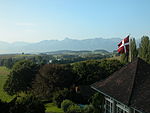
|
Gerzensee | ISOS | 46°50′00″N 7°33′00″E / 46.833333333°N 7.55°E | |||
| Gerzensee | 
|
Herrenbauernhaus Rütimatt | A | 46°50′49″N 7°32′54″E / 46.847052777°N 7.548413888°E | 912 | ||
| Gerzensee | 
|
Neues Schloss Gerzensee | B | 46°50′22″N 7°32′53″E / 46.8394°N 7.54797°E | 911 | ||
| Gerzensee | 
|
Vordere Chlapf | ISOS | 46°51′15″N 7°32′26″E / 46.85407°N 7.54048°E | |||
Gondiswil
| Location | Upload | Photo | Object | Cat. | Coordinates | KGS-Nr | |
|---|---|---|---|---|---|---|---|
| Gondiswil | 
|
Hünigen, Säge mit Reibe und Stampfe | B | 47°08′23″N 7°52′39″E / 47.139594146°N 7.877612484°E | 913 | ||
Grandval
| Location | Upload | Photo | Object | Cat. | Coordinates | KGS-Nr | |
|---|---|---|---|---|---|---|---|
| Grandval | 
|
Ecole | B | 47°16′59″N 7°25′20″E / 47.282995°N 7.42211°E | 917 | ||
| Grandval | 
|
Grandval BE | ISOS | 47°17′04″N 7°25′35″E / 47.284444444°N 7.426388888°E | |||
| Grandval | 
|
Maison de la Dîme | A | 47°16′56″N 7°25′29″E / 47.282163888°N 7.424747222°E | 916 | ||
| Grandval | 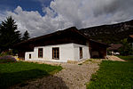
|
Maison du Banneret Wisard | A | 47°16′55″N 7°25′30″E / 47.282027777°N 7.425077777°E | 918 | ||
Grindelwald
| Location | Upload | Photo | Object | Cat. | Coordinates | KGS-Nr | |
|---|---|---|---|---|---|---|---|
| Grindelwald | 
|
Jungfraubahn | A | 46°37′00″N 8°01′34″E / 46.616736°N 8.026111°E | 10421 | ||
| Grindelwald | 
|
Kirche, Pfarrhaus, Pfrundscheune und Nebenbauten | B | 46°37′29″N 8°02′45″E / 46.624733014°N 8.045785662°E | 920 | ||
Grossaffoltern
| Location | Upload | Photo | Object | Cat. | Coordinates | KGS-Nr | |
|---|---|---|---|---|---|---|---|
| Grossaffoltern | 
|
Aeschertenwald, eisenzeitlicher Grabhügel | B | 47°03′21″N 7°21′18″E / 47.055847006°N 7.35505545°E | 921 | ||
| Grossaffoltern | 
|
Chaltbrünnen-Ischlag, eisenzeitlicher Grabhügel | B | 47°04′03″N 7°22′58″E / 47.067557234°N 7.382682782°E | 922 | ||
| Grossaffoltern | 
|
r. Kirche, Pfarrhaus und Dorfplatz | B | 47°03′57″N 7°21′32″E / 47.065744298°N 7.358857473°E | 923 | ||
Gsteig bei Gstaad
| Location | Upload | Photo | Object | Cat. | Coordinates | KGS-Nr | |
|---|---|---|---|---|---|---|---|
| Gsteig bei Gstaad | 
|
Bauernhaus | A | 46°24′02″N 7°16′16″E / 46.400597222°N 7.271030555°E | 9220 | ||
| Gsteig bei Gstaad | 
|
Bauernhaus, Feutersoey | A | 46°24′43″N 7°16′04″E / 46.412069444°N 7.267897222°E | 9771 | ||
| Gsteig bei Gstaad | 
|
Gasthof Bären | B | 46°23′07″N 7°16′02″E / 46.385183124°N 7.267113776°E | 924 | ||
| Gsteig bei Gstaad | 
|
Gsteig bei Gstaad | ISOS | 46°23′00″N 7°15′59″E / 46.383333333°N 7.266388888°E | |||
| Gsteig bei Gstaad | 
|
r. Kirche mit Pfarrhaus | B | 46°23′05″N 7°16′02″E / 46.384643585°N 7.267245488°E | 925 | ||
Gsteigwiler
| Location | Upload | Photo | Object | Cat. | Coordinates | KGS-Nr | |
|---|---|---|---|---|---|---|---|
| Gsteigwiler | 
|
Kirche Gsteig bei Interlaken | B+ISOS | 46°39′55″N 7°52′21″E / 46.66519462°N 7.87238581°E | 926 | ||
Guggisberg
| Location | Upload | Photo | Object | Cat. | Coordinates | KGS-Nr | |
|---|---|---|---|---|---|---|---|
| Guggisberg | 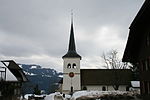
|
Guggisberg | ISOS | 46°45′59″N 7°19′59″E / 46.766388888°N 7.333055555°E | |||
| Guggisberg | 
|
reformierte Kirche | B | 46°46′00″N 7°19′45″E / 46.766626409°N 7.329258728°E | 927 | ||
| Guggisberg | 
|
Trifelers Babis Stöckli | A | 46°46′01″N 7°19′46″E / 46.766930555°N 7.329536111°E | 9221 | ||
Gurbrü
| Location | Upload | Photo | Object | Cat. | Coordinates | KGS-Nr | |
|---|---|---|---|---|---|---|---|
| Gurbrü | 
|
Stock Nr. 1 A (Hurni) | B | 46°57′52″N 7°13′08″E / 46.964320355°N 7.219008148°E | 928 | ||
Gurzelen
| Location | Upload | Photo | Object | Cat. | Coordinates | KGS-Nr | |
|---|---|---|---|---|---|---|---|
| Gurzelen | 
|
r. Kirche mit Pfarrhaus und Pfrundscheune | B | 46°46′47″N 7°31′59″E / 46.779683625°N 7.533175961°E | 929 | ||
Guttannen
| Location | Upload | Photo | Object | Cat. | Coordinates | KGS-Nr | |
|---|---|---|---|---|---|---|---|
| Guttannen | 
|
Grimselsee | A | 46°34′11″N 8°19′39″E / 46.569588888°N 8.327405555°E | 9044 | ||
Hagneck
| Location | Upload | Photo | Object | Cat. | Coordinates | KGS-Nr | |
|---|---|---|---|---|---|---|---|
| Hagneck | 
|
Gammen | ISOS | 46°55′04″N 7°14′00″E / 46.9178°N 7.2333°E | |||
| Hagneck | Kraftwerk und Wehr | Kraftwerk und Wehr | B | 47°03′35″N 7°10′40″E / 47.059686°N 7.17791°E | 9913 | ||
| Hagneck | 
|
Wasserkraftwerk Hagneck | ISOS | 47°03′36″N 7°10′41″E / 47.05995°N 7.17811°E | |||
Hasle bei Burgdorf
| Location | Upload | Photo | Object | Cat. | Coordinates | KGS-Nr | |
|---|---|---|---|---|---|---|---|
| Hasle bei Burgdorf | 
|
Bigel | ISOS | 46°59′57″N 7°40′06″E / 46.99928°N 7.6684°E | |||
| Hasle bei Burgdorf | 
|
Goldbach | ISOS | 47°00′16″N 7°40′52″E / 47.0044°N 7.6811°E | |||
| Hasle bei Burgdorf | 
|
Goldbach, 10-Jungfrauen-Speicher Nr. 372 | B | 47°00′08″N 7°40′33″E / 47.002111645°N 7.675902735°E | 931 | ||
| Hasle bei Burgdorf | 
|
Holzbrücke (vgl. Rüegsau/BE) | A | 47°01′15″N 7°38′56″E / 47.020916666°N 7.648825°E | 10492 | ||
| Hasle bei Burgdorf | 
|
Holzbrücke (vgl. Rüegsau/BE) | A | 47°01′15″N 7°38′56″E / 47.020916666°N 7.648825°E | 930 | ||
| Hasle bei Burgdorf | 
|
reformierte Kirche (Fresken) | B | 47°00′59″N 7°38′47″E / 47.016381065°N 7.646504495°E | 932 | ||
Häutligen
| Location | Upload | Photo | Object | Cat. | Coordinates | KGS-Nr | |
|---|---|---|---|---|---|---|---|
| Häutligen | 
|
Häutligen | ISOS | 46°51′26″N 7°36′19″E / 46.857222222°N 7.605277777°E | |||
Heimiswil
| Location | Upload | Photo | Object | Cat. | Coordinates | KGS-Nr | |
|---|---|---|---|---|---|---|---|
| Heimiswil | [[File:|150x150px|Eidgenössisches Mikrofilmarchiv]] | Eidgenössisches Mikrofilmarchiv | A | 47°02′46″N 7°38′47″E / 47.046066666°N 7.646288888°E | 934 | ||
| Heimiswil | 
|
Gasthaus Löwen | B | 9222 | |||
| Heimiswil | 
|
Guetisberg | ISOS | 47°04′52″N 7°40′13″E / 47.08115°N 7.67036°E | |||
| Heimiswil | 
|
Kirche und Pfarrhaus | A | 47°03′54″N 7°39′36″E / 47.065097222°N 7.660044444°E | 935 | ||
Herbligen
| Location | Upload | Photo | Object | Cat. | Coordinates | KGS-Nr | |
|---|---|---|---|---|---|---|---|
| Herbligen | 
|
Wohnstock | B | 46°49′35″N 7°36′25″E / 46.826258323°N 7.606977118°E | 10627 | ||
Herzogenbuchsee
| Location | Upload | Photo | Object | Cat. | Coordinates | KGS-Nr | |
|---|---|---|---|---|---|---|---|
| Herzogenbuchsee | 
|
Gasthof Kreuz | A | 47°11′16″N 7°42′25″E / 47.187902777°N 7.706822222°E | 937 | ||
| Herzogenbuchsee | 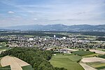
|
Herzogenbuchsee | ISOS | 47°11′18″N 7°42′22″E / 47.18838°N 7.70619°E | |||
| Herzogenbuchsee | 
|
Kornhaus und Gemeindehaus (Ortsmuseum und Archiv) | B | 47°11′17″N 7°42′21″E / 47.18806387°N 7.705820074°E | 938 | ||
| Herzogenbuchsee | 
|
Mühle und Mühlehof im Ortsteil Oberönz | A | 47°10′44″N 7°41′35″E / 47.179022222°N 7.693005555°E | 9234 | ||
| Herzogenbuchsee | 
|
reformierte Kirche | B | 47°11′14″N 7°42′29″E / 47.187159062°N 7.7081245°E | 939 | ||
Hilterfingen
| Location | Upload | Photo | Object | Cat. | Coordinates | KGS-Nr | |
|---|---|---|---|---|---|---|---|
| Hilterfingen | 
|
Landsitz Eichbühl | B | 46°44′36″N 7°39′04″E / 46.743318595°N 7.651013456°E | 941 | ||
| Hilterfingen | 
|
Schloss Hünegg | A | 46°44′16″N 7°39′18″E / 46.737794°N 7.654931°E | 940 | ||
Hindelbank
| Location | Upload | Photo | Object | Cat. | Coordinates | KGS-Nr | |
|---|---|---|---|---|---|---|---|
| Hindelbank | 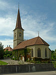
|
Kirche | A | 47°02′30″N 7°32′24″E / 47.041744444°N 7.540047222°E | 943 | ||
| Hindelbank | 
|
Pfarrhaus | A | 47°02′31″N 7°32′22″E / 47.041852777°N 7.539522222°E | 9780 | ||
| Hindelbank | 
|
Schloss Hindelbank | A+ISOS | 47°01′59″N 7°32′28″E / 47.033055555°N 7.541111111°E | 942 | ||
Hofstetten bei Brienz
| Location | Upload | Photo | Object | Cat. | Coordinates | KGS-Nr | |
|---|---|---|---|---|---|---|---|
| Hofstetten bei Brienz | 
|
Schweizerisches Freilichtmuseum Ballenberg | A | 46°44′58″N 8°05′11″E / 46.749547222°N 8.08645°E | 8545 | ||
Huttwil
| Location | Upload | Photo | Object | Cat. | Coordinates | KGS-Nr | |
|---|---|---|---|---|---|---|---|
| Huttwil | 
|
Huttwil | ISOS | 47°06′59″N 7°51′00″E / 47.116388888°N 7.85°E | |||
| Huttwil | 
|
Reformierte Kirche | B | 47°06′50″N 7°51′00″E / 47.113778°N 7.849894°E | 945 | ||
Inkwil
| Location | Upload | Photo | Object | Cat. | Coordinates | KGS-Nr | |
|---|---|---|---|---|---|---|---|
| Inkwil | 
|
Inkwil BE/Bolken SO–Inkwilersee Insel | ISOS | 47°11′55″N 7°39′46″E / 47.1986°N 7.66268°E | |||
| Inkwil | 
|
Inkwil BE/Bolken SO–Inkwilersee Insel | UNESCO | 47°11′55″N 7°39′46″E / 47.1986°N 7.66268°E | |||
| Inkwil | 
|
Inkwilersee | A | 47°11′53″N 7°39′43″E / 47.198055555°N 7.661944444°E | 9666 | ||
Innertkirchen
| Location | Upload | Photo | Object | Cat. | Coordinates | KGS-Nr | |
|---|---|---|---|---|---|---|---|
| Innertkirchen | 
|
Feldhaus, Wyler Sunnsiten | A | 46°42′33″N 8°14′40″E / 46.709227777°N 8.244536111°E | 9223 | ||
| Innertkirchen | 
|
reformierte Kirche mit ehemaligem Pfarrhaus in Gadmen | B | 46°44′18″N 8°21′11″E / 46.738326012°N 8.352992798°E | 901 | ||
| Innertkirchen | 
|
Säge, Mühletal | A | 46°42′53″N 8°15′57″E / 46.714744444°N 8.265872222°E | 9914 | ||
| Innertkirchen | 
|
Wiler, Erzknappenhaus | B | 46°42′33″N 8°14′40″E / 46.709231549°N 8.244540821°E | 948 | ||
Ins
| Location | Upload | Photo | Object | Cat. | Coordinates | KGS-Nr | |
|---|---|---|---|---|---|---|---|
| Ins | 
|
Albert Anker-Haus | A | 47°00′19″N 7°06′27″E / 47.005311111°N 7.107561111°E | 953 | ||
| Ins | 
|
Bauernhaus (Himmelriich) | A | 47°00′27″N 7°06′21″E / 47.007636111°N 7.105825°E | 10491 | ||
| Ins | 
|
Fenis, Erdwerk | A | 47°01′27″N 7°06′48″E / 47.024291666°N 7.113469444°E | 950 | ||
| Ins | 
|
Grossholz, eisenzeitliche Grabhügelgruppe | B | 47°01′39″N 7°08′07″E / 47.027500894°N 7.135412133°E | 949 | ||
| Ins | 
|
Ins BE | ISOS | 47°00′N 7°06′E / 47.0°N 7.1°E | |||
| Ins | 
|
Wagnerhaus | B | 952 | |||
Interlaken
| Location | Upload | Photo | Object | Cat. | Coordinates | KGS-Nr | |
|---|---|---|---|---|---|---|---|
| Interlaken | 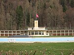
|
Bödelibad | B | 46°41′25″N 7°51′30″E / 46.69034564°N 7.858273079°E | 9915 | ||
| Interlaken | 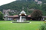
|
Casino Interlaken | A | 46°41′19″N 7°51′29″E / 46.688641666°N 7.858186111°E | 954 | ||
| Interlaken | 
|
Hotel Beaurivage | B | 46°41′23″N 7°51′52″E / 46.689737633°N 7.864543454°E | 956 | ||
| Interlaken | 
|
Hotel Royal-St.Georges | A | 46°41′20″N 7°51′46″E / 46.688780555°N 7.862652777°E | 957 | ||
| Interlaken | 
|
Interlaken | ISOS | 46°41′17″N 7°51′53″E / 46.688125°N 7.864644444°E | |||
| Interlaken | 
|
Kiosk | B | 46°41′18″N 7°51′42″E / 46.68826406°N 7.861655867°E | 958 | ||
| Interlaken | 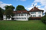
|
Kloster Interlaken | A | 46°41′14″N 7°51′53″E / 46.687194444°N 7.864597222°E | 960 | ||
| Interlaken | Kraftwerk | Kraftwerk | B | 46°40′58″N 7°51′01″E / 46.682639°N 7.850174°E | 959 | ||
| Interlaken | Victoria-Jungfrau Grand Hotel & Spa | Victoria-Jungfrau Grand Hotel & Spa | A | 46°41′11″N 7°51′25″E / 46.686461111°N 7.856877777°E | 955 | ||
Iseltwald
| Location | Upload | Photo | Object | Cat. | Coordinates | KGS-Nr | |
|---|---|---|---|---|---|---|---|
| Iseltwald | 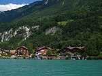
|
Iseltwald | ISOS | 46°42′35″N 7°57′49″E / 46.7098°N 7.9636°E | |||
| Iseltwald | 
|
Seeburg | B | 46°42′48″N 7°57′57″E / 46.713198165°N 7.965866154°E | 961 | ||
Ittigen
| Location | Upload | Photo | Object | Cat. | Coordinates | KGS-Nr | |
|---|---|---|---|---|---|---|---|
| Ittigen | 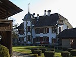
|
Campagne Thalgut | B | 46°58′30″N 7°29′01″E / 46.974957083°N 7.483710206°E | 962 | ||
| Ittigen | Gosteli Stiftung, Archiv zur Geschichte der schweizerischen Frauenbewegung | Gosteli Stiftung, Archiv zur Geschichte der schweizerischen Frauenbewegung | A | 46°58′47″N 7°27′45″E / 46.979782°N 7.462466°E | 8780 | ||
| Ittigen | 
|
Stufenbau | B | 46°58′38″N 7°28′08″E / 46.9771°N 7.469°E | 963 | ||
| Ittigen | 
|
Worblaufen, Eisenwerk Müller und Landsitz Sandhof | B | 46°58′37″N 7°27′49″E / 46.976942271°N 7.463603724°E | 964 | ||
| Ittigen | 
|
Worblental | ISOS | 46°57′22″N 7°32′16″E / 46.9561°N 7.53782°E | |||
Jegenstorf
| Location | Upload | Photo | Object | Cat. | Coordinates | KGS-Nr | |
|---|---|---|---|---|---|---|---|
| Jegenstorf | 
|
Reformierte Kirche | A | 47°03′01″N 7°30′25″E / 47.050277777°N 7.507005555°E | 965 | ||
| Jegenstorf | 
|
Schloss Jegenstorf | A | 47°02′52″N 7°30′34″E / 47.0478°N 7.50944°E | 966 | ||