File:الزراعة في تطاوين 2.jpg
Jump to navigation
Jump to search

Size of this preview: 551 × 600 pixels. Other resolutions: 220 × 240 pixels | 441 × 480 pixels | 705 × 768 pixels | 941 × 1,024 pixels | 1,536 × 1,672 pixels.
Original file (1,536 × 1,672 pixels, file size: 480 KB, MIME type: image/jpeg)
Captions
Captions
Add a one-line explanation of what this file represents
Summary[edit]
| Camera location | | View this and other nearby images on: OpenStreetMap |
|---|
| Description |
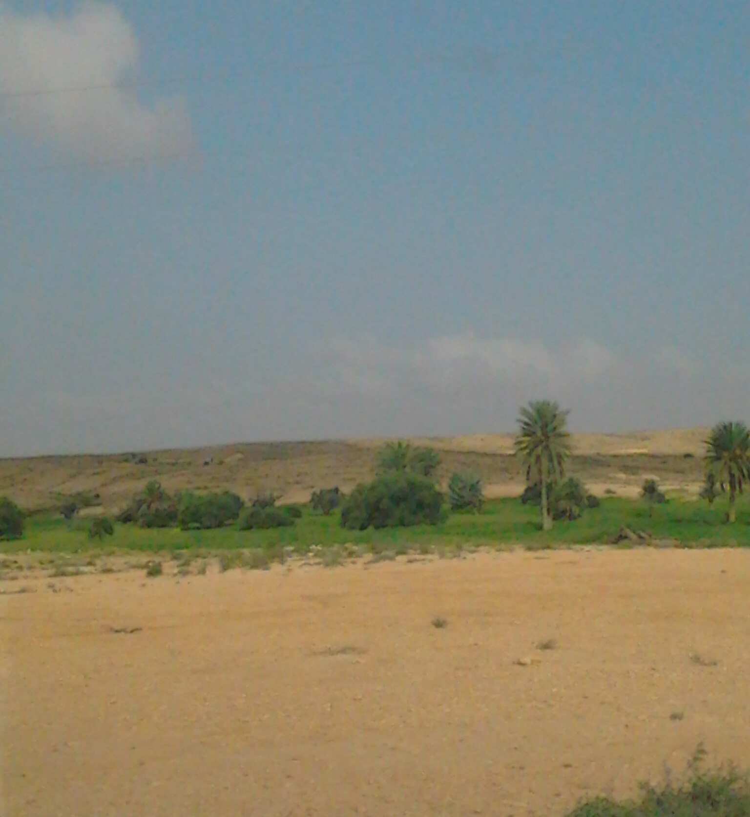
العربية: الزراعة تكون في مجرى الوادي ويتم افتعال حاجز لجمع المياه، عبارته عن سد، يسمى ب" الجسر " أو " الكاترة ". وتكون الزراعة من جهة سيلان المياه. English: Planting is in the course of the valley. They fabricate a barrier to collect water, like a dam, so-called "bridge" or "Alkatrh." Planting is upstream relative to the barrier. Français : La plantation est dans le cadre de la vallée. facilitée par la mise en place d'une barrière pour recueillir l'eau, comme un barrage, dont le nom est «pont» ou «Alkatrh." La plantation se situe en amont par rapport à la barrière. |
| Date | |
| Source | Own work |
| Author | Wael Ghabara |
Licensing[edit]
I, the copyright holder of this work, hereby publish it under the following license:
This file is licensed under the Creative Commons Attribution-Share Alike 3.0 Unported license.
- You are free:
- to share – to copy, distribute and transmit the work
- to remix – to adapt the work
- Under the following conditions:
- attribution – You must give appropriate credit, provide a link to the license, and indicate if changes were made. You may do so in any reasonable manner, but not in any way that suggests the licensor endorses you or your use.
- share alike – If you remix, transform, or build upon the material, you must distribute your contributions under the same or compatible license as the original.
File history
Click on a date/time to view the file as it appeared at that time.
| Date/Time | Thumbnail | Dimensions | User | Comment | |
|---|---|---|---|---|---|
| current | 10:35, 3 May 2015 | | 1,536 × 1,672 (480 KB) | Moumou82 (talk | contribs) | Cropped 18 % horizontally and < 1 % vertically using CropTool with precise mode. |
| 00:14, 28 March 2012 |  | 1,536 × 2,048 (632 KB) | Ghabara (talk | contribs) |
You cannot overwrite this file.
File usage on Commons
The following page uses this file:
File usage on other wikis
The following other wikis use this file:
- Usage on ar.wikipedia.org
- Usage on en.wikipedia.org
- Usage on fr.wikipedia.org
- Usage on tr.wikipedia.org