File:大坑罟.jpg
Jump to navigation
Jump to search
Size of this preview: 800 × 449 pixels. Other resolutions: 320 × 180 pixels | 640 × 360 pixels | 1,024 × 575 pixels | 1,280 × 719 pixels | 2,560 × 1,438 pixels | 5,184 × 2,912 pixels.
Original file (5,184 × 2,912 pixels, file size: 12.73 MB, MIME type: image/jpeg)
Captions
Captions
Add a one-line explanation of what this file represents
Summary
[edit]
| Description |
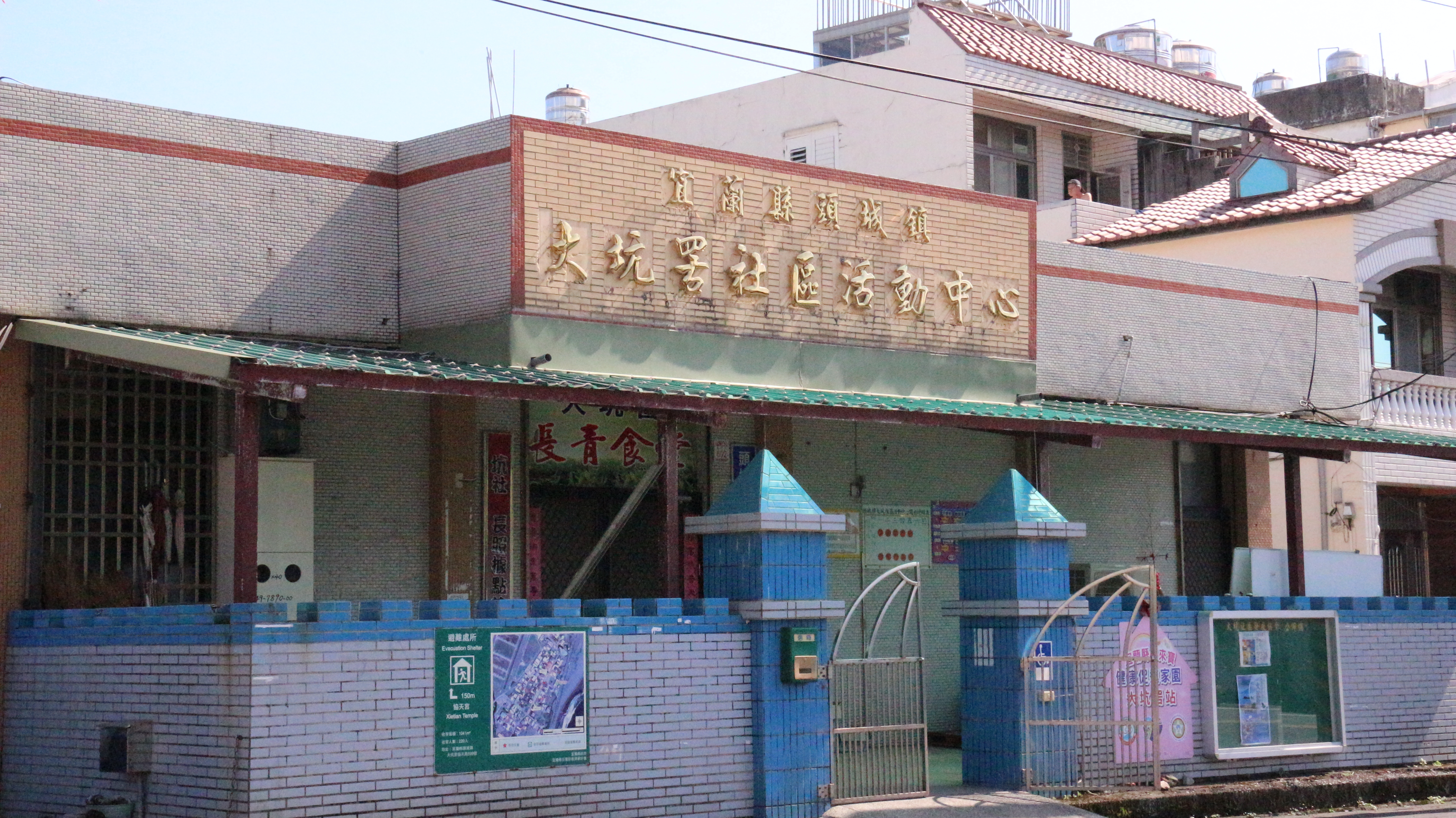
中文(臺灣):大坑罟這個地名在宜蘭有兩處,一處位於頭城鎮,一處位於蘇澳鎮。根據「陳氏大族譜」記載,兩地大坑罟先民皆來自福建漳浦縣佛曇鎮的大坑村。明末清初,為響應鄭成功反清復明,該村陳姓族人共有二十四人分別搭乘兩艘船,帶了兩組罟網,奉村內關公與玄天上帝之分靈香火移民蘭地。至於為何有兩處「大坑罟」?一說是兩艘船全部的人都在頭城上岸,但因開墾的腹地有限,而後一組人則南遷蘇澳,並抽籤決定奉祀神明,頭城的大坑罟祀關聖帝君,蘇澳則祀玄天上帝;另一說為其中一船人攜一組罟網,奉關公香火登陸頭城烏石港,另一船人則奉玄天上帝香火續航至新城溪口上岸落戶。兩地皆為紀念而以故鄉「大坑」以及「罟」為地名。至今兩地居民仍維持在神明生日時,互訪祝壽聯繫感情之舊習。 |
| Source | https://memory.culture.tw/Home/Detail?Id=282835&IndexCode=Culture_Place |
| Author | 創作者:莊文生;鄭文嵐;謝淑娟。貢獻者:宜蘭縣政府文化局 |
| Camera location | | View this and other nearby images on: OpenStreetMap |
|---|
Licensing
[edit]
This file is licensed under the Creative Commons Attribution 3.0 Taiwan license.
- You are free:
- to share – to copy, distribute and transmit the work
- to remix – to adapt the work
- Under the following conditions:
- attribution – You must give appropriate credit, provide a link to the license, and indicate if changes were made. You may do so in any reasonable manner, but not in any way that suggests the licensor endorses you or your use.

File history
Click on a date/time to view the file as it appeared at that time.
| Date/Time | Thumbnail | Dimensions | User | Comment | |
|---|---|---|---|---|---|
| current | 08:11, 13 April 2022 | | 5,184 × 2,912 (12.73 MB) | Muyueh Bot (talk | contribs) |
You cannot overwrite this file.
File usage on Commons
There are no pages that use this file.
File usage on other wikis
The following other wikis use this file:
- Usage on zh.wikipedia.org