File:Tea plantation in Tokorozawa - panoramio (1).jpg
(Redirected from File:茶畑 - panoramio (1).jpg)
.jpg&redirect=no)

Size of this preview: 800 × 600 pixels. Other resolutions: 320 × 240 pixels | 640 × 480 pixels | 1,024 × 768 pixels | 1,280 × 960 pixels.
Original file (1,280 × 960 pixels, file size: 1.81 MB, MIME type: image/jpeg)
Captions
Captions
Add a one-line explanation of what this file represents
Summary[edit]
.jpg&action=edit§ion=1)
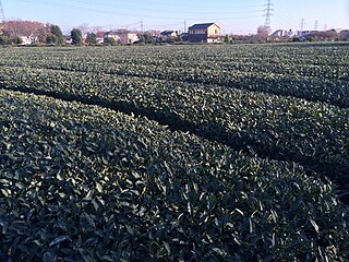
| Description | 埼玉県所沢市の茶畑 | ||
| Date | 5 December 2013 (original upload date) | ||
| Source | https://web.archive.org/web/20161030010338/http://www.panoramio.com/photo/100185947 | ||
| Author | ma go | ||
| Permission (Reusing this file) |
This file is licensed under the Creative Commons Attribution 3.0 Unported license. Attribution: ma go
|
||
| Tags (from Panoramio photo page) | Tokorozawa-shi, 水野・北中の森 |
| Camera location | | View this and other nearby images on: OpenStreetMap |
|---|
.jpg¶ms=035.814476_N_0139.434706_E_globe:Earth_type:camera_source:Panoramio_&language=en)
File history
Click on a date/time to view the file as it appeared at that time.
| Date/Time | Thumbnail | Dimensions | User | Comment | |
|---|---|---|---|---|---|
| current | 02:47, 8 March 2017 | | 1,280 × 960 (1.81 MB) | Panoramio upload bot (talk | contribs) | == {{int:filedesc}} == {{Information |description=茶畑 |date={{Original upload date|2013-12-05}} |source=http://www.panoramio.com/photo/100185947 |author=[http://www.panoramio.com/user/2104139?with_photo_id=100185947 ma go] |permission={{cc-by-3.0|ma... |
You cannot overwrite this file.
File usage on Commons
The following page uses this file:
- File:茶畑 - panoramio (1).jpg (file redirect)
.jpg&oldid=498367309)