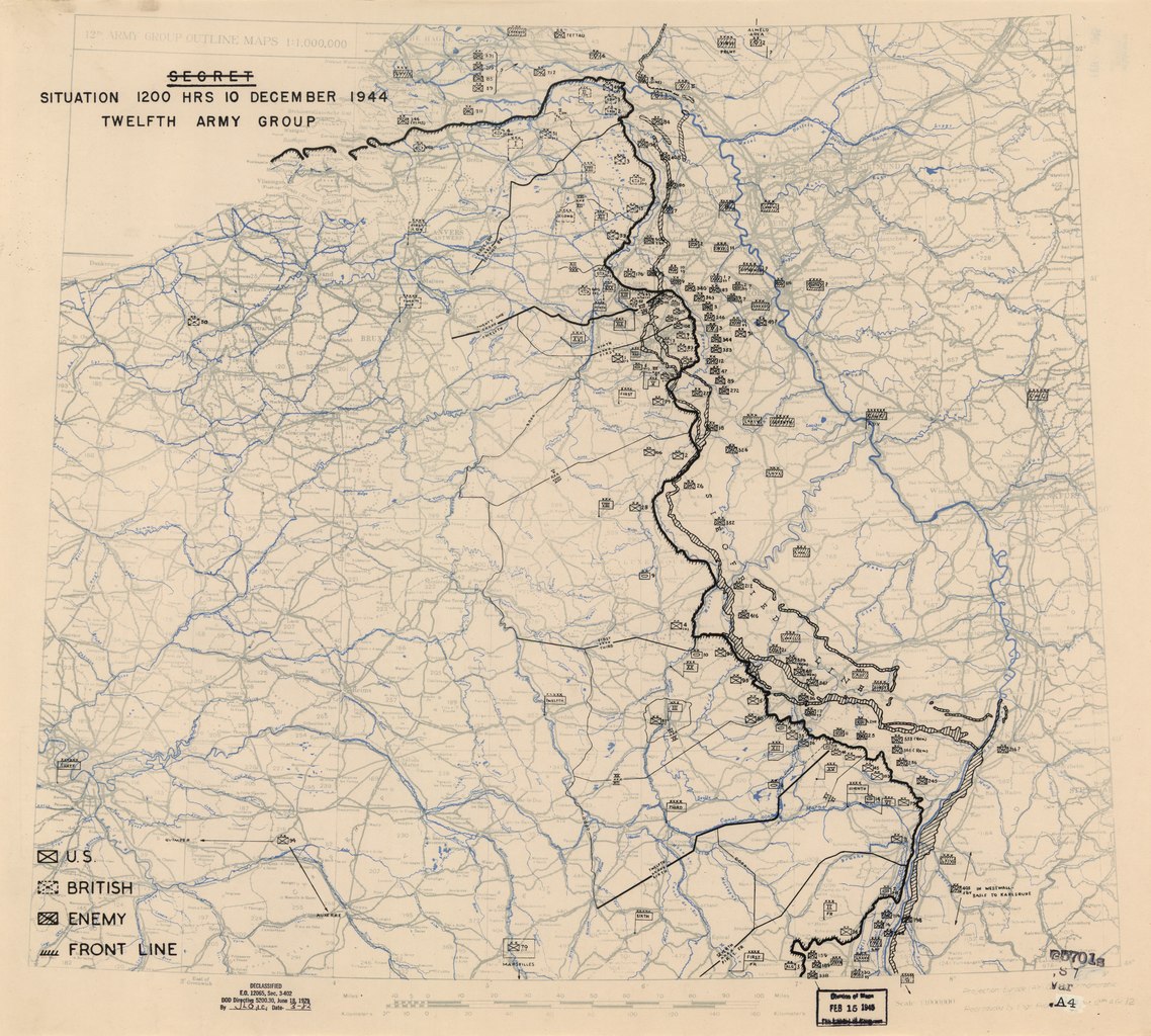
File:(December 10, 1944), HQ Twelfth Army Group situation map. LOC 2004630282.tif
Jump to navigation
Jump to search

Size of this JPG preview of this TIF file: 666 × 599 pixels. Other resolutions: 267 × 240 pixels | 533 × 480 pixels | 854 × 768 pixels | 1,138 × 1,024 pixels | 2,276 × 2,048 pixels | 6,620 × 5,957 pixels.
Original file (6,620 × 5,957 pixels, file size: 112.83 MB, MIME type: image/tiff)
Captions
Captions
Add a one-line explanation of what this file represents
Summary[edit]
| Description |
English: Available also through the Library of Congress web site as a raster image. |
||
| Title | [December 10, 1944], HQ Twelfth Army Group situation map. | ||
| Shelf ID | G5701.S7 svar .A4 | ||
| Date | |||
| Source | https://www.loc.gov/item/2004630282/ | ||
| Author | Allied Forces. Army Group, 12Th. Engineer Section; United States. Army. Army Group, 1St. Headquarters | ||
| Permission (Reusing this file) |
|
||
| Other versions |
|
||
| Location | Europe | ||
| Part of | Military Battles And Campaigns · American Memory · World War Ii Military Situation Maps · Catalog · Geography And Map Division | ||
| Subject | Campaigns · Maps · World War · Europe |

,_HQ_Twelfth_Army_Group_situation_map._LOC_2004630282.jpg)
Licensing[edit]
| This work is from the Library of Congress. According to the library, there are no known copyright restrictions on the use of this work. |  |
File history
Click on a date/time to view the file as it appeared at that time.
| Date/Time | Thumbnail | Dimensions | User | Comment | |
|---|---|---|---|---|---|
| current | 11:59, 10 May 2018 |  | 6,620 × 5,957 (112.83 MB) | Fæ (talk | contribs) | LOC Maps https://www.loc.gov/item/2004630282/ #53 |
You cannot overwrite this file.
File usage on Commons
The following page uses this file: