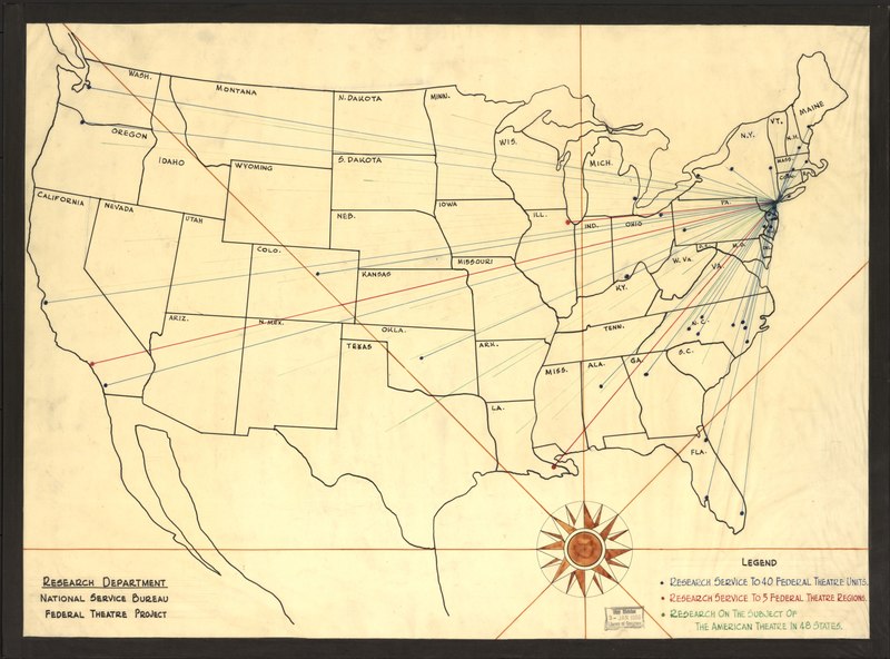
File:(Map showing) research service to 40 Federal Theatre units, research service to 5 Federal Theatre regions, research on the subject of the American theatre in 48 states LOC 2010594447.tif
Jump to navigation
Jump to search
Size of this JPG preview of this TIF file: 800 × 592 pixels. Other resolutions: 320 × 237 pixels | 640 × 474 pixels | 1,024 × 758 pixels | 1,280 × 947 pixels | 2,560 × 1,895 pixels | 11,133 × 8,240 pixels.
Original file (11,133 × 8,240 pixels, file size: 262.46 MB, MIME type: image/tiff)
Captions
Captions
Add a one-line explanation of what this file represents
Summary[edit]
| Warning | The original file is very high-resolution. It might not load properly or could cause your browser to freeze when opened at full size. |
|---|
| Description |
English: Pen and ink and watercolor. Available also through the Library of Congress Web site as a raster image. On verso: No. 1. Copy annotated in blue, red, and green to show areas of research service, mounted on board. |
||
| Title | [Map showing] research service to 40 Federal Theatre units, research service to 5 Federal Theatre regions, research on the subject of the American theatre in 48 states | ||
| Shelf ID | G3701.E645 193- .F4 | ||
| Date | |||
| Source | https://www.loc.gov/item/2010594447/ | ||
| Author | Federal Theatre Project (U.S.). National Service Bureau. Research Department | ||
| Permission (Reusing this file) |
|
||
| Other versions |
|
||
| Location | United States | ||
| Part of | American Memory · General Maps · Catalog · Geography And Map Division | ||
| Subject | Theater · Federal Theatre Project (U.S.) · United States · Maps · Theater And State · Manuscript Maps |

_research_service_to_40_Federal_Theatre_units,_research_service_to_5_Federal_Theatre_regions,_research_on_the_subject_of_the_American_theatre_in_48_states_LOC_2010594447.jpg)
Licensing[edit]
|
This is a faithful photographic reproduction of a two-dimensional, public domain work of art. The work of art itself is in the public domain for the following reason:
The official position taken by the Wikimedia Foundation is that "faithful reproductions of two-dimensional public domain works of art are public domain".
This photographic reproduction is therefore also considered to be in the public domain in the United States. In other jurisdictions, re-use of this content may be restricted; see Reuse of PD-Art photographs for details. | ||||
File history
Click on a date/time to view the file as it appeared at that time.
| Date/Time | Thumbnail | Dimensions | User | Comment | |
|---|---|---|---|---|---|
| current | 11:20, 19 June 2018 |  | 11,133 × 8,240 (262.46 MB) | Fæ (talk | contribs) | LOC Maps https://www.loc.gov/item/2010594447/ #20620 |
You cannot overwrite this file.
File usage on Commons
The following page uses this file: