File:079 ostindien (1905).png
Jump to navigation
Jump to search
Size of this preview: 477 × 599 pixels. Other resolutions: 191 × 240 pixels | 382 × 480 pixels | 612 × 768 pixels | 816 × 1,024 pixels | 1,730 × 2,172 pixels.
Original file (1,730 × 2,172 pixels, file size: 2.28 MB, MIME type: image/png)
Captions
Captions
Add a one-line explanation of what this file represents
Summary[edit]
| Description |
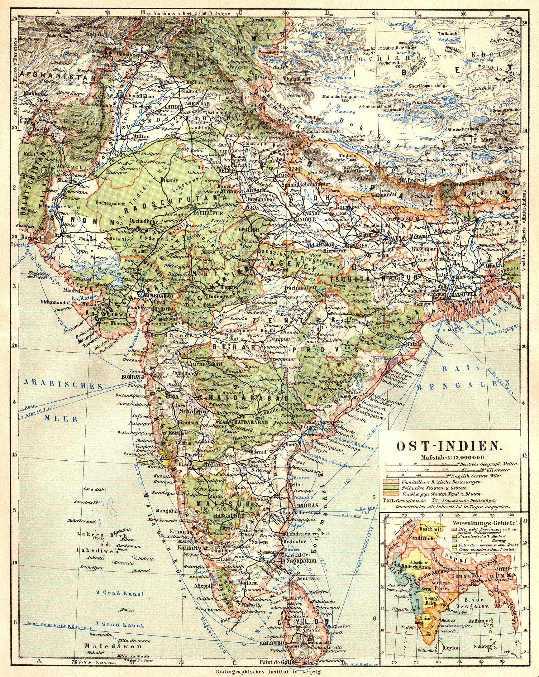
English: East Indies (1905)
Deutsch: Ostindien (1905)
Slovenčina: Východná India (1905) |
||||||||||||||||||||||
| Date | |||||||||||||||||||||||
| Source | Meyers Geographischer Hand-Atlas | ||||||||||||||||||||||
| Creator |
|
||||||||||||||||||||||
| Georeferencing | If inappropriate please set warp_status = skip to hide. | ||||||||||||||||||||||
| Other versions | |||||||||||||||||||||||
_(cropped).png)
.png&action=edit§ion=1)
Licensing[edit]
.png&action=edit§ion=2)
|
This is a faithful photographic reproduction of a two-dimensional, public domain work of art. The work of art itself is in the public domain for the following reason:
The official position taken by the Wikimedia Foundation is that "faithful reproductions of two-dimensional public domain works of art are public domain".
This photographic reproduction is therefore also considered to be in the public domain in the United States. In other jurisdictions, re-use of this content may be restricted; see Reuse of PD-Art photographs for details. | ||||
| Annotations | This image is annotated: View the annotations at Commons |
.png)
File history
Click on a date/time to view the file as it appeared at that time.
| Date/Time | Thumbnail | Dimensions | User | Comment | |
|---|---|---|---|---|---|
| current | 10:22, 25 July 2010 | | 1,730 × 2,172 (2.28 MB) | 14nu5 (talk | contribs) | {{Information |Description={{en|1=East Indies (1905)}} {{de|1=Ostindien (1905)}} {{sk|1=Východná India (1905)}} |Source=Meyers Geographischer Hand-Atlas |Author=Meyer, Hermann Julius (1826–1909); Bibliographisches Institut Leipzig |Date=1905 |Permissi |
You cannot overwrite this file.
File usage on Commons
The following page uses this file:
File usage on other wikis
The following other wikis use this file:
- Usage on en.wikipedia.org
Metadata
.png&oldid=829057983)
Categories:
- Meyers Geographischer Hand-Atlas (1905)
- Old maps of British India
- 1905 maps of India
- 20th-century maps of South Asia
- Old maps of Tibet
- 20th-century maps of Nepal
- Old maps of Sikkim
- Old maps of Bhutan
- Maps of Lhasa
- Maps of Aksai Chin
- Maps of Jammu and Kashmir (princely state)
- Maps of the history of Sri Lanka
- 1905 maps of Pakistan