File:1857 Colton Map of the United States - Geographicus - UnitedStates-colton-1857.jpg
Jump to navigation
Jump to search
Size of this preview: 800 × 472 pixels. Other resolutions: 320 × 189 pixels | 640 × 377 pixels | 1,024 × 604 pixels | 1,280 × 754 pixels | 2,560 × 1,509 pixels | 5,000 × 2,947 pixels.
Original file (5,000 × 2,947 pixels, file size: 4.73 MB, MIME type: image/jpeg)
Captions
Captions
Add a one-line explanation of what this file represents
| J. H. Colton: The United States of America.
( |
|||||||||||||||||||||
|---|---|---|---|---|---|---|---|---|---|---|---|---|---|---|---|---|---|---|---|---|---|
| Artist |
|
||||||||||||||||||||
| Title |
The United States of America. |
||||||||||||||||||||
| Description |
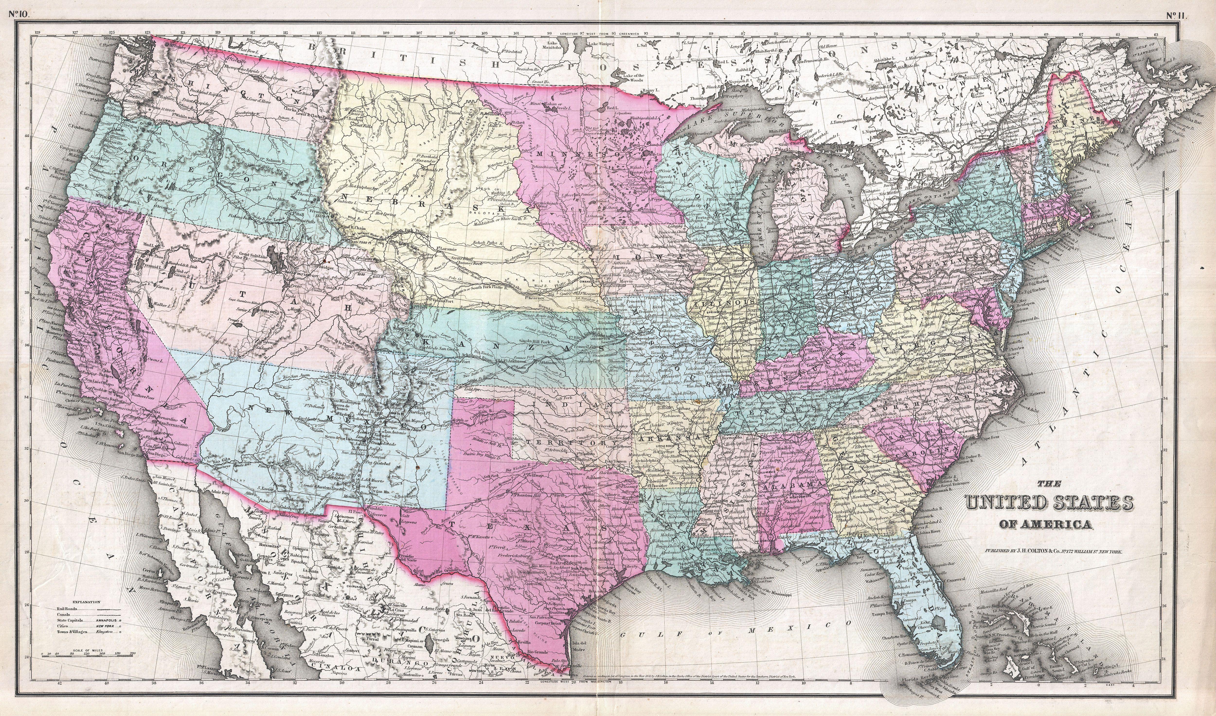
English: A beautiful example of Colton's 1857 map of the United States. Depicts a rare ephemeral statehood configuration - particularly in the western part of the country. Nebraska Territory extends from the Kansas border northwards as far as Canada. To its east, Minnesota territory includes much of what is today the Dakotas. Further west, Washington and Oregon extend inland from the Pacific as far inland as the Rocky Mountains. Likewise with Utah, which extends from California to Kansas. Further south the vast New Mexico Territory includes all of what is today New Mexico, Colorado, and Arizona. Several emigrant and explorer's routes are noted, including the Route to Santa Fe, Fremont's Route, Kearney's Route, and the Oregon Trail. Throughout, Colton identifies various cities, towns, forts, rivers, rapids, fords, and an assortment of additional topographical details. Map is hand colored in pink, green, yellow and blue pastels to define state and territorial boundaries. Surrounded by a simple line border that Colton introduced in 1857 and ran through 1859. Dated and copyrighted to J. H. Colton, 1855. Published from Colton's 172 William Street Office in New York City. Issued as page nos. 10 and 11 in George Washington Colton's 1857 Atlas of the World . |
||||||||||||||||||||
| Date | 1857 (dated 1855) | ||||||||||||||||||||
| Dimensions | height: 15.5 in (39.3 cm); width: 26 in (66 cm) | ||||||||||||||||||||
| Accession number |
Geographicus link: UnitedStates-colton-1857 |
||||||||||||||||||||
| Source/Photographer |
Colton, G. W., Colton's Atlas of the World Illustrating Physical and Political Geography, New York, 1857.
|
||||||||||||||||||||
| Permission (Reusing this file) |
|
||||||||||||||||||||

File history
Click on a date/time to view the file as it appeared at that time.
| Date/Time | Thumbnail | Dimensions | User | Comment | |
|---|---|---|---|---|---|
| current | 20:17, 23 March 2011 | | 5,000 × 2,947 (4.73 MB) | BotMultichillT (talk | contribs) | {{subst:User:Multichill/Geographicus |link=http://www.geographicus.com/P/AntiqueMap/UnitedStates-colton-1857 |product_name=1857 Colton Map of the United States |map_title=The United States of America. |description=A beautiful example of Colton's 1857 map |
You cannot overwrite this file.
File usage on Commons
The following page uses this file: