File:1 IÖR-Monitor Anteil unzerschnittener Freiräume 50 km² an Gebietsfläche 2014 Raster 100 m .png
Jump to navigation
Jump to search
Size of this preview: 548 × 599 pixels. Other resolutions: 219 × 240 pixels | 439 × 480 pixels | 702 × 768 pixels | 936 × 1,024 pixels | 1,531 × 1,674 pixels.
Original file (1,531 × 1,674 pixels, file size: 142 KB, MIME type: image/png)
Captions
Captions
Add a one-line explanation of what this file represents
Summary[edit]
| Description |
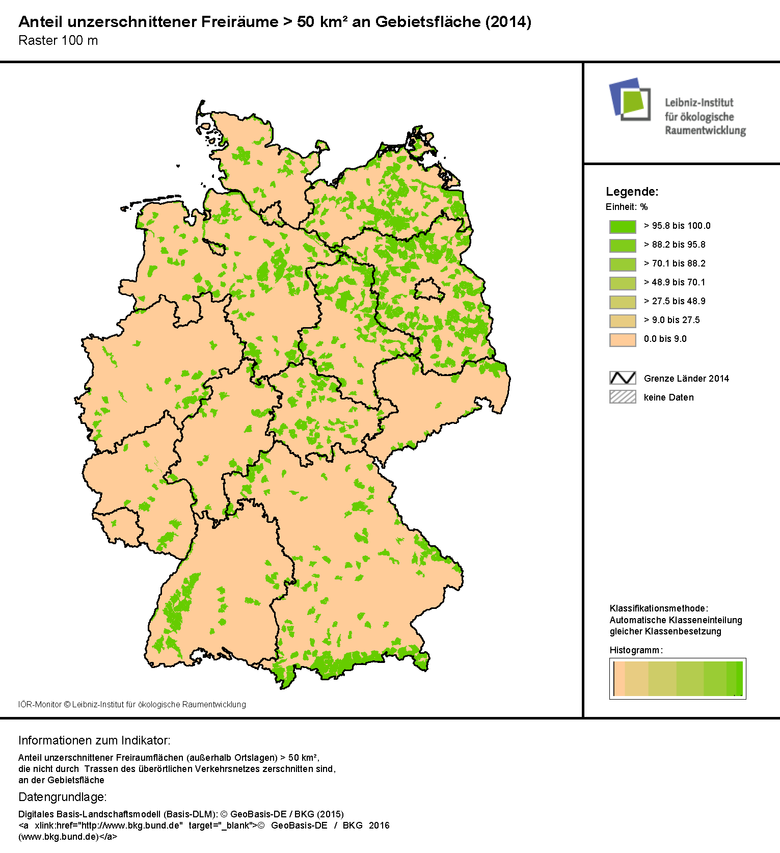
Deutsch: Etwa zwei Drittel aller Gebietseinheiten können keine unzerschnittenen Freiräume mehr aufweisen. Gebiete mit einem hohen Wert finden sich im Nordosten Deutschlands, dem Thüringer Wald, dem Schwarzwald, dem Bayrischen Wald und in den Alpenregionen. |
| Date | |
| Source | IÖR-Monitor: Rasterkarte zum Anteil der unzerschnittenden Freiräume >50km² an der Gebietsfläche, Stand 2014: http://maps.ioer.de/detailviewer/raster/?rid=381 |
| Author | Leibniz-Institut für ökologische Raumentwicklung, Forschungsbereich Monitoring der Siedlungs- und, Freiraumentwicklung Dr. Gotthard Meinel, Weberplatz 1, 01217 Dresden |
Licensing[edit]
I, the copyright holder of this work, hereby publish it under the following license:
This file is licensed under the Creative Commons Attribution-Share Alike 4.0 International license.
- You are free:
- to share – to copy, distribute and transmit the work
- to remix – to adapt the work
- Under the following conditions:
- attribution – You must give appropriate credit, provide a link to the license, and indicate if changes were made. You may do so in any reasonable manner, but not in any way that suggests the licensor endorses you or your use.
- share alike – If you remix, transform, or build upon the material, you must distribute your contributions under the same or compatible license as the original.
File history
Click on a date/time to view the file as it appeared at that time.
| Date/Time | Thumbnail | Dimensions | User | Comment | |
|---|---|---|---|---|---|
| current | 11:11, 10 October 2016 | | 1,531 × 1,674 (142 KB) | Diversitas (talk | contribs) | Bild zurecht geschnitten |
| 07:19, 10 October 2016 |  | 1,563 × 2,199 (149 KB) | Diversitas (talk | contribs) | {{Information |Description ={{de|1=Etwa zwei Drittel aller Gebietseinheiten können keine unzerschnittenen Freiräume mehr aufweisen. Gebiete mit einem hohen Wert finden sich im Nordosten Deutschlands, dem Thüringer Wald, dem Schwarzwald, dem Bayri... |
You cannot overwrite this file.
File usage on Commons
There are no pages that use this file.
File usage on other wikis
The following other wikis use this file:
- Usage on de.wikipedia.org