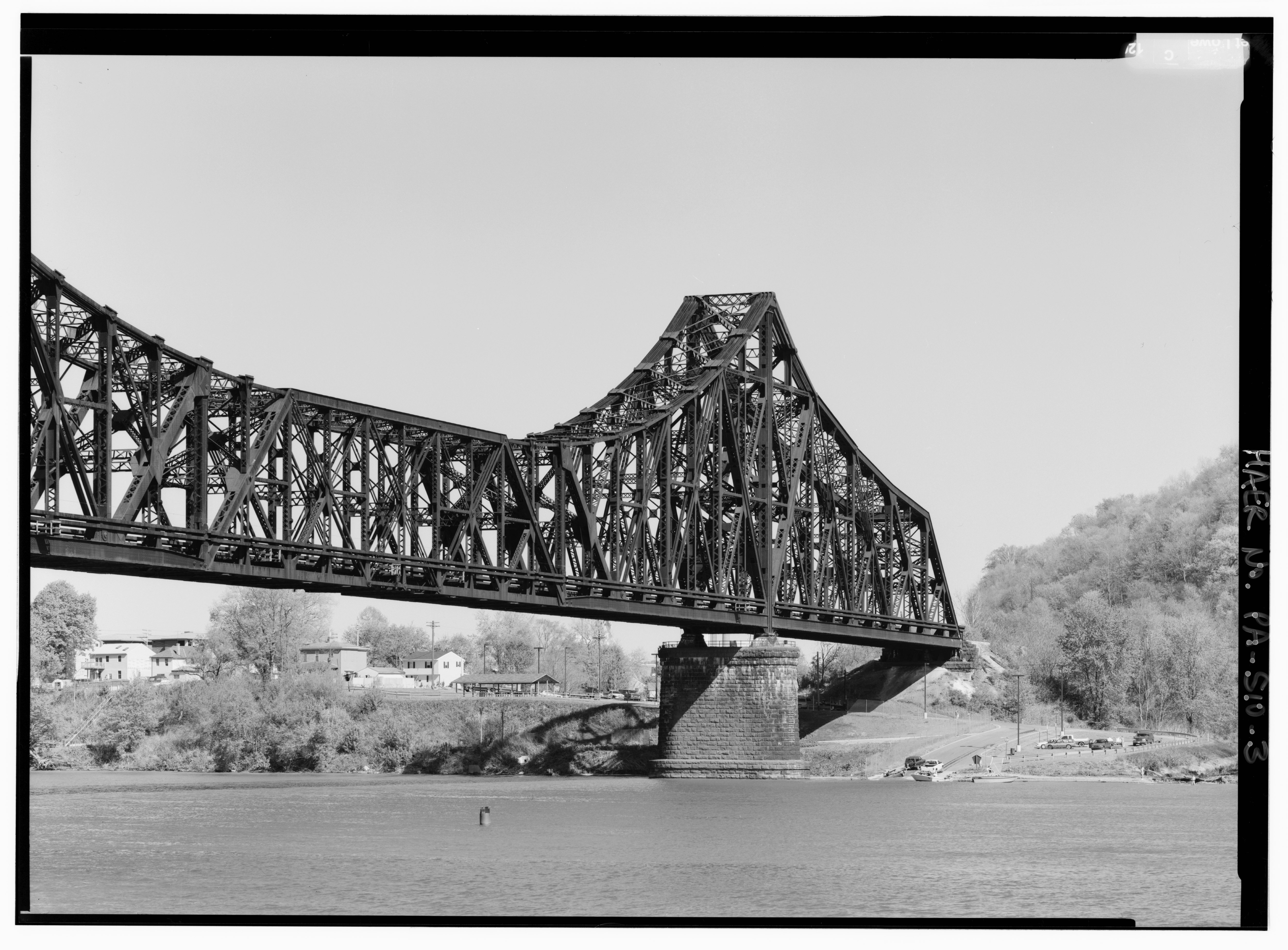
File:480-mm telephoto perspective, looking south toward mid-span and south anchor arm. - Pittsburgh and Lake Erie Railroad, Ohio River Bridge, Spanning Ohio River, West of Beaver River, HAER PA,4-BEAV,1-3.tif
Jump to navigation
Jump to search

Size of this JPG preview of this TIF file: 800 × 590 pixels. Other resolutions: 320 × 236 pixels | 640 × 472 pixels | 1,024 × 755 pixels | 1,280 × 943 pixels | 2,560 × 1,887 pixels | 5,000 × 3,685 pixels.
Original file (5,000 × 3,685 pixels, file size: 17.57 MB, MIME type: image/tiff)
Captions
Captions
Add a one-line explanation of what this file represents
| 480-mm telephoto perspective, looking south toward mid-span and south anchor arm. - Pittsburgh and Lake Erie Railroad, Ohio River Bridge, Spanning Ohio River, West of Beaver River, Beaver, Beaver County, PA | ||||
|---|---|---|---|---|
| Photographer |
Lowe, Jet Related names:
|
|||
| Title |
480-mm telephoto perspective, looking south toward mid-span and south anchor arm. - Pittsburgh and Lake Erie Railroad, Ohio River Bridge, Spanning Ohio River, West of Beaver River, Beaver, Beaver County, PA |
|||
| Description |
Raymer, A R; Lucius, Albert; Wolfel, Paul L; Dravo Contracting Company; McClintic-Marshall Construction Company; Pittsburgh and Lake Erie Railroad; Consolidated Rail Corporation (Conrail); CSX Transportation; DeLony, Eric N, project manager; Pennsylvania Historical and Museum Commission, sponsor; Consolidated Rail Corporation (Conrail), sponsor; Spivey, Justin M, historian; Lowe, Jet, photographer |
|||
| Depicted place | Pennsylvania; Beaver County; Beaver | |||
| Date | 1999 | |||
| Dimensions | 5 x 7 in. | |||
| Current location |
Library of Congress Prints and Photographs Division Washington, D.C. 20540 USA http://hdl.loc.gov/loc.pnp/pp.print |
|||
| Accession number |
HAER PA,4-BEAV,1-3 |
|||
| Credit line |
|
|||
| Notes |
|
|||
| Source | https://www.loc.gov/pictures/item/pa3716.photos.361925p | |||
| Permission (Reusing this file) |
|
|||

| Object location | | View this and other nearby images on: OpenStreetMap |
|---|
File history
Click on a date/time to view the file as it appeared at that time.
| Date/Time | Thumbnail | Dimensions | User | Comment | |
|---|---|---|---|---|---|
| current | 05:56, 1 August 2014 |  | 5,000 × 3,685 (17.57 MB) | Fæ (talk | contribs) | GWToolset: Creating mediafile for Fæ. HABS 31 July 2014 (3000:3200) |
You cannot overwrite this file.
File usage on Commons
The following page uses this file: