File:AD Kaiserslautern map.png
Jump to navigation
Jump to search

Size of this preview: 798 × 600 pixels. Other resolutions: 320 × 240 pixels | 639 × 480 pixels | 817 × 614 pixels.
Original file (817 × 614 pixels, file size: 655 KB, MIME type: image/png)
Captions
Captions
Add a one-line explanation of what this file represents
Summary[edit]
| Description |
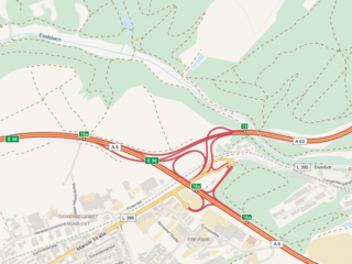
English: The picture is a map tile taken from OpenStreetMap.org map database. In the pictute there is a layout of a intersection near Kaiserslautern in Germany. Deutsch: Dieses Bild ist ein Landkartenteil, das aus dem Landkartendatenbank OpenStreetMap.org übergenommen wurde. Im Bild ist Gestalt des Autobahndreieckes Kaiserslautern in Deutschland veranschaulicht. Čeština: Tento obrázek je mapový díl pořízený z mapové databáze OpenStreetMap.org. Na obrázku je znázorněna podoba dálniční křižovatky u Kaiserslautern v Německu. |
| Date | |
| Source | www.openstreetmap.org |
| Author | © OpenStreetMap contributors www.openstreetmap.org/copyright |
Licensing[edit]
This file is licensed under the Creative Commons Attribution-Share Alike 2.5 Generic license.
- You are free:
- to share – to copy, distribute and transmit the work
- to remix – to adapt the work
- Under the following conditions:
- attribution – You must give appropriate credit, provide a link to the license, and indicate if changes were made. You may do so in any reasonable manner, but not in any way that suggests the licensor endorses you or your use.
- share alike – If you remix, transform, or build upon the material, you must distribute your contributions under the same or compatible license as the original.
File history
Click on a date/time to view the file as it appeared at that time.
| Date/Time | Thumbnail | Dimensions | User | Comment | |
|---|---|---|---|---|---|
| current | 14:33, 13 October 2015 | | 817 × 614 (655 KB) | Lakky (talk | contribs) | User created page with UploadWizard |
You cannot overwrite this file.
File usage on Commons
There are no pages that use this file.
File usage on other wikis
The following other wikis use this file:
- Usage on cs.wikipedia.org