File:AERIAL VIEW OF SOUTH ELEVATION AND GROUNDS - Rhode Island State House, 90 Smith Street, Providence, Providence County, RI HABS RI,4-PROV,180-7.tif
Jump to navigation
Jump to search

Size of this JPG preview of this TIF file: 772 × 599 pixels. Other resolutions: 309 × 240 pixels | 618 × 480 pixels | 989 × 768 pixels | 1,280 × 994 pixels | 2,560 × 1,988 pixels | 5,000 × 3,882 pixels.
Original file (5,000 × 3,882 pixels, file size: 18.51 MB, MIME type: image/tiff)
Captions
Captions
Add a one-line explanation of what this file represents
Summary[edit]
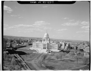
| AERIAL VIEW OF SOUTH ELEVATION AND GROUNDS - Rhode Island State House, 90 Smith Street, Providence, Providence County, RI | ||||
|---|---|---|---|---|
| Photographer |
Jack E. Boucher |
|||
| Title |
AERIAL VIEW OF SOUTH ELEVATION AND GROUNDS - Rhode Island State House, 90 Smith Street, Providence, Providence County, RI |
|||
| Description |
Alfson, Mary, transmitter; Brewster, Robert, photographer |
|||
| Depicted place | Rhode Island; Providence County; Providence | |||
| Date | April 1977 | |||
| Dimensions | 4 x 5 in. | |||
| Current location |
Library of Congress Prints and Photographs Division Washington, D.C. 20540 USA http://hdl.loc.gov/loc.pnp/pp.print |
|||
| Accession number |
HABS RI,4-PROV,180-7 |
|||
| Credit line |
|
|||
| Notes |
|
|||
| Source | https://www.loc.gov/pictures/item/ri0370.photos.145799p | |||
| Permission (Reusing this file) |
|
|||

| Object location | | View this and other nearby images on: OpenStreetMap |
|---|
File history
Click on a date/time to view the file as it appeared at that time.
| Date/Time | Thumbnail | Dimensions | User | Comment | |
|---|---|---|---|---|---|
| current | 21:20, 1 August 2014 |  | 5,000 × 3,882 (18.51 MB) | Fæ (talk | contribs) | GWToolset: Creating mediafile for Fæ. HABS 31 July 2014 (3000:3200) |
You cannot overwrite this file.
File usage on Commons
The following page uses this file: