File:AGHRC (1890) - Carta II - Divisiones coloniales de Tierra Firme, 1538.jpg
Jump to navigation
Jump to search

Size of this preview: 744 × 599 pixels. Other resolutions: 298 × 240 pixels | 596 × 480 pixels | 953 × 768 pixels | 1,271 × 1,024 pixels | 2,542 × 2,048 pixels | 4,347 × 3,502 pixels.
Original file (4,347 × 3,502 pixels, file size: 5.65 MB, MIME type: image/jpeg)
Captions
Captions
Add a one-line explanation of what this file represents
Summary[edit]
| Description |
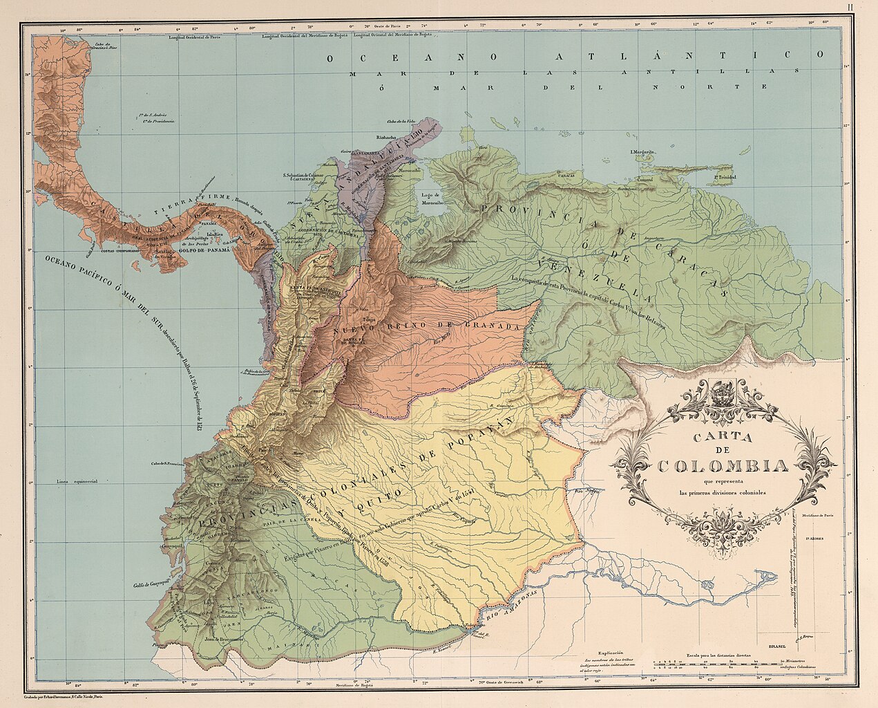
Español: Carta de las primeras divisiones coloniales de Colombia, Ecuador y Venezuela. Carta II del Atlas geográfico e histórico de la República de Colombia, 1890. |
||||||||||||||||||||
| Date | |||||||||||||||||||||
| Source |
Atlas geográfico e histórico de la República de Colombia, 1890. http://www.lablaa.org/blaavirtual/geografia/carto/carto03.htm |
||||||||||||||||||||
| Author |
|
||||||||||||||||||||

_-_Carta_I_-_Rutas_de_los_conquistadores_de_Colombia.jpg)
_-_Carta_III_-_Presidencias_de_Santaf%C3%A9_y_Quito.jpg)
_-_Carta_II_-_Divisiones_coloniales_de_Tierra_Firme,_1538.jpg&action=edit§ion=1)
Licensing[edit]
_-_Carta_II_-_Divisiones_coloniales_de_Tierra_Firme,_1538.jpg&action=edit§ion=2)
This file is in the public domain because the copyright of this work, registered in Colombia, has expired, according to “Law 23 of 1982 on Copyright, Articles 11, 21-29”, amended by “Law 44 of 1993, Article 2” and “Law 1520 of 2012, Articles 4, 6 and 10” (details). However, some restrictions have to be addressed:
|

|
File history
Click on a date/time to view the file as it appeared at that time.
| Date/Time | Thumbnail | Dimensions | User | Comment | |
|---|---|---|---|---|---|
| current | 13:30, 28 November 2018 | | 4,347 × 3,502 (5.65 MB) | Milenioscuro (talk | contribs) | high quality (from David Rumsey) |
| 04:11, 20 March 2009 |  | 2,841 × 2,303 (3.05 MB) | Milenioscuro (talk | contribs) | nuevo mapa | |
| 17:22, 5 August 2008 |  | 602 × 498 (40 KB) | Milenioscuro (talk | contribs) | {{Information |Description={{es|1=Primeras diviones coloniales de Colombia, Ecuador y Venezuela. Tomado del "Atlas histórico y geográfico de Colombia", 1890.}} |Source=http://www.lablaa.org/blaavirtual/geografia/carto/carto03.htm |Author=Agustin Codazzi |
You cannot overwrite this file.
File usage on Commons
The following 4 pages use this file:
_-_Carta_II_-_Divisiones_coloniales_de_Tierra_Firme,_1538.jpg&redirect=no)
File usage on other wikis
The following other wikis use this file:
- Usage on ast.wikipedia.org
- Usage on da.wikipedia.org
- Usage on en.wikipedia.org
- Usage on eo.wikipedia.org
- Usage on es.wikipedia.org
- Tolima
- Nuevo Reino de Granada
- Francisco Briceño Gasco
- Discusión:Nuevo Reino de Granada
- Pascual de Andagoya
- Pedro Gutiérrez de los Ríos y Aguayo
- Castilla de Oro
- Reino de Tierra Firme
- Colonización alemana de América
- Época hispánica en Colombia
- Organización territorial del Virreinato de Nueva Granada
- Región Caribe (Colombia)
- Historia territorial de Colombia
- Historia territorial de Panamá
- Provincia de Nueva Andalucía y Urabá
- Usage on fr.wikipedia.org
- Usage on gl.wikipedia.org
- Usage on id.wikipedia.org
- Usage on it.wikipedia.org
- Usage on ka.wikipedia.org
- Usage on lt.wikipedia.org
- Usage on nl.wikipedia.org
- Usage on no.wikipedia.org
- Usage on pt.wikipedia.org
- Usage on ro.wikipedia.org
- Usage on ru.wikipedia.org
- Usage on tr.wikipedia.org
- Usage on uk.wikipedia.org
_-_Carta_II_-_Divisiones_coloniales_de_Tierra_Firme,_1538.jpg&oldid=774055975)