File:A plan of the operations of the King's army under the command of General Sr. William Howe, K.B. in New York and east New Jersey against the American forces commanded by General Washington from the LOC gm71005422.tif
Jump to navigation
Jump to search

Size of this JPG preview of this TIF file: 411 × 600 pixels. Other resolutions: 164 × 240 pixels | 329 × 480 pixels | 526 × 768 pixels | 701 × 1,024 pixels | 1,403 × 2,048 pixels | 4,909 × 7,166 pixels.
Original file (4,909 × 7,166 pixels, file size: 100.65 MB, MIME type: image/tiff)
Captions
Captions
Add a one-line explanation of what this file represents
Summary[edit]
| Description |
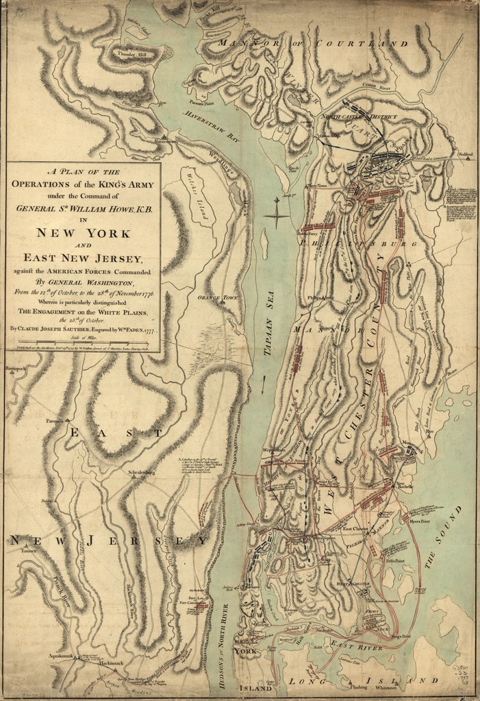
English: Scale ca. 1:84,000. Hand colored. Relief shown by hachures. LC Copy 1 on verso: Plan of operations at New York. LC Maps of North America, 1750-1789, 1055 Available also through the Library of Congress Web site as a raster image. Vault AACR2: 100; 651/1; 651/2; 650/3; 700/1 |
||
| Title | A plan of the operations of the King's army under the command of General Sr. William Howe, K.B. in New York and east New Jersey against the American forces commanded by General Washington from the 12th. of October, to the 28th. of November 1776, wherein is particularly distinguished the engagement on the White Plains, the 28th. of October. | ||
| Shelf ID | G3804.W7S3 1777 .S2 | ||
| Date | |||
| Source | https://www.loc.gov/item/gm71005422/ | ||
| Author | Sauthier, Claude Joseph; Faden, William | ||
| Permission (Reusing this file) |
|
||
| Other versions |
|
||
| Location | New Jersey · United States · New York (State) · New York | ||
| Part of | Military Battles And Campaigns · American Memory · Catalog · Geography And Map Division · American Revolution And Its Era: Maps And Charts Of North America And The West Indies, 1750-1789 | ||
| Subject | Revolution · New Jersey · White Plains, Battle Of, White Plains, N.Y. · United States · Maps · Early Works To 1800 · New York (State) · History |


Licensing[edit]
|
This is a faithful photographic reproduction of a two-dimensional, public domain work of art. The work of art itself is in the public domain for the following reason:
The official position taken by the Wikimedia Foundation is that "faithful reproductions of two-dimensional public domain works of art are public domain".
This photographic reproduction is therefore also considered to be in the public domain in the United States. In other jurisdictions, re-use of this content may be restricted; see Reuse of PD-Art photographs for details. | ||||
File history
Click on a date/time to view the file as it appeared at that time.
| Date/Time | Thumbnail | Dimensions | User | Comment | |
|---|---|---|---|---|---|
| current | 00:43, 17 May 2018 |  | 4,909 × 7,166 (100.65 MB) | Fæ (talk | contribs) | LOC Maps https://www.loc.gov/item/gm71005422/ #9821 |
You cannot overwrite this file.
File usage on Commons
The following page uses this file: