File:Alsace-Champagne-Ardenne-Lorraine Map.svg
Jump to navigation
Jump to search

Size of this PNG preview of this SVG file: 507 × 553 pixels. Other resolutions: 220 × 240 pixels | 440 × 480 pixels | 704 × 768 pixels | 939 × 1,024 pixels | 1,878 × 2,048 pixels.
Original file (SVG file, nominally 507 × 553 pixels, file size: 150 KB)
Captions
Captions
Add a one-line explanation of what this file represents
Summary[edit]
| Description |
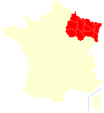
Русский: Расположение региона Эльзас — Шампань — Арденны — Лотарингия на карте Франции
English: Position of the Alsace-Champagne-Ardenne-Lorraine region on the map of France
Français : Position de la région Alsace-Champagne-Ardenne-Lorraine sur la carte de France |
| Date | |
| Source | Own work |
| Author | Leokand |
Licensing[edit]
I, the copyright holder of this work, hereby publish it under the following license:
This file is licensed under the Creative Commons Attribution-Share Alike 4.0 International license.
- You are free:
- to share – to copy, distribute and transmit the work
- to remix – to adapt the work
- Under the following conditions:
- attribution – You must give appropriate credit, provide a link to the license, and indicate if changes were made. You may do so in any reasonable manner, but not in any way that suggests the licensor endorses you or your use.
- share alike – If you remix, transform, or build upon the material, you must distribute your contributions under the same or compatible license as the original.
File history
Click on a date/time to view the file as it appeared at that time.
| Date/Time | Thumbnail | Dimensions | User | Comment | |
|---|---|---|---|---|---|
| current | 16:41, 1 January 2016 | | 507 × 553 (150 KB) | Leokand (talk | contribs) | User created page with UploadWizard |
You cannot overwrite this file.
File usage on Commons
The following page uses this file:
File usage on other wikis
The following other wikis use this file:
- Usage on kk.wikipedia.org
- Usage on ru.wikipedia.org
- Usage on uk.wikipedia.org