File:Andros Island-1844.jpg
Original file (1,091 × 1,431 pixels, file size: 178 KB, MIME type: image/jpeg)
Captions
Captions
Summary[edit]
| Description |
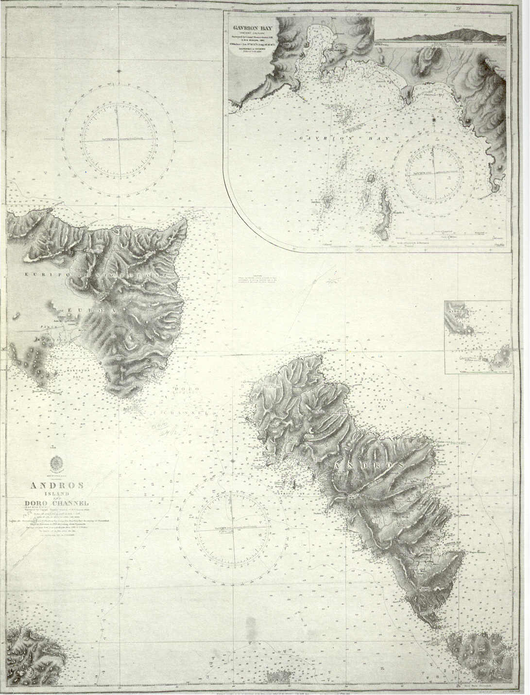
English: Admiralty chart of Andros Island and Cape Doro strait (today Kafireus Strait), Greece. Includes a large scale chart of Gavrion Bay (1844). Ελληνικά: Ναυτικός χάρτης Στενού Καφηρέως - Ν. Άνδρου του Βρετανικού Ναυαρχείου με ένθετο χάρτη μεγάλης κλίμακας του Όρμου Γαυρίου (1844). |
| Date | |
| Source | http://www.hellenicnavy.gr/upload/UALASIA_PERIGRAFH_THS_ANDROY_1844.jpg |
| Author | Office of Hydrographer to the Admiralty, headed by Admiral Beaufort |
Licensing[edit]
This image is in the public domain because it is a mere mechanical scan or photocopy of a public domain original, or – from the available evidence – is so similar to such a scan or photocopy that no copyright protection can be expected to arise. The original itself is in the public domain for the following reason:
This tag is designed for use where there may be a need to assert that any enhancements (eg brightness, contrast, colour-matching, sharpening) are in themselves insufficiently creative to generate a new copyright. It can be used where it is unknown whether any enhancements have been made, as well as when the enhancements are clear but insufficient. For known raw unenhanced scans you can use an appropriate {{PD-old}} tag instead. For usage, see Commons:When to use the PD-scan tag.  |

File history
Click on a date/time to view the file as it appeared at that time.
| Date/Time | Thumbnail | Dimensions | User | Comment | |
|---|---|---|---|---|---|
| current | 14:20, 8 August 2008 | | 1,091 × 1,431 (178 KB) | Sv1xv (talk | contribs) | {{Information |Description={{en|1=Chart of Andros Island and Cape Doro strait, Greece}} |Source=http://www.hellenicnavy.gr/upload/UALASIA_PERIGRAFH_THS_ANDROY_1844.jpg |Author=UK Admiralty |Date=1844 |Permission={{PD-old}} |other_versions=PD-old }} {{Im |
You cannot overwrite this file.
File usage on Commons
The following page uses this file:
File usage on other wikis
The following other wikis use this file:
- Usage on ar.wikipedia.org
- Usage on bg.wikipedia.org
- Usage on el.wikipedia.org
- Usage on en.wikipedia.org
- Usage on gl.wikipedia.org
- Usage on it.wikipedia.org
- Usage on ru.wikipedia.org
- Usage on tr.wikipedia.org
- Usage on zh.wikipedia.org