File:Atlas of the city and island of Montreal.png
Jump to navigation
Jump to search

Size of this preview: 800 × 577 pixels. Other resolutions: 320 × 231 pixels | 640 × 462 pixels | 1,024 × 739 pixels | 1,280 × 923 pixels | 2,560 × 1,847 pixels | 4,807 × 3,468 pixels.
Original file (4,807 × 3,468 pixels, file size: 14.26 MB, MIME type: image/png)
Captions
Captions
Add a one-line explanation of what this file represents
Summary[edit]
| Description |
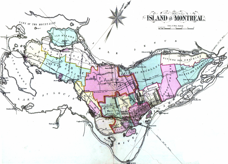
English: Atlas of the city and island of Montreal, including the counties of Jacques Cartier and Hochelaga ; from actual surveys, based upon the cadastral plans deposited in the office of the Department of Crown Lands
Français : 1 atlas (107 p.) : cartes en coul. ; 45 cm. Colorié à la main |
||||||||||||||||||||||
| Date | |||||||||||||||||||||||
| Source |
|
||||||||||||||||||||||
| Author |
|
||||||||||||||||||||||

Licensing[edit]
|
This work is in the public domain in its country of origin and other countries and areas where the copyright term is the author's life plus 100 years or fewer. | |
| This file has been identified as being free of known restrictions under copyright law, including all related and neighboring rights. | |
File history
Click on a date/time to view the file as it appeared at that time.
| Date/Time | Thumbnail | Dimensions | User | Comment | |
|---|---|---|---|---|---|
| current | 01:19, 26 April 2013 | | 4,807 × 3,468 (14.26 MB) | Jeangagnon (talk | contribs) | {{Information |Description ={{en|1=Atlas of the city and island of Montreal, including the counties of Jacques Cartier and Hochelaga ; from actual surveys, based upon the cadastral plans deposited in the office of the Department of Crown Lands }} {{... |
You cannot overwrite this file.
File usage on Commons
There are no pages that use this file.
File usage on other wikis
The following other wikis use this file:
- Usage on fr.wikipedia.org
- Usage on www.wikidata.org