File:Autonomous Region Kurdistan-en.png
Jump to navigation
Jump to search
Size of this preview: 581 × 599 pixels. Other resolutions: 233 × 240 pixels | 465 × 480 pixels | 1,012 × 1,044 pixels.
Original file (1,012 × 1,044 pixels, file size: 514 KB, MIME type: image/png)
Captions
Captions
Add a one-line explanation of what this file represents
Summary
[edit]| Description |
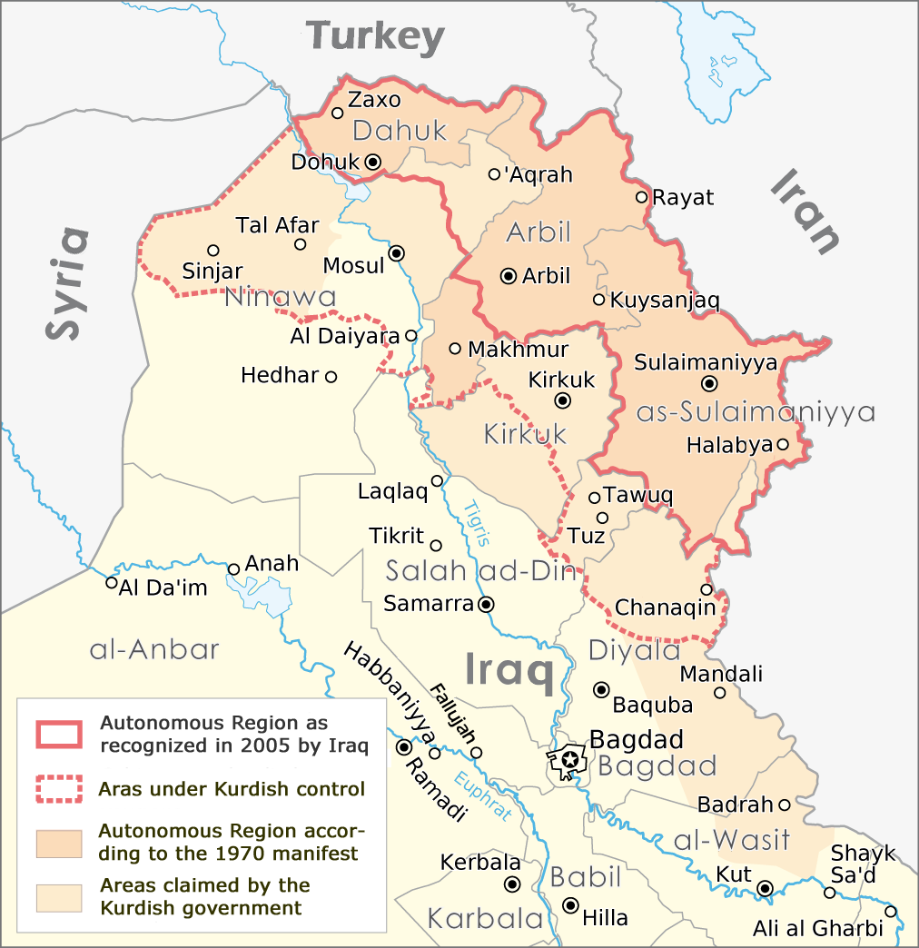
English: Map of the Autonomous Region Kurdistan, created by Maximilian Dörrbecker,
translated into English by ilyacadiz |
| Date | |
| Source | Autonome Region Kurdistan (Karte).png |
| Author |
Maximilian Dörrbecker (Chumwa), derviative work by ilyacadiz |
| Other versions |
|
.png)
Licensing
[edit]
This file is licensed under the Creative Commons Attribution-Share Alike 3.0 Unported license.
- You are free:
- to share – to copy, distribute and transmit the work
- to remix – to adapt the work
- Under the following conditions:
- attribution – You must give appropriate credit, provide a link to the license, and indicate if changes were made. You may do so in any reasonable manner, but not in any way that suggests the licensor endorses you or your use.
- share alike – If you remix, transform, or build upon the material, you must distribute your contributions under the same or compatible license as the original.
File history
Click on a date/time to view the file as it appeared at that time.
| Date/Time | Thumbnail | Dimensions | User | Comment | |
|---|---|---|---|---|---|
| current | 11:02, 20 October 2017 | | 1,012 × 1,044 (514 KB) | Rob984 (talk | contribs) | The southern part of the Kifri district was not incorporated. The northern part in the Sulaymaniyah Governorate was, which may be the reason for the confusions (there is effectively two "Kifri districts") |
| 17:37, 14 October 2008 |  | 1,012 × 1,044 (535 KB) | Ilyacadiz (talk | contribs) | {{Information |Description={{en|1=Map of the Autonomous Region Kurdistan, created by Maximilian Dörrbecker, translated into English by ilyacadiz }} |Source=Image:Autonome Region Kurdistan (Karte).png |Author=Maximilian Dörrbecker (Chumwa) |Date=October |
You cannot overwrite this file.
File usage on Commons
The following 6 pages use this file:
File usage on other wikis
The following other wikis use this file:
- Usage on af.wikipedia.org
- Usage on ca.wikipedia.org
- Usage on ckb.wikipedia.org
- Usage on en.wikipedia.org
- Usage on fa.wikipedia.org
- Usage on fr.wikipedia.org
- Usage on he.wikipedia.org
- Usage on hr.wikipedia.org
- Usage on it.wikipedia.org
- Usage on ku.wikipedia.org
- Usage on nl.wikipedia.org
- Usage on no.wikipedia.org
- Usage on sh.wikipedia.org
- Usage on sr.wikipedia.org