File:Baltimore osm-mapnik location map.png
跳转到导航
跳转到搜索
没有更高的分辨率。
Baltimore_osm-mapnik_location_map.png (490 × 475像素,文件大小:349 KB,MIME类型:image/png)
说明
说明
添加一行文字以描述该文件所表现的内容
摘要
[编辑]
| 描述 |
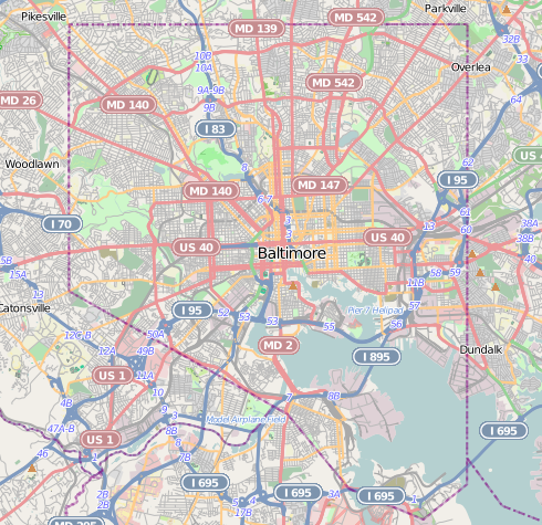
English: Map of Baltimore
Geographic limits of the map:
|
| 日期 | |
| 来源 | http://www.openstreetmap.org |
| 作者 | OpenStreetMap contributors |
| 授权 (二次使用本文件) |
Cartography is licensed as CC-BY-SA (http://www.openstreetmap.org/copyright) |
许可协议
[编辑]
| 此作品内含来自OpenStreetMap贡献者的地图资料,以开放数据库许可证(ODbL)释出。
对于从ODbL数据生成的地图,ODbL不需要任何特定许可。在2020年8月1日之前,OpenStreetMap基金会制作的地图图块已根据CC-BY-SA-2.0许可证授权。其他人制作的地图可能需要获得其他许可。 |
本文件采用知识共享署名-相同方式共享 2.0 通用许可协议授权。
- 您可以自由地:
- 共享 – 复制、发行并传播本作品
- 修改 – 改编作品
- 惟须遵守下列条件:
- 署名 – 您必须对作品进行署名,提供授权条款的链接,并说明是否对原始内容进行了更改。您可以用任何合理的方式来署名,但不得以任何方式表明许可人认可您或您的使用。
- 相同方式共享 – 如果您再混合、转换或者基于本作品进行创作,您必须以与原先许可协议相同或相兼容的许可协议分发您贡献的作品。
文件历史
点击某个日期/时间查看对应时刻的文件。
| 日期/时间 | 缩略图 | 大小 | 用户 | 备注 | |
|---|---|---|---|---|---|
| 当前 | 2012年12月13日 (四) 21:29 | | 490 × 475(349 KB) | Alexrk2(留言 | 贡献) | {{Information |Description={{en|1=Map of Baltimore Geographic limits of the map: * N: 39.3805° * S: 39.1953° * W: -76.7426° * E: -76.4957° }} |Source=http://www.openstreetmap.org |Author=OpenStreetMap contributors |Date=2012-12 |Permission=Cart... |
您不可以覆盖此文件。
文件用途
以下35个页面使用本文件:
- Baltimore, Maryland
- Category:2020 in Baltimore
- Category:Baltimore
- Category:Baltimore in the 1900s
- Category:Baltimore in the 1910s
- Category:Baltimore in the 1940s
- Category:Baltimore in the 1950s
- Category:Baltimore in the 1960s
- Category:Baltimore in the 1970s
- Category:Baltimore in the 1980s
- Category:Baltimore in the 1990s
- Category:Baltimore in the 2000s
- Category:Baltimore in the 2010s
- Category:Births in Baltimore
- Category:Bridges in Baltimore
- Category:Buildings in Baltimore
- Category:Cemeteries in Baltimore
- Category:Deaths in Baltimore
- Category:Education in Baltimore
- Category:Historic districts in Baltimore, Maryland
- Category:Hotels in Baltimore
- Category:Museums in Baltimore
- Category:National Register of Historic Places in Baltimore, Maryland
- Category:Neighborhoods in Baltimore, Maryland
- Category:Paintings in Baltimore
- Category:Parks in Baltimore
- Category:Politicians of Baltimore
- Category:Politics of Baltimore
- Category:Roads in Baltimore
- Category:Schools in Baltimore
- Category:Skyscrapers in Baltimore
- Category:Sports venues in Baltimore
- Category:Streets in Baltimore
- Category:Tunnels in Baltimore
- Category:Universities and colleges in Baltimore
全域文件用途
以下其他wiki使用此文件:
- ar.wikipedia.org上的用途
- arz.wikipedia.org上的用途
- bh.wikipedia.org上的用途
- ceb.wikipedia.org上的用途
- en.wikipedia.org上的用途
- NS Savannah
- Oriole Park at Camden Yards
- M&T Bank Stadium
- SS John W. Brown
- USCGC Taney
- Inner Harbor
- USS Torsk
- United States lightship Chesapeake (LV-116)
- Fell's Point, Baltimore
- Westminster Hall and Burying Ground
- B&O Railroad Museum
- Locust Point, Baltimore
- Federal Hill, Baltimore
- Hampden, Baltimore
- Little Italy, Baltimore
- Congregation Tiferes Yisroel
- Canton, Baltimore
- Bolton Hill, Baltimore
- Phoenix Shot Tower
- Pigtown, Baltimore
- Lyric Baltimore
- Peale Museum
- Armistead Gardens, Baltimore
- Mount Washington, Baltimore
- Curtis Bay, Baltimore
- Abell, Baltimore
- Template:Infobox hospital
- Baltimore Hebrew Congregation
- Reservoir Hill, Baltimore
- Upton, Baltimore
- Butchers Hill, Baltimore
- Washington Hill, Baltimore
- McElderry Park, Baltimore
- Carrollton Viaduct
- Cylburn Arboretum
- Loudon Park National Cemetery
- Jewish Museum of Maryland
- Greektown, Baltimore
- Highlandtown, Baltimore
- Brewers Hill, Baltimore
- Hamilton Hills, Baltimore
- Union Square, Baltimore
- Dickeyville Historic District
查看此文件的更多全域用途。