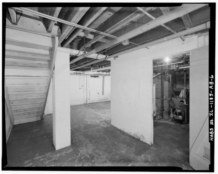
File:Basement. - Chanute Air Force Base, Non-Commissioned Officer Housing, Galaxy Street, Rantoul, Champaign County, IL HABS ILL,10-RAN.V,1AB-6.tif
Jump to navigation
Jump to search
Size of this JPG preview of this TIF file: 751 × 599 pixels. Other resolutions: 301 × 240 pixels | 601 × 480 pixels | 962 × 768 pixels | 1,280 × 1,022 pixels | 2,560 × 2,043 pixels | 5,000 × 3,991 pixels.
Original file (5,000 × 3,991 pixels, file size: 19.03 MB, MIME type: image/tiff)
Captions
Captions
Add a one-line explanation of what this file represents
Summary[edit]
| Basement. - Chanute Air Force Base, Non-Commissioned Officer Housing, Galaxy Street, Rantoul, Champaign County, IL | ||||
|---|---|---|---|---|
| Title |
Basement. - Chanute Air Force Base, Non-Commissioned Officer Housing, Galaxy Street, Rantoul, Champaign County, IL |
|||
| Depicted place | Illinois; Champaign County; Rantoul | |||
| Date | Documentation compiled after 1933 | |||
| Dimensions | 4 x 5 in. | |||
| Current location |
Library of Congress Prints and Photographs Division Washington, D.C. 20540 USA http://hdl.loc.gov/loc.pnp/pp.print |
|||
| Accession number |
HABS ILL,10-RAN.V,1AB-6 |
|||
| Credit line |
|
|||
| Notes |
|
|||
| Source | https://www.loc.gov/pictures/item/il0795.photos.334907p | |||
| Permission (Reusing this file) |
|
|||

| Object location | | View this and other nearby images on: OpenStreetMap |
|---|
File history
Click on a date/time to view the file as it appeared at that time.
| Date/Time | Thumbnail | Dimensions | User | Comment | |
|---|---|---|---|---|---|
| current | 13:41, 17 July 2014 |  | 5,000 × 3,991 (19.03 MB) | Fæ (talk | contribs) | GWToolset: Creating mediafile for Fæ. HABS 16 July 2014 (1201:1400) |
You cannot overwrite this file.
File usage on Commons
The following page uses this file: