File:Bopha 2012-12-03 0435Z.png
Jump to navigation
Jump to search
Size of this preview: 800 × 498 pixels. Other resolutions: 320 × 199 pixels | 640 × 398 pixels | 1,024 × 637 pixels | 1,280 × 797 pixels | 2,560 × 1,594 pixels | 3,701 × 2,304 pixels.
Original file (3,701 × 2,304 pixels, file size: 14.24 MB, MIME type: image/png)
Captions
Captions
Add a one-line explanation of what this file represents
Summary[edit]
| Description |
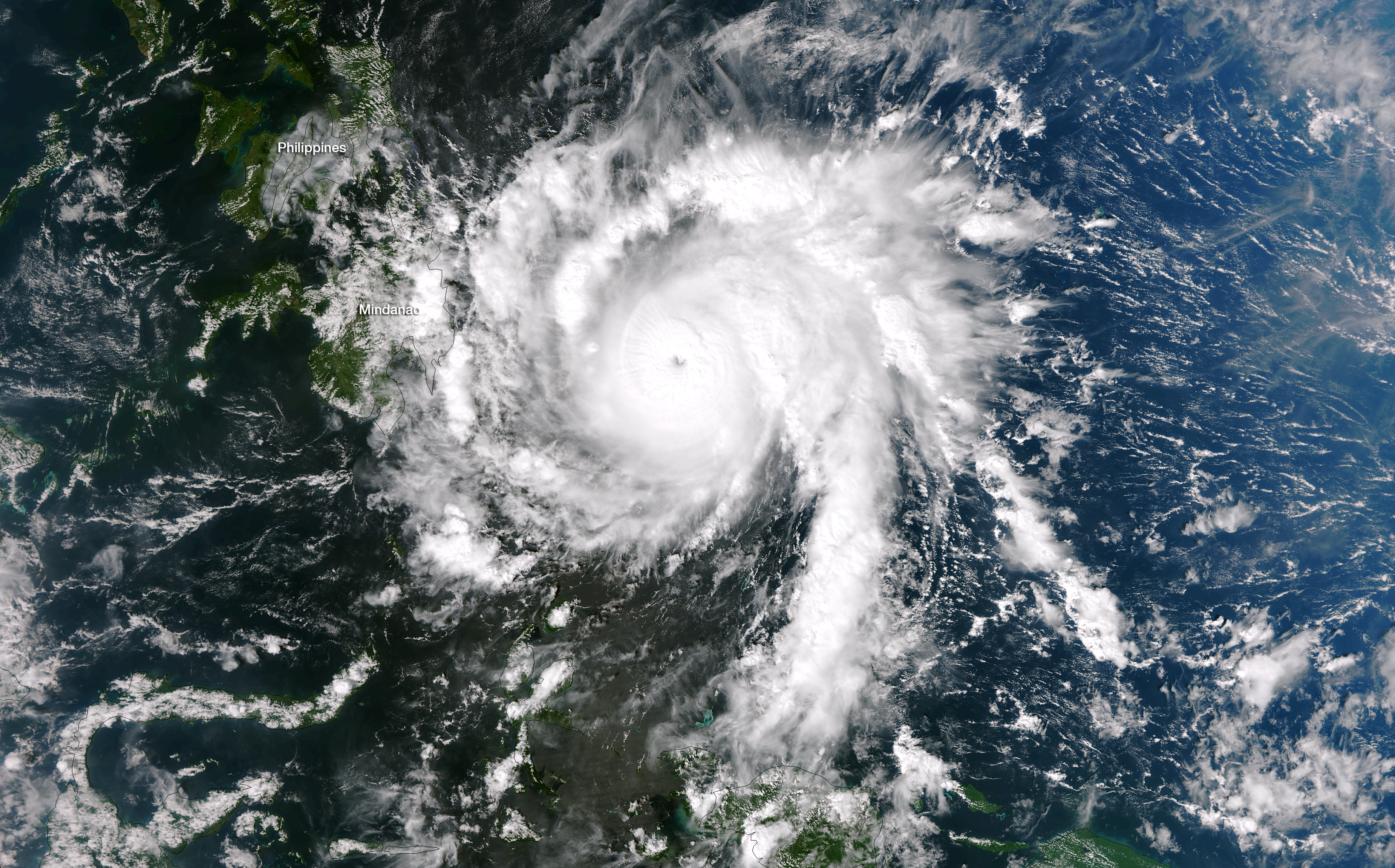
English: Bopha is tracking west-northwestward at 16 knots, on course to cross the island of Mindanao late tonight. With winds sustained near 135 knots and gusts near 165 knots, and with significant wave heights of 52 feet, Super Typhoon Bopha is expected to cause significant damage to coastal areas of the island. This image was taken by the NASA/NOAA Suomi NPP satellite's VIIRS instrument around 0435Z on December 3, 2012. |
| Date | |
| Source | https://www.nnvl.noaa.gov/MediaDetail2.php?MediaID=1245&MediaTypeID=1 |
| Author | NASA |
Licensing[edit]
| This file is in the public domain in the United States because it was solely created by NASA. NASA copyright policy states that "NASA material is not protected by copyright unless noted". (See Template:PD-USGov, NASA copyright policy page or JPL Image Use Policy.) | ||
 |
Warnings:
|
File history
Click on a date/time to view the file as it appeared at that time.
| Date/Time | Thumbnail | Dimensions | User | Comment | |
|---|---|---|---|---|---|
| current | 08:10, 9 April 2018 | | 3,701 × 2,304 (14.24 MB) | A1Cafel (talk | contribs) | Remove shadow |
| 08:04, 9 April 2018 |  | 4,096 × 2,304 (15.39 MB) | A1Cafel (talk | contribs) | User created page with UploadWizard |
You cannot overwrite this file.
File usage on Commons
There are no pages that use this file.