File:Ca. 1695 Dutch sea chart of the Atlantic Ocean.jpg
Jump to navigation
Jump to search
Size of this preview: 730 × 599 pixels. Other resolutions: 292 × 240 pixels | 585 × 480 pixels | 936 × 768 pixels | 1,247 × 1,024 pixels | 2,495 × 2,048 pixels | 3,045 × 2,500 pixels.
Original file (3,045 × 2,500 pixels, file size: 1.48 MB, MIME type: image/jpeg)
Captions
Captions
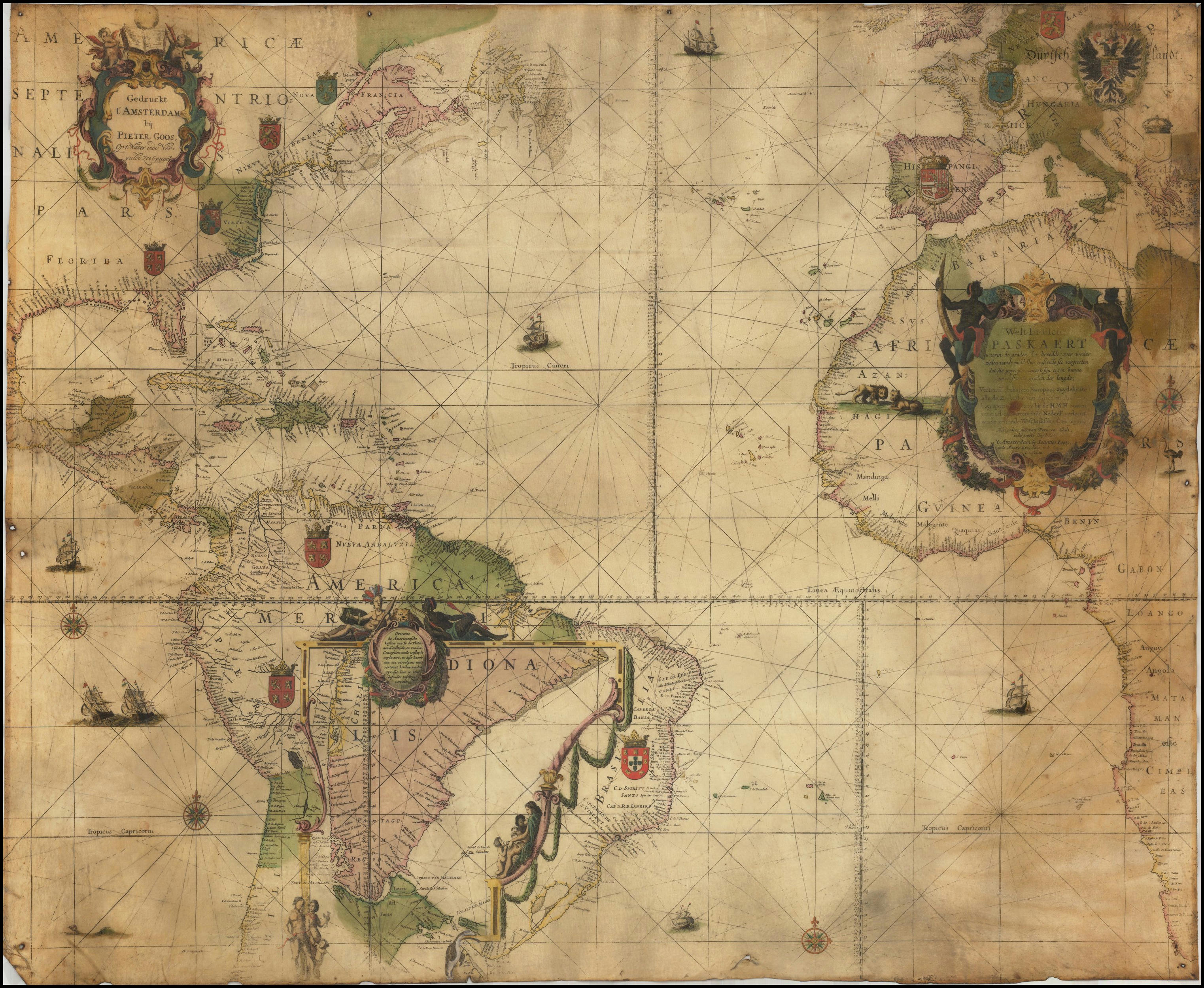
ca. 1695 Dutch sea chart of the Atlantic Ocean
Summary[edit]
| Description |
English: ca. 1695 Dutch sea chart of the Atlantic Ocean
Nederlands: West Indische PASKAERT waerin de graden der breedde over weder zijden vande middelijn wassende soo vergrooten dat die geproportioneert sijn tegen hunne nevenstaende graden der lengde; Vertonen (behalven Europaes zuydelijcste) alle de Zeekusten van Africa en America. . . bij Ioannes Loots. |
| Date | circa 1695 |
| Source | https://www.raremaps.com/gallery/detail/46848/west-indische-paskaert-waerin-de-graden-der-breedde-over-wed-blaeu-goos-loots |
| Author | Willem Janszoon Blaeu / Pieter Goos / Johannes Loots |
| Other versions |


Licensing[edit]
|
This work is in the public domain in its country of origin and other countries and areas where the copyright term is the author's life plus 70 years or fewer. This work is in the public domain in the United States because it was published (or registered with the U.S. Copyright Office) before January 1, 1929. | |
| This file has been identified as being free of known restrictions under copyright law, including all related and neighboring rights. | |
File history
Click on a date/time to view the file as it appeared at that time.
| Date/Time | Thumbnail | Dimensions | User | Comment | |
|---|---|---|---|---|---|
| current | 11:20, 30 May 2020 | | 3,045 × 2,500 (1.48 MB) | Balkanique (talk | contribs) | Uploaded a work by Willem Janszoon Blaeu / Pieter Goos / Johannes Loots from https://www.raremaps.com/gallery/detail/46848/west-indische-paskaert-waerin-de-graden-der-breedde-over-wed-blaeu-goos-loots with UploadWizard |
You cannot overwrite this file.
File usage on Commons
The following 4 pages use this file: