File:Centralenucleairefessenheimetagglomulhousienne.png
Jump to navigation
Jump to search

Size of this preview: 800 × 518 pixels. Other resolutions: 320 × 207 pixels | 640 × 415 pixels | 880 × 570 pixels.
Original file (880 × 570 pixels, file size: 2.61 MB, MIME type: image/png)
Captions
Captions
Add a one-line explanation of what this file represents
| Description |
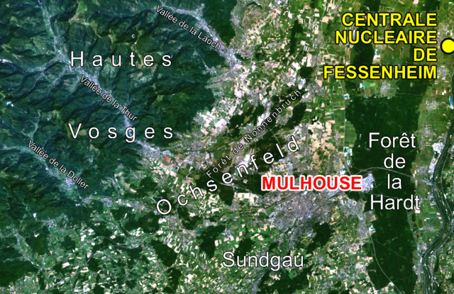
Français : Photo satellite de la région mulhousienne annoté |
| Date | (UTC) |
| Source | |
| Author |
|
| This is a retouched picture, which means that it has been digitally altered from its original version. The original can be viewed here: Regionmulhousiennesatelliteannotée.png:
|
| This file is in the public domain in the United States because it was solely created by NASA. NASA copyright policy states that "NASA material is not protected by copyright unless noted". (See Template:PD-USGov, NASA copyright policy page or JPL Image Use Policy.) | ||
 |
Warnings:
|
Original upload log[edit]
This image is a derivative work of the following images:
- File:Regionmulhousiennesatelliteannotée.png licensed with PD-USGov-NASA
- 2009-10-08T22:42:39Z Monsieur Fou 880x570 (2740982 Bytes) {{Information |Description={{fr|1=Photo satellite de la région mulhousienne annoté}} |Source=Nasa |Author=Nasa |Date= |Permission=libre de droits Nasa |other_versions= }} [[Category:Maps of Mulhouse]]
Uploaded with derivativeFX
File history
Click on a date/time to view the file as it appeared at that time.
| Date/Time | Thumbnail | Dimensions | User | Comment | |
|---|---|---|---|---|---|
| current | 18:30, 15 April 2011 | | 880 × 570 (2.61 MB) | Monsieur Fou (talk | contribs) | {{Information |Description={{fr|1=Photo satellite de la région mulhousienne annoté}} |Source=*File:Regionmulhousiennesatelliteannotée.png |Date=2011-04-15 18:27 (UTC) |Author=*File:Regionmulhousiennesatelliteannotée.png: Nasa *derivative w |
You cannot overwrite this file.
File usage on Commons
There are no pages that use this file.