File:Chance of clear sky in the United States.tif
Jump to navigation
Jump to search

Size of this PNG preview of this TIF file: 800 × 463 pixels. Other resolutions: 320 × 185 pixels | 640 × 371 pixels | 1,024 × 593 pixels | 1,280 × 741 pixels | 2,560 × 1,482 pixels | 9,054 × 5,242 pixels.
Original file (9,054 × 5,242 pixels, file size: 22.52 MB, MIME type: image/tiff)
Captions
Captions
Add a one-line explanation of what this file represents
Summary[edit]
| Description |
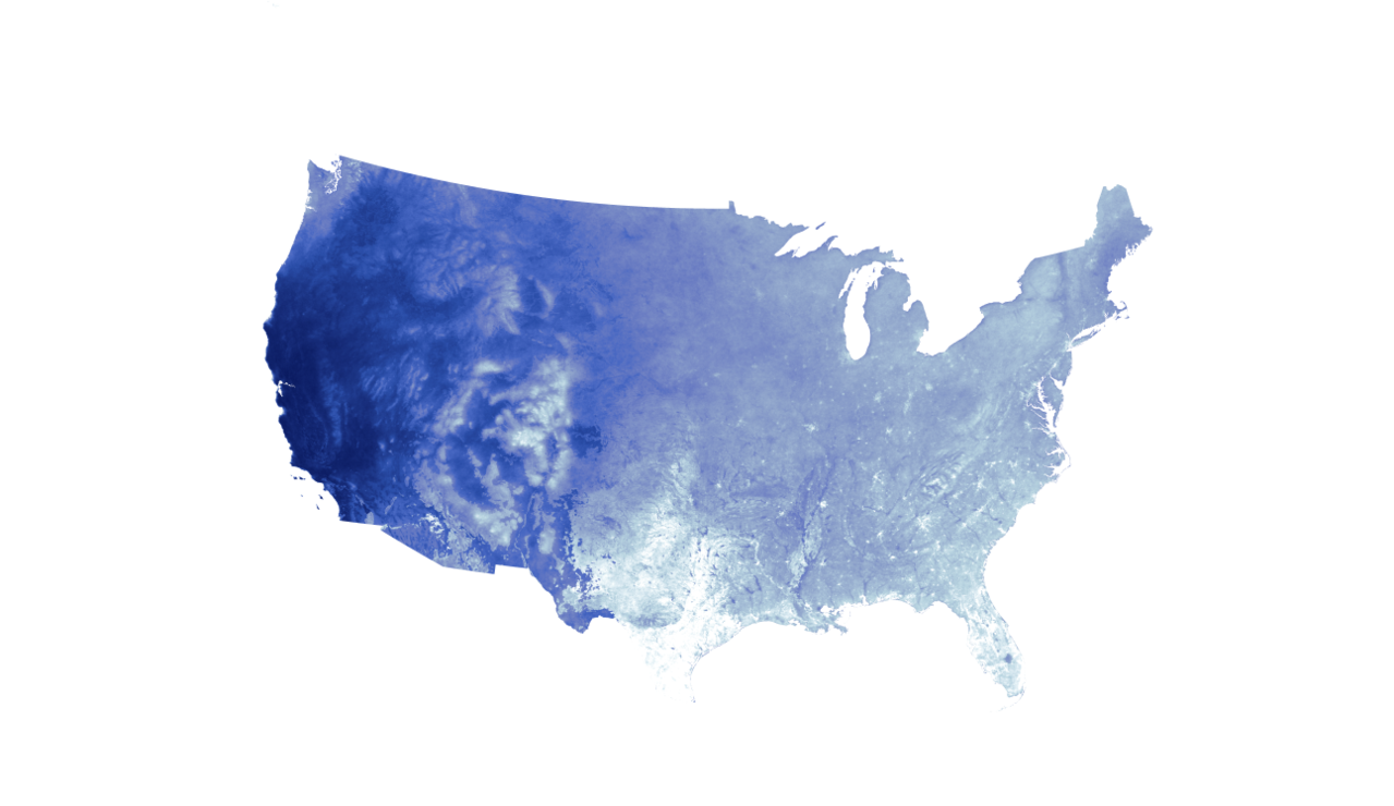
English: The map was developed using satellite observations from the Moderate Resolution Imaging Spectroradiometer (MODIS) sensor on NASA’s Terra and Aqua satellites. It is based on data collected on August 21 between 2000 and 2016. Areas where the sensors observed clear skies the most on August 21 are shown with dark blue; areas where the sensors observed the most clouds on that date are white. Clouds were the main factor that affected where the instruments observed clear skies, but it is possible that smoke or haze also contributed to reduced visibility to a small degree in some areas. |
| Date | |
| Source | https://earthobservatory.nasa.gov/NaturalHazards/view.php?id=90729&eocn=image&eoci=morenh |
| Author | NASA |
Licensing[edit]
| This file is in the public domain in the United States because it was solely created by NASA. NASA copyright policy states that "NASA material is not protected by copyright unless noted". (See Template:PD-USGov, NASA copyright policy page or JPL Image Use Policy.) | ||
 |
Warnings:
|
File history
Click on a date/time to view the file as it appeared at that time.
| Date/Time | Thumbnail | Dimensions | User | Comment | |
|---|---|---|---|---|---|
| current | 03:08, 29 January 2018 |  | 9,054 × 5,242 (22.52 MB) | A1Cafel (talk | contribs) | User created page with UploadWizard |
You cannot overwrite this file.
File usage on Commons
There are no pages that use this file.