File:Crecimiento Santiago.svg
Jump to navigation
Jump to search

Size of this PNG preview of this SVG file: 600 × 600 pixels. Other resolutions: 240 × 240 pixels | 480 × 480 pixels | 768 × 768 pixels | 1,024 × 1,024 pixels | 2,048 × 2,048 pixels.
Original file (SVG file, nominally 600 × 600 pixels, file size: 59 KB)
Captions
Captions
Add a one-line explanation of what this file represents
| Description |
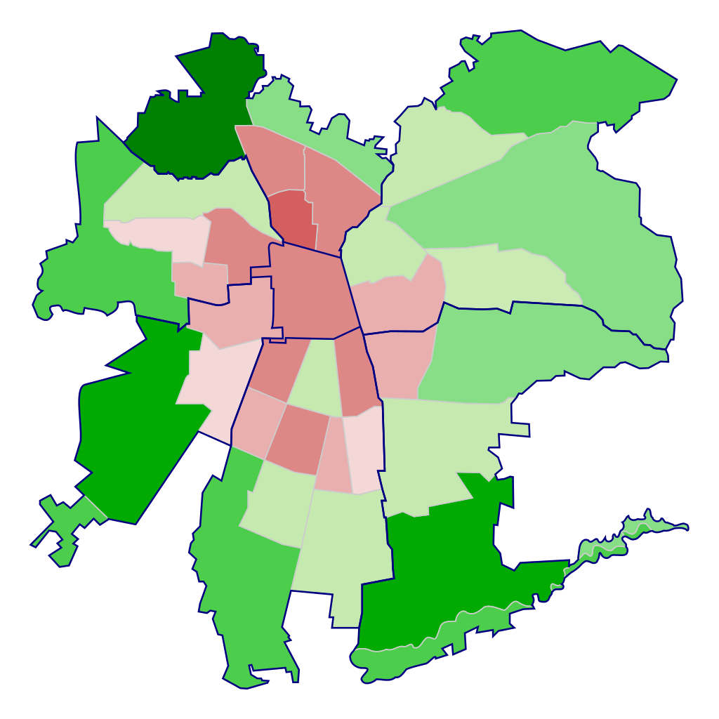
Español: Mapa de las comunas de Santiago de Chile según su tasa de crecimiento demográfico en el período intercensal (1992-2002). Además, se agrupan por sectores geográficos (Centro, Nororiente, Suroriente, Sur, Surponiente, Norponiente, Norte).
> a 10,0
5,0 - 10,0
2,5 - 5,0
1,5 - 2,5
0,0 - 1,5
-0,5 - 0,0
-1,0 - 0,5
-1,5 - -1,0
Menos de -1,5 |
||
| Date | |||
| Source |
Mapa obtenido de Image:Comunas de Santiago.svg. Datos obtenidos de Censo Nacional de Población y Vivienda 2002 (INE)
|
||
| Author | Osmar Valdebenito | ||
| Permission (Reusing this file) |
Osmar Valdebenito, the copyright holder of this work, hereby publishes it under the following license: This file is licensed under the Creative Commons Attribution-Share Alike 2.5 Generic license. Attribution: Osmar Valdebenito
|
File history
Click on a date/time to view the file as it appeared at that time.
| Date/Time | Thumbnail | Dimensions | User | Comment | |
|---|---|---|---|---|---|
| current | 04:38, 10 October 2007 | | 600 × 600 (59 KB) | B1mbo (talk | contribs) | Error... intercambiado Independencia y Recoleta |
| 01:10, 8 October 2007 |  | 600 × 600 (59 KB) | B1mbo (talk | contribs) | {{Information |Description={{es|Mapa de las comunas de Santiago de Chile según su tasa de crecimiento demográfico en el período intercensal (1992-2002). Además, se agrupan por sectores geográficos (Centro, Nororiente, Suroriente, Sur, Surponiente |
You cannot overwrite this file.
File usage on Commons
There are no pages that use this file.