File:DETAIL VIEW OF FOUNDRY PITS - Bevin Brothers Bell Shops, Bevin Court, East Hampton, Middlesex County, CT HAER CONN,4-HAMPE,1-6.tif
Jump to navigation
Jump to search

Size of this JPG preview of this TIF file: 482 × 599 pixels. Other resolutions: 193 × 240 pixels | 386 × 480 pixels | 618 × 768 pixels | 824 × 1,024 pixels | 1,648 × 2,048 pixels | 3,987 × 4,955 pixels.
Original file (3,987 × 4,955 pixels, file size: 18.84 MB, MIME type: image/tiff)
Captions
Captions
Add a one-line explanation of what this file represents
Summary[edit]
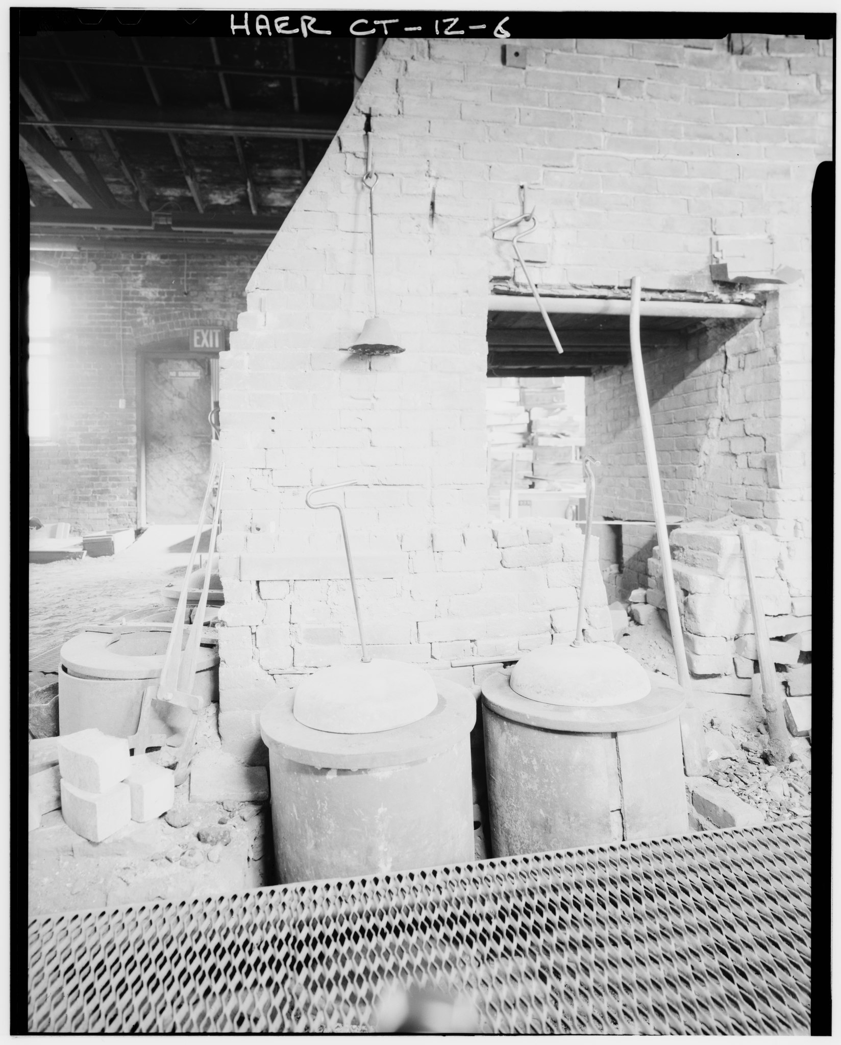
| DETAIL VIEW OF FOUNDRY PITS - Bevin Brothers Bell Shops, Bevin Court, East Hampton, Middlesex County, CT | ||||
|---|---|---|---|---|
| Photographer |
Lowe, Jet Related names:
|
|||
| Title |
DETAIL VIEW OF FOUNDRY PITS - Bevin Brothers Bell Shops, Bevin Court, East Hampton, Middlesex County, CT |
|||
| Depicted place | Connecticut; Middlesex County; East Hampton | |||
| Date | 1979 | |||
| Dimensions | 4 x 5 in. | |||
| Current location |
Library of Congress Prints and Photographs Division Washington, D.C. 20540 USA http://hdl.loc.gov/loc.pnp/pp.print |
|||
| Accession number |
HAER CONN,4-HAMPE,1-6 |
|||
| Credit line |
|
|||
| Notes |
|
|||
| Source | https://www.loc.gov/pictures/item/ct0320.photos.023667p | |||
| Permission (Reusing this file) |
|
|||

| Object location | | View this and other nearby images on: OpenStreetMap |
|---|
File history
Click on a date/time to view the file as it appeared at that time.
| Date/Time | Thumbnail | Dimensions | User | Comment | |
|---|---|---|---|---|---|
| current | 01:35, 8 July 2014 |  | 3,987 × 4,955 (18.84 MB) | Fæ (talk | contribs) | GWToolset: Creating mediafile for Fæ. HABS 06 July 2014 (611:700) |
You cannot overwrite this file.
File usage on Commons
The following page uses this file: