File:Details of MESSENGER's Impact Location.jpg
Jump to navigation
Jump to search

Size of this preview: 540 × 599 pixels. Other resolutions: 216 × 240 pixels | 433 × 480 pixels | 692 × 768 pixels | 1,262 × 1,400 pixels.
Original file (1,262 × 1,400 pixels, file size: 704 KB, MIME type: image/jpeg)
Captions
Captions
Add a one-line explanation of what this file represents
Summary[edit]
| Description |
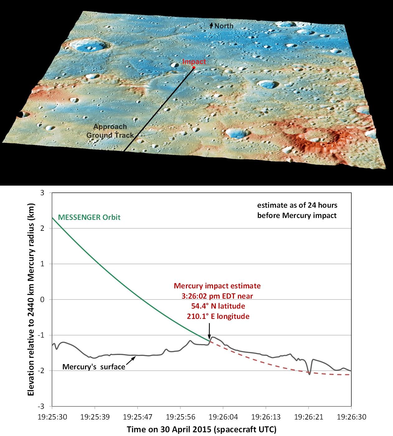
English: These graphics show the current best prediction of the location and time of MESSENGER's impact on Mercury's surface, as of 24 hours before the impact. Those current best estimates are:
|
| Date | |
| Source | DETAILS OF MESSENGER'S IMPACT LOCATION (image link) |
| Author | NASA/Johns Hopkins University Applied Physics Laboratory/Carnegie Institution of Washington |
| Other versions | http://photojournal.jpl.nasa.gov/jpeg/PIA19443.jpg |
Licensing[edit]
| This file is in the public domain in the United States because it was solely created by NASA. NASA copyright policy states that "NASA material is not protected by copyright unless noted". (See Template:PD-USGov, NASA copyright policy page or JPL Image Use Policy.) | ||
 |
Warnings:
|
File history
Click on a date/time to view the file as it appeared at that time.
| Date/Time | Thumbnail | Dimensions | User | Comment | |
|---|---|---|---|---|---|
| current | 08:28, 1 May 2015 | | 1,262 × 1,400 (704 KB) | Jcpag2012 (talk | contribs) | User created page with UploadWizard |
You cannot overwrite this file.
File usage on Commons
The following 2 pages use this file:
File usage on other wikis
The following other wikis use this file:
- Usage on de.wikipedia.org
- Usage on en.wikipedia.org
- Usage on it.wikipedia.org