File:Djibouti to Lake Rudolf. Carta puta Djibouti - Rudolf-jezero. (WOMAT-AFR-ABY-25-1).jpg

Original file (7,496 × 5,406 pixels, file size: 31.22 MB, MIME type: image/jpeg)
Captions
Captions
Summary[edit]
| Title |
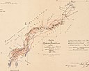
Djibouti to Lake Rudolf. Created by Mirko Seljan and Stjepan Seljan. 'Carta puta "Djibouti - Rudolf-jezero.' |
|||||||||||||||||||||||
| DescriptionDjibouti to Lake Rudolf. Carta puta Djibouti - Rudolf-jezero. (WOMAT-AFR-ABY-25-1).jpg |
Depicts an expedition route from Djibouti in French Somaliland to Lake Rudolf (Rudolf jezero), with larger scale mapping along the Omo River valley.'risao i sastavio: Mirko Seljan Brusselj 1903' (Drawn and assembled: Mirko Seljan, Brussels, 1903). From surveys completed 1899-1902.In Croatian, with German translation in a different hand. Title translation: 'Route map Djibouti - Lake Rudolf.'Covers a 750-mile expedition corridor from Djibouti in French Somaliland south-westwards to the northern shore of Lake Rudolf in southern Abyssinia to a width of approximately 100 miles. Portrays hydrology, relief by form lines, roads, railways, settlements, camps, telegraph stations, international boundaries, place names and the expedition route.The sheet also includes a long profile of the expedition route (horizontal scale 1:2,000,000; vertical scale 1:50,000), cross-sections of the Omo River valley (horizontal scale 1:10,000; vertical scale 1:250) and the Lake Rudolf basin (horizontal scale 1:500,000; vertical scale 1:1,000), and a diagram showing the classification of land by height (vertical scale approximately 1:50,000).Sheet numbered 'Carte: IV.' |
|||||||||||||||||||||||
| British Library Shelfmark InfoField | WOMAT/AFR/ABY/25/1 | |||||||||||||||||||||||
| Locations Depicted InfoField | Djibouti, French Somaliland
French Somaliland, Africa, 1896-1967 Omo River, Abyssinia Rudolf jezero, Abessinija / Protektorat Istocnoj Africi, before 1975 |
|||||||||||||||||||||||
| Centre Point Coordinates InfoField | 8.1667,39.8750 | |||||||||||||||||||||||
| Date | ||||||||||||||||||||||||
| Source |
|
|||||||||||||||||||||||
| Creator |
Seljan, Mirko, 1871-1913, explorer and surveyor, Cartographer Seljan, Stjepan, 1875-1936, explorer and surveyor, Surveyor |
|||||||||||||||||||||||
| Permission (Reusing this file) |
|
|||||||||||||||||||||||
| Geotemporal data | ||||||||||||||||||||||||
| Map location | Abyssinia | |||||||||||||||||||||||
| Scale | Scale 1:3,000,000 | |||||||||||||||||||||||
| Bounding box | ||||||||||||||||||||||||
| Georeferencing | Georeference the map in Wikimaps Warper If inappropriate please set warp_status = skip to hide. | |||||||||||||||||||||||
| Archival data | ||||||||||||||||||||||||
| Collection |
institution QS:P195,Q23308 |
|||||||||||||||||||||||
| Dimensions | 61 x 84cm | |||||||||||||||||||||||
| Medium | Manuscript: coloured ink on paper | |||||||||||||||||||||||
| Notes | For more information please see the British Library’s Collection Guide to the War Office Archive. Archived from the original on 2016-01-11. Retrieved on 2018-04-05. | |||||||||||||||||||||||
| Other versions |
|
|||||||||||||||||||||||
File history
Click on a date/time to view the file as it appeared at that time.
| Date/Time | Thumbnail | Dimensions | User | Comment | |
|---|---|---|---|---|---|
| current | 13:20, 5 April 2018 |  | 7,496 × 5,406 (31.22 MB) | Ndalyrose (talk | contribs) | GWToolset: Creating mediafile for Ndalyrose. |
You cannot overwrite this file.
File usage on Commons
The following page uses this file:
Metadata
This file contains additional information such as Exif metadata which may have been added by the digital camera, scanner, or software program used to create or digitize it. If the file has been modified from its original state, some details such as the timestamp may not fully reflect those of the original file. The timestamp is only as accurate as the clock in the camera, and it may be completely wrong.
| Camera manufacturer | Phase One |
|---|---|
| Camera model | IQ180 |
| Author | 11861 |
| Exposure time | 4/5 sec (0.8) |
| F-number | f/12 |
| ISO speed rating | 50 |
| Date and time of data generation | 11:46, 18 September 2017 |
| Lens focal length | 55 mm |
| Headline | WOMAT/11/Abyssinia/25 |
| Source | The British Library |
| Credit/Provider | The British Library |
| Copyright holder |
|
| Usage terms |
|
| City shown | London |
| Horizontal resolution | 300 dpi |
| Vertical resolution | 300 dpi |
| Software used | Capture One 10 Macintosh |
| Exposure Program | Manual |
| Exif version | 2.3 |
| Date and time of digitizing | 11:46, 18 September 2017 |
| APEX shutter speed | 0.321928 |
| APEX aperture | 7.169925 |
| APEX exposure bias | 0 |
| Metering mode | Center weighted average |
| Light source | Other light source |
| Focal plane X resolution | 1,923.0769348145 |
| Focal plane Y resolution | 1,923.0769348145 |
| Focal plane resolution unit | 3 |
| File source | Digital still camera |
| Scene type | A directly photographed image |
| White balance | 5 |
| Unique image ID | 00E058000072000004015E11D1001D2C |
| Serial number of camera | FP020465 |
| Lens used | Schneider Kreuznach LS 55mm f/2.8 |
| Writer | |
| Special instructions | |
| Category | |
| Original transmission location code | |
| Type of item | |
| Contact information |
www.bl.uk
, , NW1 2DB |
| Province or state shown | England |
| Country shown | GBR |
| Sublocation of city shown | St Pancras |
| Code for country shown | |
| IIM version | 4 |


