File:Edgeøya or Edge Island ESA359684.jpg
Original file (4,829 × 5,601 pixels, file size: 42.67 MB, MIME type: image/jpeg)
Captions
Captions
Summary[edit]
| Description |
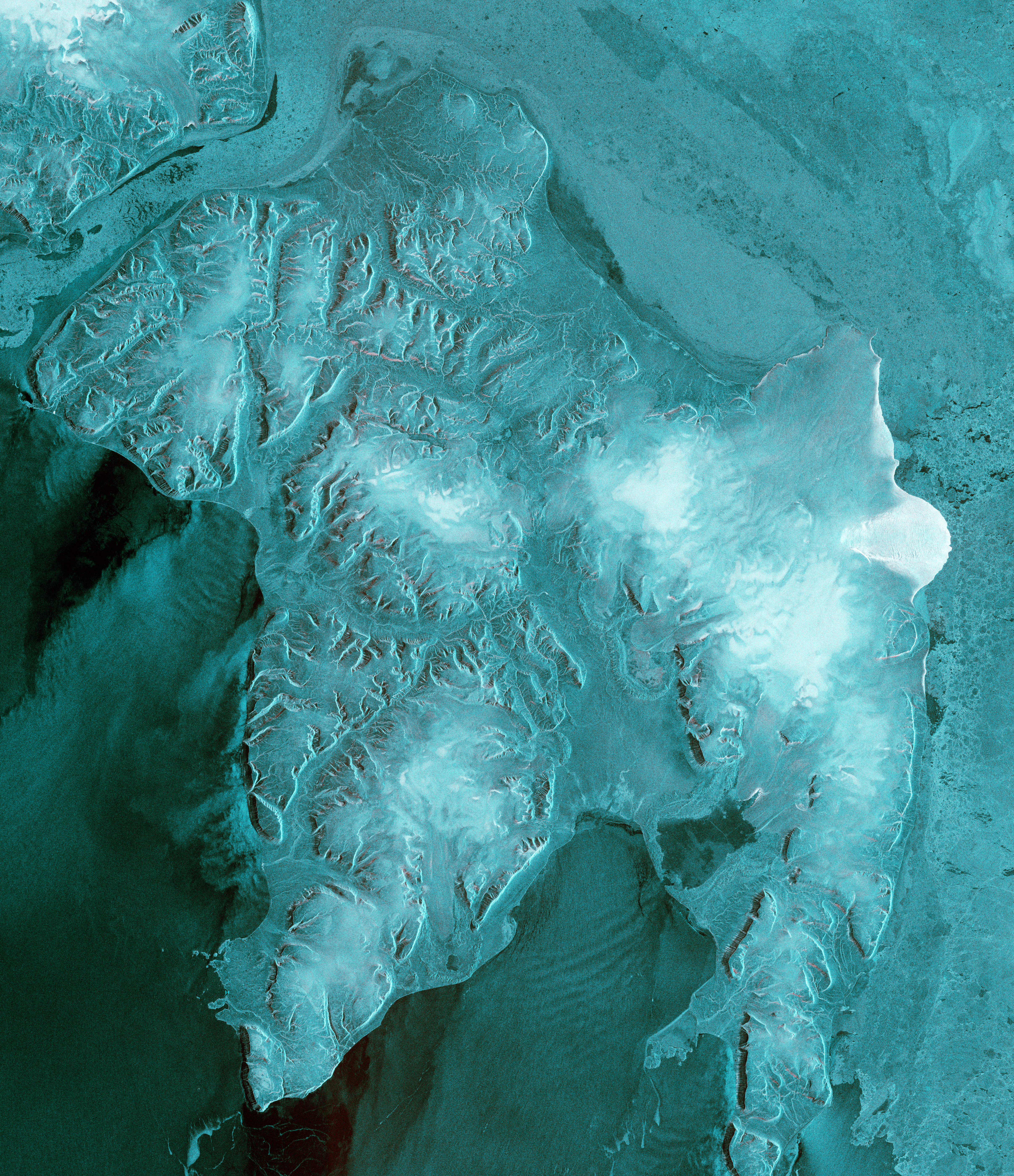
English: This full resolution subset of Sentinel-1B's first data take shows Edgeøya or Edge Island, which is one of the islands making up theSvalbard archipelago. It was captured on 28 April 2016 at 05:37 GMT (07:37 CEST) – just two hours after the satellite’s radar was switched on. Sentinel-1B lifted off on a Soyuz rocket from Europe’s Spaceport in French Guiana on 25 April at 21:02 GMT (23:02 CEST). It joins its twin, Sentinel-1A, to provide more ‘radar vision’ for Europe’s environmental Copernicus programme.
Read article:Sentinel-1B delivers |
| Date | |
| Source | http://www.esa.int/spaceinimages/Images/2016/04/Edgeoeya_or_Edge_Island |
| Author | European Space Agency |
| Permission (Reusing this file) |
Contains modified Copernicus Sentinel data [2016], processed by ESA,CC BY-SA 3.0 IGO |
| Other versions |
|
| Title | Edgeøya or Edge Island |
| Mission | Sentinel-1 |
| Activity | Observing the Earth |

Licensing[edit]
- You are free:
- to share – to copy, distribute and transmit the work
- to remix – to adapt the work
- Under the following conditions:
- attribution – You must give appropriate credit, provide a link to the license, and indicate if changes were made. You may do so in any reasonable manner, but not in any way that suggests the licensor endorses you or your use.
- share alike – If you remix, transform, or build upon the material, you must distribute your contributions under the same or compatible license as the original.

|
This image contains data from a satellite in the Copernicus Programme, such as Sentinel-1, Sentinel-2 or Sentinel-3. Attribution is required when using this image.
Attribution: Contains modified Copernicus Sentinel data {{{year}}}
The use of Copernicus Sentinel Data is regulated under EU law (Commission Delegated Regulation (EU) No 1159/2013 and Regulation (EU) No 377/2014). Relevant excerpts:
Free access shall be given to GMES dedicated data [...] made available through GMES dissemination platforms [...].
Access to GMES dedicated data [...] shall be given for the purpose of the following use in so far as it is lawful:
GMES dedicated data [...] may be used worldwide without limitations in time.
GMES dedicated data and GMES service information are provided to users without any express or implied warranty, including as regards quality and suitability for any purpose. |
File history
Click on a date/time to view the file as it appeared at that time.
| Date/Time | Thumbnail | Dimensions | User | Comment | |
|---|---|---|---|---|---|
| current | 14:23, 8 May 2017 | | 4,829 × 5,601 (42.67 MB) | Yann (talk | contribs) | c:User:Rillke/bigChunkedUpload.js: HR from TIFF, 98% compression |
| 14:33, 7 May 2017 |  | 1,655 × 1,920 (437 KB) | Fæ (talk | contribs) | European Space Agency, Id 359684, http://www.esa.int/spaceinimages/Images/2016/04/Edgeoeya_or_Edge_Island, User:Fæ/Project_list/ESA |
You cannot overwrite this file.
File usage on Commons
The following 3 pages use this file: