File:Elevated overall view showing roofs, looking southeast. - Tapacito Pueblito, North of confluence of Tapacito and Largo Canyons, Dulce, Rio Arriba County, NM HABS NM,20-DUL.V,13-2.tif
Jump to navigation
Jump to search
Size of this JPG preview of this TIF file: 752 × 600 pixels. Other resolutions: 301 × 240 pixels | 602 × 480 pixels | 963 × 768 pixels | 1,280 × 1,021 pixels | 2,560 × 2,041 pixels | 5,500 × 4,386 pixels.
Original file (5,500 × 4,386 pixels, file size: 23.01 MB, MIME type: image/tiff)
Captions
Captions
Add a one-line explanation of what this file represents
Summary[edit]
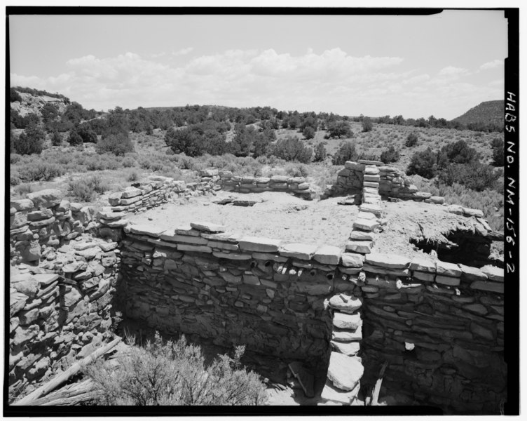
| Elevated overall view showing roofs, looking southeast. - Tapacito Pueblito, North of confluence of Tapacito and Largo Canyons, Dulce, Rio Arriba County, NM | ||||
|---|---|---|---|---|
| Photographer |
Related names:
|
|||
| Title |
Elevated overall view showing roofs, looking southeast. - Tapacito Pueblito, North of confluence of Tapacito and Largo Canyons, Dulce, Rio Arriba County, NM |
|||
| Depicted place | New Mexico; Rio Arriba County; Dulce | |||
| Date | Documentation compiled after 1933 | |||
| Dimensions | 4 x 5 in. | |||
| Current location |
Library of Congress Prints and Photographs Division Washington, D.C. 20540 USA http://hdl.loc.gov/loc.pnp/pp.print |
|||
| Accession number |
HABS NM,20-DUL.V,13-2 |
|||
| Credit line |
|
|||
| Notes |
|
|||
| Source | https://www.loc.gov/pictures/item/nm0163.photos.381233p | |||
| Permission (Reusing this file) |
|
|||

| Object location | | View this and other nearby images on: OpenStreetMap |
|---|
File history
Click on a date/time to view the file as it appeared at that time.
| Date/Time | Thumbnail | Dimensions | User | Comment | |
|---|---|---|---|---|---|
| current | 23:24, 28 July 2014 |  | 5,500 × 4,386 (23.01 MB) | Fæ (talk | contribs) | GWToolset: Creating mediafile for Fæ. HABS 24 July 2014 (2301:2600) |
You cannot overwrite this file.
File usage on Commons
The following page uses this file: